
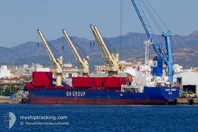
LADY SEMA
Bulk Carrier
Current Trip
| Time Travelled | 22 days |
|---|---|
| Remaining Time | 8 h, 5 mins |
| Distance Travelled | 1968.12 nm |
| Remaining Distance | 94.33 nm |
| AVG Speed | 7 Knots |
| MAX Speed | 11.2 Knots |
| AVG Wind | 14.7 knots |
| MAX Wind | 41 knots |
| MIN Temp | 8.4°C / 47.12°F |
| MAX Temp | 25.3°C / 77.54°F |
| Dybgang | 5 m |
| Position Modtaget | 53 m siden |
Current Position
| Longitude | -1.81974° |
|---|---|
| Latitude | 45.02905° |
| Status | Under way using engine |
| Fart | 9.6 Knots |
| Kurs | 338.5° |
| Område | Bay of Biscay |
| Station | T-AIS |
| Position Modtaget | 53 m siden |
Info
Information
The current position of LADY SEMA is in Bay of Biscay with coordinates 45.02905° / -1.81974° as reported on 2024-04-20 02:25 by AIS to our vessel tracker app. The vessel's current speed is 9.6 Knots and is heading at the port of LA PALLICE. The estimated time of arrival as calculated by MyShipTracking vessel tracking app is 2024-04-20 11:24 LT
The vessel LADY SEMA (IMO: 9233624, MMSI: 371043000) is a Bulk Carrier that was built in 2001 ( 23 år gamle ). It's sailing under the flag of [PA] Panama.
In this page you can find informations about the vessels current position, last detected port calls, and current voyage information. If the vessels is not in coverage by AIS you will find the latest position.
The current position of LADY SEMA is detected by our AIS receivers and we are not responsible for the reliability of the data. The last position was recorded while the vessel was in Coverage by the Ais receivers of our vessel tracking app.
The current draught of LADY SEMA as reported by AIS is 5 meters
Weather
| Temperature | 12.9°C / 55.22°F |
|---|---|
| Wind Speed | 12 knots |
| Direction | 35° NE |
| Pressure | 1021.4 hPa |
| Humidity | 83.8 % |
| Cloud Coverage | 4 % |
Featured Company
Most Visited Ports (Last year)
| Port | Arrivals | |
|---|---|---|
| 2 | ||
| 1 | ||
| 1 | ||
| 1 | ||
| 1 | ||
| 1 |
Events
| Tid | Hændelsen | Detaljer | Position / Dest | Info |
|---|---|---|---|---|
| 2024-04-20 03:05 | Status er ændret | Default Under way using engine |
45.12846 / -1.87504
FR_LPE
|
Fart: 9.6 kn Kurs: 338.5° |
| 2024-04-19 18:23 | Fundet i havområde | French part of the Bay of Biscay |
43.75143 / -1.96222
Bay of Biscay
FR_LPE
|
Fart: 9.2 kn Kurs: 17.1° |
| 2024-04-19 17:40 | Destination er ændret | FR_LPE ORDER |
43.64857 / -2.01224
FR_LPE
|
Fart: 9 kn Kurs: 20° |
| 2024-04-19 17:40 | ETA er ændret | 2024/04/20 12:00 2024/06/04 14:00 |
43.64857 / -2.01224
FR_LPE
|
Fart: 9 kn Kurs: 20° |
| 2024-04-19 11:16 | Fundet i havområde | Spanish part of the Bay of Biscay |
43.61256 / -1.82060
Bay of Biscay
|
Fart: 10.3 kn Kurs: 292° |
| 2024-04-19 10:14 | Status er ændret | Under way using engine Moored |
43.56543 / -1.58968
ORDER
|
Fart: 10 kn Kurs: 276.4° |
| 2024-04-19 09:37 | START Sejllads | 2.63 nm, North West of BAYONNE |
43.52788 / -1.51174
ORDER
|
Fart: 4.3 kn Kurs: 274.9° |
| 2024-04-19 07:22 | Destination er ændret | ORDER FR_BAY |
43.52873 / -1.50929
ORDER
|
Fart: Kurs: 511° |
| 2024-04-19 06:45 | Dybgangen er ændret | 5 7.4 |
43.52871 / -1.50926
FR_BAY
|
Fart: Kurs: 511° |
| 2024-04-18 21:10 | Status er ændret | Moored Default |
43.52873 / -1.50928
FR_BAY
|
Fart: Kurs: -1° |