
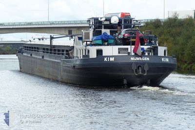
KIM
Cargo
Current Trip
XX
| Time Travelled | 17 h, 1 mins |
|---|---|
| Remaining Time | --- |
| Distance Travelled | 28.56 nm |
| Remaining Distance | --- |
| AVG Speed | 5.8 Knots |
| MAX Speed | 7.9 Knots |
| AVG Wind | 13.4 knots |
| MAX Wind | 16 knots |
| MIN Temp | 6.2°C / 43.16°F |
| MAX Temp | 9.3°C / 48.74°F |
| Dybgang | 0.2 m |
| Position Modtaget | 7 h, 0 m siden |
Current Position
| Longitude | 5.10865° |
|---|---|
| Latitude | 52.04536° |
| Status | Under way using engine |
| Fart | |
| Kurs | --- |
| Område | North Sea |
| Station | T-AIS |
| Position Modtaget | 7 h, 0 m siden |
Info
Information
The current position of KIM is in North Sea with coordinates 52.04536° / 5.10865° as reported on 2024-04-24 17:23 by AIS to our vessel tracker app. The vessel's current speed is 0 Knots
The vessel KIM (MMSI: 244710655) is a Cargo It's sailing under the flag of [NL] Netherlands.
In this page you can find informations about the vessels current position, last detected port calls, and current voyage information. If the vessels is not in coverage by AIS you will find the latest position.
The current position of KIM is detected by our AIS receivers and we are not responsible for the reliability of the data. The last position was recorded while the vessel was in Coverage by the Ais receivers of our vessel tracking app.
The current draught of KIM as reported by AIS is 0.2 meters
Weather
| Temperature | 7.5°C / 45.5°F |
|---|---|
| Wind Speed | 12 knots |
| Direction | 329° NNW |
| Pressure | 1008.6 hPa |
| Humidity | 74.5 % |
| Cloud Coverage | 74 % |
Featured Company
Last Port Calls
| Port | Arrival | Departure | Time In Port |
|---|---|---|---|
| 2024-04-24 06:46 | 2024-04-24 07:23 | 36 m | |
| 2024-04-21 08:24 | 2024-04-23 17:44 | 2 d | |
| 2024-04-21 06:08 | 2024-04-21 06:28 | 19 m | |
| 2024-04-19 11:51 | 2024-04-19 13:01 | 1 h | |
| 2024-03-27 13:20 | 2024-03-27 14:13 | 53 m | |
| 2024-03-26 18:33 | 2024-03-27 05:24 | 10 h | |
| 2024-03-26 17:54 | 2024-03-26 18:28 | 34 m | |
| 2024-03-25 13:22 | 2024-03-26 15:43 | 1 d | |
| 2024-03-25 10:44 | 2024-03-25 11:35 | 50 m | |
| 2024-03-14 11:39 | 2024-03-25 10:24 | 10 d |
Most Visited Ports (Last year)
| Port | Arrivals | |
|---|---|---|
| 13 | ||
| 12 | ||
| 12 | ||
| 8 | ||
| 6 | ||
| 6 |
Last Trips
| Origin | Departure | Destination | Arrival | Distance | |
|---|---|---|---|---|---|
| 2024-04-23 19:44 | 2024-04-24 08:46 | 5.15 nm | |||
| 2024-04-21 08:28 | 2024-04-21 10:24 | 7.01 nm | |||
| 2024-04-19 15:01 | 2024-04-21 08:08 | 99.30 nm | |||
| 2024-03-27 15:13 | 2024-04-19 13:51 | 631.69 nm | |||
| 2024-03-27 06:24 | 2024-03-27 14:20 | 54.43 nm | |||
| 2024-03-26 19:28 | 2024-03-26 19:33 | 0.61 nm | |||
| 2024-03-26 16:43 | 2024-03-26 18:54 | 11.79 nm | |||
| 2024-03-25 12:35 | 2024-03-25 14:22 | 10.49 nm | |||
| 2024-03-25 11:24 | 2024-03-25 11:44 | 2.14 nm | |||
| 2024-03-14 09:10 | 2024-03-14 12:39 | 23.44 nm |
Events
| Tid | Hændelsen | Detaljer | Position / Dest | Info |
|---|---|---|---|---|
| 2024-04-24 17:23 | Udenfor Dækning |
52.04536 / 5.10865
North Sea
|
Fart: Kurs: 346.5° |
|
| 2024-04-24 17:09 | STOP Sejllads | 1.12 nm, North of NIEUWEGEIN |
52.04535 / 5.10865
XX
|
Fart: Kurs: 511° |
| 2024-04-24 17:05 | START Sejllads | 1.01 nm, North of NIEUWEGEIN |
52.04351 / 5.10911
XX
|
Fart: 3.7 kn Kurs: 344.4° |
| 2024-04-24 17:03 | Status er ændret | Under way using engine Moored |
52.04189 / 5.11047
XX
|
Fart: Kurs: 511° |
| 2024-04-24 15:08 | Status er ændret | Moored Under way using engine |
52.04169 / 5.11085
XX
|
Fart: Kurs: 511° |
| 2024-04-24 14:28 | STOP Sejllads | 0.91 nm, North of NIEUWEGEIN |
52.04166 / 5.11088
XX
|
Fart: Kurs: 511° |
| 2024-04-24 13:10 | Indenfor Dækning |
51.96956 / 5.31360
North Sea
|
Fart: 7.2 kn Kurs: 292.3° |
|
| 2024-04-24 11:56 | Udenfor Dækning |
51.91341 / 5.44636
North Sea
|
Fart: 7.5 kn Kurs: 321.3° |
|
| 2024-04-24 11:51 | START Sejllads | 1.14 nm, North of TIEL |
51.90503 / 5.45260
XX
|
Fart: 6.2 kn Kurs: 339.8° |
| 2024-04-24 11:26 | STOP Sejllads | 0.87 nm, North East of TIEL |
51.89871 / 5.45650
XX
|
Fart: 0.1 kn Kurs: 511° |