
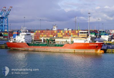
KAPPAGAS
Lpg Tanker
Current Trip
| Time Travelled | 8 days |
|---|---|
| Remaining Time | --- |
| Distance Travelled | 1927.07 nm |
| Remaining Distance | 2117.63 nm |
| AVG Speed | 10.1 Knots |
| MAX Speed | 13 Knots |
| AVG Wind | 14.3 knots |
| MAX Wind | 32 knots |
| MIN Temp | 12.7°C / 54.86°F |
| MAX Temp | 27.7°C / 81.86°F |
| Dybgang | 4.7 m |
| Position Modtaget | 23 h, 48 m siden |
Current Position
| Longitude | 12.07932° |
|---|---|
| Latitude | 37.57600° |
| Status | Under way using engine |
| Fart | 10 Knots |
| Kurs | 299.6° |
| Område | Mediterranean Sea - Eastern Basin |
| Station | T-AIS |
| Position Modtaget | 23 h, 48 m siden |
Info
Information
The current position of KAPPAGAS is in Mediterranean Sea - Eastern Basin with coordinates 37.57600° / 12.07932° as reported on 2024-04-24 00:32 by AIS to our vessel tracker app. The vessel's current speed is 10 Knots and is heading at the port of ANTWERP. The estimated time of arrival as calculated by MyShipTracking vessel tracking app is 2024-05-02 03:00 LT
The vessel KAPPAGAS (IMO: 9215141, MMSI: 304050982) is a Lpg Tanker that was built in 2001 ( 23 år gamle ). It's sailing under the flag of [AG] Antigua Barbuda.
In this page you can find informations about the vessels current position, last detected port calls, and current voyage information. If the vessels is not in coverage by AIS you will find the latest position.
The current position of KAPPAGAS is detected by our AIS receivers and we are not responsible for the reliability of the data. The last position was recorded while the vessel was in Coverage by the Ais receivers of our vessel tracking app.
The current draught of KAPPAGAS as reported by AIS is 4.7 meters
Weather
| Temperature | 14.4°C / 57.92°F |
|---|---|
| Wind Speed | 20 knots |
| Direction | 275° W |
| Pressure | 1014.8 hPa |
| Humidity | 60.5 % |
| Cloud Coverage | 25 % |
Featured Company
Last Port Calls
| Port | Arrival | Departure | Time In Port |
|---|---|---|---|
| 2024-04-19 04:25 | 2024-04-19 13:27 | 9 h | |
| 2024-04-15 19:30 | 2024-04-16 16:03 | 20 h | |
| 2024-04-14 09:06 | 2024-04-15 06:26 | 21 h | |
| 2024-04-11 03:25 | 2024-04-11 12:49 | 9 h | |
| 2024-03-23 03:36 | 2024-03-26 11:32 | 3 d | |
| 2024-02-29 16:04 | 2024-02-29 22:39 | 6 h | |
| 2024-02-07 11:00 | 2024-02-08 23:55 | 1 d |
Most Visited Ports (Last year)
| Port | Arrivals | |
|---|---|---|
| 6 | ||
| 4 | ||
| 4 | ||
| 4 | ||
| 3 | ||
| 3 |
Last Trips
| Origin | Departure | Destination | Arrival | Distance | |
|---|---|---|---|---|---|
| 2024-04-16 19:03 | 2024-04-19 06:25 | 585.91 nm | |||
| 2024-04-15 09:26 | 2024-04-15 22:30 | 110.78 nm | |||
| 2024-03-26 12:32 | 2024-04-14 12:06 | 4019.85 nm | |||
| 2024-03-26 12:32 | 2024-04-11 05:25 | 3400.50 nm | |||
| 2024-03-01 00:39 | 2024-03-23 04:36 | 6311.47 nm | |||
| 2024-02-09 02:55 | 2024-02-29 18:04 | 5332.48 nm | |||
| 2023-12-27 20:29 | 2024-02-07 14:00 | 8737.14 nm |
Events
| Tid | Hændelsen | Detaljer | Position / Dest | Info |
|---|---|---|---|---|
| 2024-04-24 00:53 | Status er ændret | Default Under way using engine |
37.60500 / 12.01667
SA RAB>BE ANR
|
Fart: 10 kn Kurs: 299.6° |
| 2024-04-24 00:32 | Udenfor Dækning |
37.57600 / 12.07932
Mediterranean Sea - Eastern Basin
SA RAB>BE ANR
|
Fart: 10 kn Kurs: 299.6° |
|
| 2024-04-23 23:37 | Status er ændret | Under way using engine Default |
37.50692 / 12.23988
SA RAB>BE ANR
|
Fart: 10 kn Kurs: 299° |
| 2024-04-23 23:35 | Status er ændret | Default Under way using engine |
37.50333 / 12.24667
SA RAB>BE ANR
|
Fart: 9.4 kn Kurs: 297.1° |
| 2024-04-23 22:27 | ETA er ændret | 2024/05/02 03:00 2024/05/02 06:00 |
37.41557 / 12.44103
SA RAB>BE ANR
|
Fart: 9.4 kn Kurs: 295° |
| 2024-04-23 22:20 | Status er ændret | Under way using engine Default |
37.40802 / 12.46210
SA RAB>BE ANR
|
Fart: 10 kn Kurs: 296° |
| 2024-04-23 21:59 | Status er ændret | Default Under way using engine |
37.38197 / 12.52943
SA RAB>BE ANR
|
Fart: 10.2 kn Kurs: 297.7° |
| 2024-04-23 21:51 | Status er ændret | Under way using engine Default |
37.37133 / 12.55543
SA RAB>BE ANR
|
Fart: 11 kn Kurs: 298° |
| 2024-04-23 21:51 | Indenfor Dækning |
37.37133 / 12.55543
Mediterranean Sea - Eastern Basin
SA RAB>BE ANR
|
Fart: 10.1 kn Kurs: 297.6° |
|
| 2024-04-23 12:18 | Udenfor Dækning |
36.71322 / 14.02207
Mediterranean Sea - Eastern Basin
SA RAB>BE ANR
|
Fart: 7.7 kn Kurs: 297.2° |