
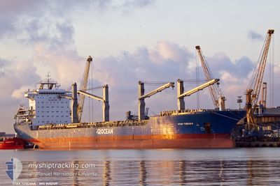
STAR TOSCANA
General Cargo
Current Trip
| Time Travelled | 46 days |
|---|---|
| Remaining Time | --- |
| Distance Travelled | 7160.99 nm |
| Remaining Distance | --- |
| AVG Speed | 9.9 Knots |
| MAX Speed | 15 Knots |
| AVG Wind | 14.7 knots |
| MAX Wind | 39 knots |
| MIN Temp | -2.2°C / 28.04°F |
| MAX Temp | 24.6°C / 76.28°F |
| Dybgang | 9.1 m |
| Position Modtaget | 6 h, 28 m siden |
Current Position
| Longitude | -79.49861° |
|---|---|
| Latitude | 25.76127° |
| Status | Under way using engine |
| Fart | 10.6 Knots |
| Kurs | 181.8° |
| Område | North Atlantic Ocean |
| Station | T-AIS |
| Position Modtaget | 6 h, 28 m siden |
Info
Information
The current position of STAR TOSCANA is in North Atlantic Ocean with coordinates 25.76127° / -79.49861° as reported on 2024-04-19 19:21 by AIS to our vessel tracker app. The vessel's current speed is 10.6 Knots and is heading at the port of PANAMA CITY. The estimated time of arrival as calculated by MyShipTracking vessel tracking app is 2024-04-23 08:00 LT
The vessel STAR TOSCANA (IMO: 9452139, MMSI: 538008385) is a General Cargo that was built in 2012 ( 12 år gamle ). It's sailing under the flag of [MH] Marshall Is.
In this page you can find informations about the vessels current position, last detected port calls, and current voyage information. If the vessels is not in coverage by AIS you will find the latest position.
The current position of STAR TOSCANA is detected by our AIS receivers and we are not responsible for the reliability of the data. The last position was recorded while the vessel was in Coverage by the Ais receivers of our vessel tracking app.
The current draught of STAR TOSCANA as reported by AIS is 9.1 meters
Weather
| Temperature | 24.5°C / 76.1°F |
|---|---|
| Wind Speed | 8 knots |
| Direction | 66° ENE |
| Pressure | 1018.2 hPa |
| Humidity | 68.7 % |
| Cloud Coverage | --- |
Featured Company
Last Port Calls
| Port | Arrival | Departure | Time In Port |
|---|---|---|---|
| 2024-02-29 11:21 | 2024-03-04 07:23 | 3 d | |
| 2024-02-27 15:15 | 2024-02-29 02:34 | 1 d | |
| 2024-02-18 13:21 | 2024-02-24 05:20 | 5 d | |
| 2024-02-02 09:51 |
Last Trips
| Origin | Departure | Destination | Arrival | Distance | |
|---|---|---|---|---|---|
| 2024-02-29 03:34 | 2024-02-29 12:21 | 74.43 nm | |||
| 2024-02-24 05:20 | 2024-02-27 16:15 | 622.32 nm | |||
| 2024-02-02 06:51 | 2024-02-18 13:21 | 4067.50 nm |
Events
| Tid | Hændelsen | Detaljer | Position / Dest | Info |
|---|---|---|---|---|
| 2024-04-19 19:25 | Status er ændret | Default Under way using engine |
25.74833 / -79.49834
USPFN
|
Fart: 10.6 kn Kurs: 181.8° |
| 2024-04-19 19:21 | Status er ændret | Under way using engine Default |
25.76127 / -79.49861
USPFN
|
Fart: 10 kn Kurs: 180° |
| 2024-04-19 19:21 | Udenfor Dækning |
25.76127 / -79.49861
North Atlantic Ocean
USPFN
|
Fart: 10.6 kn Kurs: 181.8° |
|
| 2024-04-19 19:16 | Status er ændret | Default Under way using engine |
25.77500 / -79.49667
USPFN
|
Fart: 10.4 kn Kurs: 181.4° |
| 2024-04-19 19:10 | Status er ændret | Under way using engine Default |
25.79554 / -79.49772
USPFN
|
Fart: 10.3 kn Kurs: 182° |
| 2024-04-19 19:10 | Indenfor Dækning |
25.79554 / -79.49772
North Atlantic Ocean
USPFN
|
Fart: 10.3 kn Kurs: 181.9° |
|
| 2024-04-19 14:40 | START Sejllads | 18.37 nm, South of FREEPORT (BS) |
26.21666 / -78.79667
USPFN
|
Fart: 4 kn Kurs: -1° |
| 2024-04-19 14:21 | STOP Sejllads | 18.29 nm, South of FREEPORT (BS) |
26.21765 / -78.78871
USPFN
|
Fart: 0.3 kn Kurs: 253° |
| 2024-04-19 03:19 | Status er ændret | Default Under way using engine |
25.51333 / -77.23167
USPFN
|
Fart: 12.3 kn Kurs: 237.1° |
| 2024-04-19 02:26 | Udenfor Dækning |
25.61365 / -77.05922
North Atlantic Ocean
USPFN
|
Fart: 12.3 kn Kurs: 237.1° |