
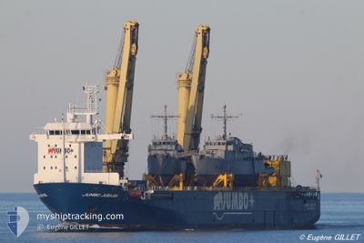
JUMBO JUBILEE
Heavy Load Carrier
Current Trip
| Time Travelled | --- |
|---|---|
| Remaining Time | 11 days |
| Distance Travelled | --- |
| Remaining Distance | 4359.64 nm |
| AVG Speed | --- |
| MAX Speed | --- |
| AVG Wind | --- |
| MAX Wind | --- |
| MIN Temp | --- |
| MAX Temp | --- |
| Dybgang | 7.1 m |
| Position Modtaget | 3 h, 38 m siden |
Current Position
| Longitude | 17.94657° |
|---|---|
| Latitude | -33.66009° |
| Status | Under way using engine |
| Fart | 15.8 Knots |
| Kurs | 310.3° |
| Område | South Atlantic Ocean |
| Station | T-AIS |
| Position Modtaget | 3 h, 38 m siden |
Info
Information
The current position of JUMBO JUBILEE is in South Atlantic Ocean with coordinates -33.66009° / 17.94657° as reported on 2024-04-25 11:32 by AIS to our vessel tracker app. The vessel's current speed is 15.8 Knots and is heading at the port of LAS PALMAS. The estimated time of arrival as calculated by MyShipTracking vessel tracking app is 2024-05-07 05:38 LT
The vessel JUMBO JUBILEE (IMO: 9371581, MMSI: 246309000) is a Heavy Load Carrier that was built in 2009 ( 15 år gamle ). It's sailing under the flag of [NL] Netherlands.
In this page you can find informations about the vessels current position, last detected port calls, and current voyage information. If the vessels is not in coverage by AIS you will find the latest position.
The current position of JUMBO JUBILEE is detected by our AIS receivers and we are not responsible for the reliability of the data. The last position was recorded while the vessel was in Coverage by the Ais receivers of our vessel tracking app.
The current draught of JUMBO JUBILEE as reported by AIS is 7.1 meters
Weather
| Temperature | 17.7°C / 63.86°F |
|---|---|
| Wind Speed | 19 knots |
| Direction | 168° SSE |
| Pressure | 1020 hPa |
| Humidity | 85.2 % |
| Cloud Coverage | 100 % |
Featured Company
Events
| Tid | Hændelsen | Detaljer | Position / Dest | Info |
|---|---|---|---|---|
| 2024-04-25 11:39 | Status er ændret | Default Under way using engine |
-33.63773 / 17.91552
LAS PALMAS
|
Fart: 15.8 kn Kurs: 310.3° |
| 2024-04-25 11:32 | Udenfor Dækning |
-33.66009 / 17.94657
South Atlantic Ocean
|
Fart: 15.8 kn Kurs: 310.3° |
|
| 2024-04-25 07:44 | Status er ændret | Under way using engine Default |
-34.30081 / 18.20647
LAS PALMAS
|
Fart: 14.2 kn Kurs: 334° |
| 2024-04-25 07:43 | Status er ændret | Default Under way using engine |
-34.30435 / 18.20853
LAS PALMAS
|
Fart: 14.2 kn Kurs: 333.5° |
| 2024-04-25 06:00 | Status er ændret | Under way using engine Default |
-34.54674 / 18.55900
LAS PALMAS
|
Fart: 14 kn Kurs: 299° |
| 2024-04-25 05:59 | Status er ændret | Default Under way using engine |
-34.54913 / 18.56424
LAS PALMAS
|
Fart: 13.9 kn Kurs: 299.6° |
| 2024-04-25 05:30 | Status er ændret | Under way using engine Default |
-34.60312 / 18.68251
LAS PALMAS
|
Fart: 14.2 kn Kurs: 298° |
| 2024-04-25 05:14 | Status er ændret | Default Under way using engine |
-34.63271 / 18.75129
LAS PALMAS
|
Fart: 14.5 kn Kurs: 297.2° |
| 2024-04-25 05:10 | Status er ændret | Under way using engine Default |
-34.64086 / 18.77026
LAS PALMAS
|
Fart: 14.4 kn Kurs: 298° |
| 2024-04-25 04:32 | Status er ændret | Default Under way using engine |
-34.71219 / 18.92849
LAS PALMAS
|
Fart: 14.1 kn Kurs: 298.4° |