
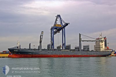
JULIANA
Container Ship
Current Trip
| Trip Time | 2 days |
|---|---|
| Trip Distance | 875.42 nm |
| AVG Speed | 14 Knots |
| MAX Speed | 19.1 Knots |
| Dybgang | 6.8 m |
| AVG Wind | 6.6 knots |
| MAX Wind | 13.4 knots |
| MIN Temp | 20.6°C / 69.08°F |
| MAX Temp | 30.1°C / 86.18°F |
| Position Modtaget | 2 d siden |
Current Position
| Longitude | -79.46067° |
|---|---|
| Latitude | 8.45167° |
| Status | Under way using engine |
| Fart | 17.3 Knots |
| Kurs | 179° |
| Område | North Pacific Ocean |
| Station | T-AIS |
| Position Modtaget | 2 d siden |
Info
Information
The current position of JULIANA is in North Pacific Ocean with coordinates 8.45167° / -79.46067° as reported on 2024-04-23 03:33 by AIS to our vessel tracker app. The vessel's current speed is 17.3 Knots and is currently inside the port of PAITA.
The vessel JULIANA (IMO: 9477294, MMSI: 255710000) is a Container Ship that was built in 2009 ( 15 år gamle ). It's sailing under the flag of [PT] Portugal.
In this page you can find informations about the vessels current position, last detected port calls, and current voyage information. If the vessels is not in coverage by AIS you will find the latest position.
The current position of JULIANA is detected by our AIS receivers and we are not responsible for the reliability of the data. The last position was recorded while the vessel was in Coverage by the Ais receivers of our vessel tracking app.
The current draught of JULIANA as reported by AIS is 6.8 meters
Weather
| Temperature | 23.9°C / 75.02°F |
|---|---|
| Wind Speed | 9 knots |
| Direction | 158° SSE |
| Pressure | 1012.3 hPa |
| Humidity | 69.3 % |
| Cloud Coverage | 77 % |
Featured Company
Last Port Calls
| Port | Arrival | Departure | Time In Port |
|---|---|---|---|
| 2024-04-25 06:52 | |||
| 2024-04-21 19:22 | 2024-04-22 14:58 | 19 h | |
| 2024-04-18 02:29 | 2024-04-18 07:35 | 5 h | |
| 2024-04-14 20:02 | 2024-04-15 05:15 | 9 h | |
| 2024-04-11 02:16 | 2024-04-11 08:30 | 6 h | |
| 2024-04-07 19:09 | 2024-04-08 02:32 | 7 h | |
| 2024-04-04 02:12 | 2024-04-04 08:40 | 6 h | |
| 2024-03-31 19:22 | 2024-04-01 12:10 | 16 h | |
| 2024-03-28 02:35 | 2024-03-28 08:57 | 6 h | |
| 2024-03-24 18:33 | 2024-03-25 10:20 | 15 h |
Most Visited Ports (Last year)
| Port | Arrivals | |
|---|---|---|
| 23 | ||
| 14 | ||
| 9 | ||
| 7 | ||
| 6 | ||
| 6 |
Last Trips
| Origin | Departure | Destination | Arrival | Distance | |
|---|---|---|---|---|---|
| 2024-04-22 09:58 | 2024-04-25 01:52 | 875.42 nm | |||
| 2024-04-18 02:35 | 2024-04-21 14:22 | 1007.67 nm | |||
| 2024-04-15 00:15 | 2024-04-17 21:29 | 868.47 nm | |||
| 2024-04-11 03:30 | 2024-04-14 15:02 | 1012.37 nm | |||
| 2024-04-07 21:32 | 2024-04-10 21:16 | 869.13 nm | |||
| 2024-04-04 03:40 | 2024-04-07 14:09 | 1014.28 nm | |||
| 2024-04-01 07:10 | 2024-04-03 21:12 | 868.09 nm | |||
| 2024-03-28 03:57 | 2024-03-31 14:22 | 1009.96 nm | |||
| 2024-03-25 05:20 | 2024-03-27 21:35 | 870.53 nm | |||
| 2024-03-18 07:53 | 2024-03-20 23:44 | 867.64 nm |
Events
| Tid | Hændelsen | Detaljer | Position / Dest | Info |
|---|---|---|---|---|
| 2024-04-25 06:52 | Skibe i havn |
|
-5.07933 / -81.10900
[PE] PAITA
|
Fart: 4.2 kn Kurs: 134° |
| 2024-04-23 03:34 | Status er ændret | Default Under way using engine |
8.44200 / -79.46067
PEPAI
|
Fart: 17.3 kn Kurs: 179° |
| 2024-04-23 03:33 | Udenfor Dækning |
8.45167 / -79.46067
North Pacific Ocean
|
Fart: 17.3 kn Kurs: 179° |
|
| 2024-04-23 03:27 | Status er ændret | Under way using engine Default |
8.47728 / -79.46091
PEPAI
|
Fart: 17.5 kn Kurs: 180° |
| 2024-04-23 03:24 | Status er ændret | Default Under way using engine |
8.49650 / -79.46100
PEPAI
|
Fart: 17.4 kn Kurs: 181° |
| 2024-04-23 03:19 | Status er ændret | Under way using engine Default |
8.51634 / -79.46083
PEPAI
|
Fart: 17.4 kn Kurs: 181° |
| 2024-04-23 03:18 | Status er ændret | Default Under way using engine |
8.52605 / -79.46068
PEPAI
|
Fart: 17.3 kn Kurs: 180° |
| 2024-04-23 01:24 | START Sejllads | 2.56 nm, North West of TABOGA |
8.82964 / -79.58289
PEPAI
|
Fart: 3.6 kn Kurs: 54° |
| 2024-04-23 00:57 | Status er ændret | Under way using engine At anchor |
8.82783 / -79.58500
PEPAI
|
Fart: 0.3 kn Kurs: 15° |
| 2024-04-23 00:20 | Status er ændret | At anchor Default |
8.82766 / -79.58516
PEPAI
|
Fart: Kurs: 18° |