
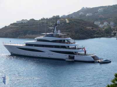
JUICE
Pleasure Craft
Current Trip
PALM BEACH
| Time Travelled | 2 days |
|---|---|
| Remaining Time | --- |
| Distance Travelled | 12.48 nm |
| Remaining Distance | --- |
| AVG Speed | 12.2 Knots |
| MAX Speed | 12.8 Knots |
| AVG Wind | 11.7 knots |
| MAX Wind | 12.8 knots |
| MIN Temp | 21.8°C / 71.24°F |
| MAX Temp | 23.4°C / 74.12°F |
| Dybgang | 3.7 m |
| Position Modtaget | 2 d siden |
Current Position
| Longitude | -79.82308° |
|---|---|
| Latitude | 26.94253° |
| Status | Under way using engine |
| Fart | 12.8 Knots |
| Kurs | 45.5° |
| Område | North Atlantic Ocean |
| Station | T-AIS |
| Position Modtaget | 2 d siden |
Info
Information
The current position of JUICE is in North Atlantic Ocean with coordinates 26.94253° / -79.82308° as reported on 2024-04-23 19:52 by AIS to our vessel tracker app. The vessel's current speed is 12.8 Knots
The vessel JUICE (IMO: 9868857, MMSI: 319218500) is a Pleasure Craft It's sailing under the flag of [KY] Cayman Is.
In this page you can find informations about the vessels current position, last detected port calls, and current voyage information. If the vessels is not in coverage by AIS you will find the latest position.
The current position of JUICE is detected by our AIS receivers and we are not responsible for the reliability of the data. The last position was recorded while the vessel was in Coverage by the Ais receivers of our vessel tracking app.
The current draught of JUICE as reported by AIS is 3.7 meters
Weather
| Temperature | 21.9°C / 71.42°F |
|---|---|
| Wind Speed | 12 knots |
| Direction | 52° NE |
| Pressure | 1020.9 hPa |
| Humidity | 56.9 % |
| Cloud Coverage | 10 % |
Featured Company
Last Port Calls
| Port | Arrival | Departure | Time In Port |
|---|---|---|---|
| 2024-04-23 18:34 | |||
| 2024-03-28 12:44 | 2024-03-28 14:30 | 1 h | |
| 2024-03-21 17:58 | 2024-03-28 04:18 | 6 d | |
| 2024-03-21 11:37 | 2024-03-21 11:57 | 20 m | |
| 2024-02-15 17:24 | 2024-02-15 18:28 | 1 h | |
| 2024-02-14 13:46 |
Most Visited Ports (Last year)
| Port | Arrivals | |
|---|---|---|
| 4 | ||
| 3 | ||
| 2 | ||
| 1 | ||
| 1 | ||
| 1 |
Last Trips
| Origin | Departure | Destination | Arrival | Distance | |
|---|---|---|---|---|---|
| 2024-03-28 00:18 | 2024-03-28 08:44 | 63.37 nm | |||
| 2024-03-21 07:57 | 2024-03-21 13:58 | 63.70 nm | |||
| 2024-02-15 13:28 | 2024-03-21 07:37 | 0.51 nm | |||
| 2024-02-14 08:46 | 2024-02-15 12:24 | 341.18 nm |
Events
| Tid | Hændelsen | Detaljer | Position / Dest | Info |
|---|---|---|---|---|
| 2024-04-23 19:52 | Udenfor Dækning |
26.94253 / -79.82308
North Atlantic Ocean
|
Fart: 12.8 kn Kurs: 45.5° |
|
| 2024-04-23 18:34 | Afsejlet fra sidste havn |
|
26.79312 / -79.98524
PALM BEACH
|
Fart: 6.6 kn Kurs: 68° |
| 2024-04-23 18:21 | START Sejllads |
26.76779 / -80.04745
[US] PALM BEACH
|
Fart: 5.4 kn Kurs: 56° |
|
| 2024-04-23 15:58 | Indenfor Dækning |
26.76664 / -80.05227
North Atlantic Ocean
[US] PALM BEACH
|
Fart: Kurs: 175.4° |
|
| 2024-04-23 11:07 | Udenfor Dækning |
26.76663 / -80.05228
North Atlantic Ocean
[US] PALM BEACH
|
Fart: Kurs: 191.3° |
|
| 2024-04-23 03:27 | Destination er ændret | PALM BEACH TOWN OF WEST PALM |
26.76665 / -80.05230
[US] PALM BEACH
|
Fart: Kurs: 82° |
| 2024-04-23 03:27 | ETA er ændret | 2024/04/22 09:30 2024/04/12 12:30 |
26.76665 / -80.05230
[US] PALM BEACH
|
Fart: Kurs: 82° |
| 2024-04-23 03:17 | Indenfor Dækning |
26.76665 / -80.05230
North Atlantic Ocean
[US] PALM BEACH
|
Fart: Kurs: 185.7° |
|
| 2024-04-22 14:13 | Udenfor Dækning |
26.76676 / -80.04989
North Atlantic Ocean
|
Fart: 1.9 kn Kurs: 221.5° |
|
| 2024-04-22 14:08 | Indenfor Dækning |
26.76768 / -80.04848
North Atlantic Ocean
|
Fart: 1.7 kn Kurs: 252.9° |