
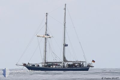
JOHANN SMIDT
Sailing
Current Trip
| Time Travelled | 1 day |
|---|---|
| Remaining Time | 8 h, 53 mins |
| Distance Travelled | 89.43 nm |
| Remaining Distance | 40.98 nm |
| AVG Speed | 4.2 Knots |
| MAX Speed | 7.4 Knots |
| AVG Wind | 10.9 knots |
| MAX Wind | 18 knots |
| MIN Temp | 5.5°C / 41.9°F |
| MAX Temp | 8.4°C / 47.12°F |
| Dybgang | 3.7 m |
| Position Modtaget | Nu |
Current Position
| Longitude | 11.23458° |
|---|---|
| Latitude | 54.64500° |
| Status | Under way sailing |
| Fart | 4.3 Knots |
| Kurs | 65° |
| Område | Baltic Sea |
| Station | T-AIS |
| Position Modtaget | Nu |
Info
Information
The current position of JOHANN SMIDT is in Baltic Sea with coordinates 54.64500° / 11.23458° as reported on 2024-04-25 12:48 by AIS to our vessel tracker app. The vessel's current speed is 4.3 Knots and is heading at the port of ROSTOCK. The estimated time of arrival as calculated by MyShipTracking vessel tracking app is 2024-04-25 21:42 LT
The vessel JOHANN SMIDT (IMO: 1472145, MMSI: 211237730) is a Sailing It's sailing under the flag of [DE] Germany.
In this page you can find informations about the vessels current position, last detected port calls, and current voyage information. If the vessels is not in coverage by AIS you will find the latest position.
The current position of JOHANN SMIDT is detected by our AIS receivers and we are not responsible for the reliability of the data. The last position was recorded while the vessel was in Coverage by the Ais receivers of our vessel tracking app.
The current draught of JOHANN SMIDT as reported by AIS is 3.7 meters
Weather
| Temperature | 8.3°C / 46.94°F |
|---|---|
| Wind Speed | 8 knots |
| Direction | 144° SE |
| Pressure | 1003.1 hPa |
| Humidity | 65.4 % |
| Cloud Coverage | 100 % |
Featured Company
Last Port Calls
| Port | Arrival | Departure | Time In Port |
|---|---|---|---|
| 2024-04-22 17:41 | 2024-04-24 09:15 | 1 d | |
| 2024-04-22 15:51 | 2024-04-22 16:49 | 58 m | |
| 2024-04-22 14:08 |
Last Trips
| Origin | Departure | Destination | Arrival | Distance | |
|---|---|---|---|---|---|
| 2024-04-22 18:49 | 2024-04-22 19:41 | 1.95 nm | |||
| 2024-04-22 16:08 | 2024-04-22 17:51 | 2.92 nm |
Events
| Tid | Hændelsen | Detaljer | Position / Dest | Info |
|---|---|---|---|---|
| 2024-04-25 12:16 | Ændre havområde | Danish part of the Baltic Sea German part of the Baltic Sea |
54.61559 / 11.18503
Baltic Sea
ROSTOCK
|
Fart: 4.5 kn Kurs: 39.3° |
| 2024-04-25 10:44 | Ændre havområde | German part of the Baltic Sea Danish part of the Baltic Sea |
54.63006 / 11.10520
Baltic Sea
ROSTOCK
|
Fart: 4.7 kn Kurs: 182.6° |
| 2024-04-25 03:55 | START Sejllads | 14.16 nm, South West of TARS |
54.67036 / 10.82772
ROSTOCK
|
Fart: 3.1 kn Kurs: 53° |
| 2024-04-25 03:39 | STOP Sejllads | 14.72 nm, South West of NAKSKOV |
54.66250 / 10.81823
ROSTOCK
|
Fart: 0.3 kn Kurs: 103° |
| 2024-04-25 01:05 | Ændre havområde | Danish part of the Baltic Sea Danish part of the Kattegat |
54.74163 / 10.85390
Baltic Sea
ROSTOCK
|
Fart: 2 kn Kurs: 168.1° |
| 2024-04-25 00:35 | Ændre havområde | Danish part of the Kattegat Danish part of the Baltic Sea |
54.74522 / 10.85740
Kattegat
ROSTOCK
|
Fart: 3.5 kn Kurs: 345.9° |
| 2024-04-24 19:35 | START Sejllads | 10.82 nm, South of MARSTAL |
54.68004 / 10.58183
ROSTOCK
|
Fart: 5 kn Kurs: 158.8° |
| 2024-04-24 19:33 | Status er ændret | Under way sailing Under way using engine |
54.68158 / 10.58100
ROSTOCK
|
Fart: Kurs: 0° |
| 2024-04-24 19:33 | Status er ændret | Under way using engine Under way sailing |
54.68181 / 10.58075
ROSTOCK
|
Fart: 3.3 kn Kurs: 130° |
| 2024-04-24 19:33 | STOP Sejllads | 10.71 nm, South of MARSTAL |
54.68181 / 10.58075
ROSTOCK
|
Fart: Kurs: 0° |