
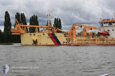
JEAN ANGO
Trailing Suction Hopper Dredger
Current Trip
SEINE
| Time Travelled | 1 day |
|---|---|
| Remaining Time | --- |
| Distance Travelled | 211.64 nm |
| Remaining Distance | --- |
| AVG Speed | 8.9 Knots |
| MAX Speed | 13.1 Knots |
| AVG Wind | 7.8 knots |
| MAX Wind | 14.8 knots |
| MIN Temp | 7.6°C / 45.68°F |
| MAX Temp | 11.2°C / 52.16°F |
| Dybgang | 5 m |
| Position Modtaget | Nu |
Current Position
| Longitude | -0.00983° |
|---|---|
| Latitude | 49.45223° |
| Status | Restricted manoeuverability |
| Fart | 11.4 Knots |
| Kurs | 88.5° |
| Område | English Channel |
| Station | T-AIS |
| Position Modtaget | Nu |
Info
Information
The current position of JEAN ANGO is in English Channel with coordinates 49.45223° / -0.00983° as reported on 2024-04-25 20:06 by AIS to our vessel tracker app. The vessel's current speed is 11.4 Knots
The vessel JEAN ANGO (IMO: 9614763, MMSI: 228029800) is a Trailing Suction Hopper Dredger that was built in 2013 ( 11 år gamle ). It's sailing under the flag of [FR] France.
In this page you can find informations about the vessels current position, last detected port calls, and current voyage information. If the vessels is not in coverage by AIS you will find the latest position.
The current position of JEAN ANGO is detected by our AIS receivers and we are not responsible for the reliability of the data. The last position was recorded while the vessel was in Coverage by the Ais receivers of our vessel tracking app.
The current draught of JEAN ANGO as reported by AIS is 5 meters
Weather
| Temperature | 11°C / 51.8°F |
|---|---|
| Wind Speed | 11 knots |
| Direction | 266° W |
| Pressure | 1003.8 hPa |
| Humidity | 74.2 % |
| Cloud Coverage | 97 % |
Featured Company
Last Port Calls
| Port | Arrival | Departure | Time In Port |
|---|---|---|---|
| 2024-04-24 15:35 | 2024-04-24 15:56 | 21 m | |
| 2024-04-24 06:48 | 2024-04-24 07:27 | 38 m | |
| 2024-04-22 06:42 | 2024-04-22 07:39 | 56 m | |
| 2024-04-17 04:22 | 2024-04-17 15:38 | 11 h | |
| 2024-04-15 13:02 | 2024-04-15 13:20 | 18 m | |
| 2024-04-15 07:06 | 2024-04-15 07:14 | 8 m | |
| 2024-04-12 11:41 | 2024-04-12 11:58 | 17 m | |
| 2024-04-12 06:38 | 2024-04-12 07:53 | 1 h | |
| 2024-04-10 07:11 | 2024-04-10 08:17 | 1 h | |
| 2024-04-08 04:56 | 2024-04-08 15:07 | 10 h |
Most Visited Ports (Last year)
| Port | Arrivals | |
|---|---|---|
| 259 | ||
| 103 | ||
| 39 | ||
| 21 | ||
| 21 | ||
| 1 |
Last Trips
| Origin | Departure | Destination | Arrival | Distance | |
|---|---|---|---|---|---|
| 2024-04-24 09:27 | 2024-04-24 17:35 | 65.24 nm | |||
| 2024-04-22 09:39 | 2024-04-24 08:48 | 305.97 nm | |||
| 2024-04-17 17:38 | 2024-04-22 08:42 | 680.20 nm | |||
| 2024-04-15 15:20 | 2024-04-17 06:22 | 165.41 nm | |||
| 2024-04-15 09:14 | 2024-04-15 15:02 | 38.57 nm | |||
| 2024-04-12 13:58 | 2024-04-15 09:06 | 389.98 nm | |||
| 2024-04-12 09:53 | 2024-04-12 13:41 | 29.89 nm | |||
| 2024-04-10 10:17 | 2024-04-12 08:38 | 347.09 nm | |||
| 2024-04-08 17:07 | 2024-04-10 09:11 | 214.41 nm | |||
| 2024-04-08 03:17 | 2024-04-08 06:56 | 24.75 nm |
Events
| Tid | Hændelsen | Detaljer | Position / Dest | Info |
|---|---|---|---|---|
| 2024-04-25 16:52 | START Sejllads | 10.72 nm, West of LE HAVRE |
49.46346 / -.15149
SEINE
|
Fart: 3.2 kn Kurs: 103° |
| 2024-04-25 16:35 | STOP Sejllads | 10.83 nm, West of LE HAVRE |
49.46496 / -.15439
SEINE
|
Fart: 0.3 kn Kurs: 76° |
| 2024-04-25 14:16 | START Sejllads | 10.35 nm, West of LE HAVRE |
49.46896 / -.14242
SEINE
|
Fart: 4.8 kn Kurs: 118° |
| 2024-04-25 14:07 | STOP Sejllads | 10.46 nm, West of LE HAVRE |
49.46967 / -.14527
SEINE
|
Fart: 0.3 kn Kurs: 148° |
| 2024-04-25 08:29 | START Sejllads | 2.67 nm, South West of LE HAVRE |
49.43639 / .08989
SEINE
|
Fart: 5.7 kn Kurs: 270° |
| 2024-04-25 08:26 | STOP Sejllads | 2.62 nm, South West of LE HAVRE |
49.43627 / .09302
SEINE
|
Fart: 0.3 kn Kurs: 266° |
| 2024-04-25 07:18 | START Sejllads | 10.57 nm, West of LE HAVRE |
49.46393 / -.14759
SEINE
|
Fart: 3.4 kn Kurs: 122° |
| 2024-04-25 06:56 | STOP Sejllads | 10.73 nm, West of LE HAVRE |
49.46322 / -.15160
SEINE
|
Fart: 0.3 kn Kurs: 230° |
| 2024-04-25 04:23 | START Sejllads | 10.83 nm, North West of TROUVILLE-SUR-MER |
49.46039 / -.15614
SEINE
|
Fart: 3.1 kn Kurs: 93° |
| 2024-04-25 04:01 | STOP Sejllads | 11.02 nm, West of LE HAVRE |
49.46406 / -.15911
SEINE
|
Fart: 0.2 kn Kurs: 85° |