
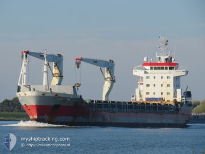
IJSSELBORG
General Cargo
Current Trip
| Trip Time | 4 days |
|---|---|
| Trip Distance | 93.83 nm |
| AVG Speed | 9.4 Knots |
| MAX Speed | 15.6 Knots |
| Dybgang | 8.1 m |
| AVG Wind | 15.7 knots |
| MAX Wind | 17.9 knots |
| MIN Temp | 26.8°C / 80.24°F |
| MAX Temp | 27.5°C / 81.5°F |
| Position Modtaget | 15 d siden |
Current Position
| Longitude | -26.24918° |
|---|---|
| Latitude | 36.17517° |
| Status | Under way using engine |
| Fart | 11.3 Knots |
| Kurs | 222.6° |
| Område | North Atlantic Ocean |
| Station | T-AIS |
| Position Modtaget | 15 d siden |
Info
Information
The current position of IJSSELBORG is in North Atlantic Ocean with coordinates 36.17517° / -26.24918° as reported on 2024-04-02 17:16 by AIS to our vessel tracker app. The vessel's current speed is 11.3 Knots and is currently inside the port of WILLEMSTAD.
The vessel IJSSELBORG (IMO: 9456745, MMSI: 244707000) is a General Cargo that was built in 2010 ( 14 år gamle ). It's sailing under the flag of [NL] Netherlands.
In this page you can find informations about the vessels current position, last detected port calls, and current voyage information. If the vessels is not in coverage by AIS you will find the latest position.
The current position of IJSSELBORG is detected by our AIS receivers and we are not responsible for the reliability of the data. The last position was recorded while the vessel was in Coverage by the Ais receivers of our vessel tracking app.
The current draught of IJSSELBORG as reported by AIS is 8.1 meters
Weather
| Temperature | 26.9°C / 80.42°F |
|---|---|
| Wind Speed | 11 knots |
| Direction | 80° E |
| Pressure | 1009.1 hPa |
| Humidity | 87.8 % |
| Cloud Coverage | 53 % |
Featured Company
Last Port Calls
| Port | Arrival | Departure | Time In Port |
|---|---|---|---|
| 2024-04-17 03:05 | |||
| 2024-04-12 09:20 | 2024-04-12 19:32 | 10 h | |
| 2024-03-25 04:56 | 2024-03-26 21:25 | 1 d | |
| 2024-03-09 00:04 | |||
| 2024-03-01 13:25 | 2024-03-02 02:32 | 13 h | |
| 2024-02-11 16:21 | 2024-02-13 16:37 | 2 d |
Most Visited Ports (Last year)
| Port | Arrivals | |
|---|---|---|
| 16 | ||
| 9 | ||
| 5 | ||
| 4 |
Last Trips
| Origin | Departure | Destination | Arrival | Distance | |
|---|---|---|---|---|---|
| 2024-04-12 15:32 | 2024-04-16 23:05 | 93.83 nm | |||
| 2024-03-26 22:25 | 2024-04-12 05:20 | 4521.21 nm | |||
| 2024-03-08 20:04 | 2024-03-25 05:56 | 4325.05 nm | |||
| 2024-02-13 17:37 | 2024-03-01 09:25 | 4472.29 nm | |||
| 2024-01-26 18:54 | 2024-02-11 17:21 | 4287.42 nm |
Events
| Tid | Hændelsen | Detaljer | Position / Dest | Info |
|---|---|---|---|---|
| 2024-04-17 03:06 | STOP Sejllads |
12.11590 / -68.91271
[CW] WILLEMSTAD
|
Fart: 0.1 kn Kurs: 276° |
|
| 2024-04-17 03:05 | Skibe i havn |
|
12.11590 / -68.91271
[CW] WILLEMSTAD
|
Fart: 1.3 kn Kurs: 272° |
| 2024-04-16 23:05 | START Sejllads | 7.33 nm, South East of GOTO |
12.14607 / -68.28271
WILLEMSTAD
|
Fart: 7.8 kn Kurs: 255° |
| 2024-04-13 01:34 | STOP Sejllads | 7.57 nm, South East of GOTO |
12.14500 / -68.27834
WILLEMSTAD
|
Fart: Kurs: -1° |
| 2024-04-12 19:32 | Afsejlet fra sidste havn |
|
12.09660 / -68.94182
WILLEMSTAD
|
Fart: 7 kn Kurs: 210° |
| 2024-04-12 19:12 | START Sejllads |
12.11588 / -68.91698
[CW] WILLEMSTAD
|
Fart: 6.2 kn Kurs: 288° |
|
| 2024-04-12 09:20 | STOP Sejllads |
12.11462 / -68.91389
[CW] WILLEMSTAD
|
Fart: Kurs: 279° |
|
| 2024-04-12 09:20 | Skibe i havn |
|
12.11462 / -68.91389
[CW] WILLEMSTAD
|
Fart: 0.7 kn Kurs: 273° |
| 2024-04-12 01:00 | START Sejllads |
12.48057 / -70.00206
WILLEMSTAD
|
Fart: 4.1 kn Kurs: 281° |
|
| 2024-04-11 17:24 | STOP Sejllads |
12.47926 / -69.99714
WILLEMSTAD
|
Fart: 0.2 kn Kurs: 139° |