
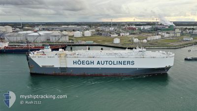
HOEGH NEW YORK
Vehicles Carrier
Current Trip
| Time Travelled | 16 h, 13 mins |
|---|---|
| Remaining Time | --- |
| Distance Travelled | 65.03 nm |
| Remaining Distance | --- |
| AVG Speed | 12.2 Knots |
| MAX Speed | 15.9 Knots |
| AVG Wind | 9.8 knots |
| MAX Wind | 11.7 knots |
| MIN Temp | 10.3°C / 50.54°F |
| MAX Temp | 19.8°C / 67.64°F |
| Dybgang | 9 m |
| Position Modtaget | 10 h, 45 m siden |
Current Position
| Longitude | -75.51272° |
|---|---|
| Latitude | 39.70208° |
| Status | Under way using engine |
| Fart | 6.2 Knots |
| Kurs | 20° |
| Område | North Atlantic Ocean |
| Station | T-AIS |
| Position Modtaget | 10 h, 45 m siden |
Info
Information
The current position of HOEGH NEW YORK is in North Atlantic Ocean with coordinates 39.70208° / -75.51272° as reported on 2024-04-25 02:29 by AIS to our vessel tracker app. The vessel's current speed is 6.2 Knots
The vessel HOEGH NEW YORK (IMO: 9295830, MMSI: 257560000) is a Vehicles Carrier that was built in 2005 ( 19 år gamle ). It's sailing under the flag of [NO] Norway.
In this page you can find informations about the vessels current position, last detected port calls, and current voyage information. If the vessels is not in coverage by AIS you will find the latest position.
The current position of HOEGH NEW YORK is detected by our AIS receivers and we are not responsible for the reliability of the data. The last position was recorded while the vessel was in Coverage by the Ais receivers of our vessel tracking app.
The current draught of HOEGH NEW YORK as reported by AIS is 9 meters
Weather
| Temperature | 8.6°C / 47.48°F |
|---|---|
| Wind Speed | 8 knots |
| Direction | 53° NE |
| Pressure | 1026.4 hPa |
| Humidity | 49 % |
| Cloud Coverage | 100 % |
Featured Company
Last Port Calls
| Port | Arrival | Departure | Time In Port |
|---|---|---|---|
| 2024-04-24 07:47 | 2024-04-24 21:02 | 13 h | |
| 2024-04-14 12:56 | 2024-04-16 00:41 | 1 d | |
| 2024-04-09 17:21 | 2024-04-10 16:29 | 23 h | |
| 2024-04-05 13:11 | 2024-04-06 15:43 | 1 d | |
| 2024-03-10 22:06 | 2024-03-11 14:23 | 16 h | |
| 2024-03-08 03:18 | 2024-03-08 15:23 | 12 h | |
| 2024-02-28 23:04 | 2024-02-29 16:39 | 17 h | |
| 2024-02-26 00:20 | 2024-02-26 06:11 | 5 h | |
| 2024-02-18 10:51 | |||
| 2024-02-11 05:31 | 2024-02-11 14:48 | 9 h |
Most Visited Ports (Last year)
| Port | Arrivals | |
|---|---|---|
| 5 | ||
| 2 | ||
| 2 | ||
| 2 | ||
| 2 | ||
| 2 |
Last Trips
| Origin | Departure | Destination | Arrival | Distance | |
|---|---|---|---|---|---|
| 2024-04-15 19:41 | 2024-04-24 03:47 | 2043.87 nm | |||
| 2024-04-10 11:29 | 2024-04-14 07:56 | 704.11 nm | |||
| 2024-04-06 10:43 | 2024-04-09 12:21 | 1237.12 nm | |||
| 2024-03-11 23:23 | 2024-04-05 08:11 | 8989.92 nm | |||
| 2024-03-08 23:23 | 2024-03-11 07:06 | 804.77 nm | |||
| 2024-02-29 23:39 | 2024-03-08 11:18 | 2366.56 nm | |||
| 2024-02-26 14:11 | 2024-02-29 06:04 | 811.05 nm | |||
| 2024-02-11 18:48 | 2024-02-18 16:21 | 2659.96 nm | |||
| 2024-02-10 21:59 | 2024-02-11 09:31 | 138.04 nm | |||
| 2024-02-07 22:01 | 2024-02-10 05:25 | 183.96 nm |
Events
| Tid | Hændelsen | Detaljer | Position / Dest | Info |
|---|---|---|---|---|
| 2024-04-25 02:54 | STOP Sejllads | 1.62 nm, South East of WILMINGTON |
39.70851 / -75.51257
USILG
|
Fart: 0.1 kn Kurs: 199° |
| 2024-04-25 02:38 | Status er ændret | Default Under way using engine |
39.70799 / -75.51015
USILG
|
Fart: 6.2 kn Kurs: 20° |
| 2024-04-25 02:29 | Udenfor Dækning |
39.70208 / -75.51272
North Atlantic Ocean
USILG
|
Fart: 6.2 kn Kurs: 20° |
|
| 2024-04-25 02:21 | Status er ændret | Under way using engine Default |
39.68593 / -75.51932
USILG
|
Fart: 7.4 kn Kurs: 18° |
| 2024-04-25 02:14 | Indenfor Dækning |
39.68593 / -75.51932
North Atlantic Ocean
USILG
|
Fart: 7.7 kn Kurs: 17° |
|
| 2024-04-24 22:50 | Status er ændret | Default Under way using engine |
39.34245 / -76.17968
USILG
|
Fart: 13.6 kn Kurs: 49° |
| 2024-04-24 22:44 | Udenfor Dækning |
39.32577 / -76.20308
North Atlantic Ocean
USILG
|
Fart: 13.6 kn Kurs: 49° |
|
| 2024-04-24 21:02 | Afsejlet fra sidste havn |
|
39.19783 / -76.48267
USILG
|
Fart: 3.6 kn Kurs: 172° |
| 2024-04-24 20:56 | START Sejllads |
39.20323 / -76.48315
[US] SPARROWS POINT
|
Fart: 3.1 kn Kurs: 176° |
|
| 2024-04-24 20:26 | Status er ændret | Under way using engine Moored |
39.21168 / -76.48288
[US] SPARROWS POINT
|
Fart: Kurs: 264° |