
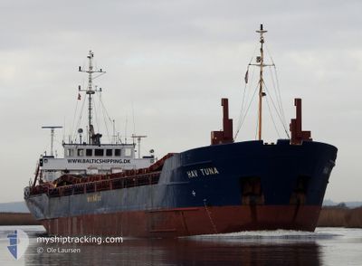
HAV TUNA
General Cargo
Current Trip
| Time Travelled | 23 h, 46 mins |
|---|---|
| Remaining Time | 4 h, 54 mins |
| Distance Travelled | 195.58 nm |
| Remaining Distance | 82.72 nm |
| AVG Speed | 9.1 Knots |
| MAX Speed | 11.8 Knots |
| AVG Wind | 10.1 knots |
| MAX Wind | 15.8 knots |
| MIN Temp | 2°C / 35.6°F |
| MAX Temp | 7.2°C / 44.96°F |
| Dybgang | 3 m |
| Position Modtaget | 3 h, 34 m siden |
Current Position
| Longitude | 13.62819° |
|---|---|
| Latitude | 54.66891° |
| Status | Under way using engine |
| Fart | 9.8 Knots |
| Kurs | 152.6° |
| Område | Baltic Sea |
| Station | T-AIS |
| Position Modtaget | 3 h, 34 m siden |
Info
Information
The current position of HAV TUNA is in Baltic Sea with coordinates 54.66891° / 13.62819° as reported on 2024-04-19 14:54 by AIS to our vessel tracker app. The vessel's current speed is 9.8 Knots and is heading at the port of SZCZECIN. The estimated time of arrival as calculated by MyShipTracking vessel tracking app is 2024-04-19 23:23 LT
The vessel HAV TUNA (IMO: 9084487, MMSI: 304717000) is a General Cargo that was built in 1993 ( 31 år gamle ). It's sailing under the flag of [AG] Antigua Barbuda.
In this page you can find informations about the vessels current position, last detected port calls, and current voyage information. If the vessels is not in coverage by AIS you will find the latest position.
The current position of HAV TUNA is detected by our AIS receivers and we are not responsible for the reliability of the data. The last position was recorded while the vessel was in Coverage by the Ais receivers of our vessel tracking app.
The current draught of HAV TUNA as reported by AIS is 3 meters
Weather
| Temperature | 5.7°C / 42.26°F |
|---|---|
| Wind Speed | 17 knots |
| Direction | 68° ENE |
| Pressure | 1000.6 hPa |
| Humidity | 92.5 % |
| Cloud Coverage | 100 % |
Featured Company
Last Port Calls
| Port | Arrival | Departure | Time In Port |
|---|---|---|---|
| 2024-04-18 10:58 | 2024-04-18 18:43 | 7 h | |
| 2024-04-18 04:21 | 2024-04-18 10:18 | 5 h | |
| 2024-04-16 11:53 | 2024-04-16 12:49 | 55 m | |
| 2024-04-14 15:25 | 2024-04-16 06:25 | 1 d | |
| 2024-04-12 13:22 | 2024-04-13 12:25 | 23 h | |
| 2024-04-11 04:03 | 2024-04-11 17:55 | 13 h | |
| 2024-04-03 02:00 | 2024-04-09 02:20 | 6 d | |
| 2024-04-01 18:30 | 2024-04-02 16:16 | 21 h | |
| 2024-03-24 06:20 | 2024-03-25 14:52 | 1 d | |
| 2024-03-20 20:01 | 2024-03-22 19:59 | 1 d |
Most Visited Ports (Last year)
| Port | Arrivals | |
|---|---|---|
| 9 | ||
| 6 | ||
| 6 | ||
| 4 | ||
| 4 | ||
| 4 |
Last Trips
| Origin | Departure | Destination | Arrival | Distance | |
|---|---|---|---|---|---|
| 2024-04-18 12:18 | 2024-04-18 12:58 | 5.26 nm | |||
| 2024-04-16 14:49 | 2024-04-18 06:21 | 124.01 nm | |||
| 2024-04-16 08:25 | 2024-04-16 13:53 | 42.06 nm | |||
| 2024-04-13 14:25 | 2024-04-14 17:25 | 207.97 nm | |||
| 2024-04-11 19:55 | 2024-04-12 15:22 | 183.87 nm | |||
| 2024-04-09 04:20 | 2024-04-11 06:03 | 371.27 nm | |||
| 2024-04-02 18:16 | 2024-04-03 04:00 | 73.60 nm | |||
| 2024-03-25 15:52 | 2024-04-01 20:30 | 649.05 nm | |||
| 2024-03-22 20:59 | 2024-03-24 07:20 | 241.98 nm | |||
| 2024-03-19 21:24 | 2024-03-20 21:01 | 227.37 nm |
Events
| Tid | Hændelsen | Detaljer | Position / Dest | Info |
|---|---|---|---|---|
| 2024-04-19 15:37 | Status er ændret | Default Under way using engine |
54.56633 / 13.72297
PLSZZ
|
Fart: 9.8 kn Kurs: 152.6° |
| 2024-04-19 14:54 | Udenfor Dækning |
54.66891 / 13.62819
Baltic Sea
PLSZZ
|
Fart: 9.8 kn Kurs: 152.6° |
|
| 2024-04-19 12:29 | Ændre havområde | German part of the Baltic Sea Swedish part of the Baltic Sea |
55.00741 / 13.27269
Baltic Sea
PLSZZ
|
Fart: 9.7 kn Kurs: 134.5° |
| 2024-04-19 09:34 | Ændre havområde | Swedish part of the Baltic Sea Danish part of the Baltic Sea |
55.30192 / 12.64644
Baltic Sea
PLSZZ
|
Fart: 9.5 kn Kurs: 125.7° |
| 2024-04-19 09:25 | Ændre havområde | Danish part of the Baltic Sea Danish part of the Kattegat |
55.32113 / 12.62832
Baltic Sea
PLSZZ
|
Fart: 9.6 kn Kurs: 181.3° |
| 2024-04-19 09:13 | Ændre havområde | Danish part of the Kattegat Swedish part of the Kattegat |
55.35285 / 12.63374
Kattegat
PLSZZ
|
Fart: 9.6 kn Kurs: 188.4° |
| 2024-04-19 08:34 | Ændre havområde | Swedish part of the Kattegat Danish part of the Kattegat |
55.45607 / 12.65941
Kattegat
PLSZZ
|
Fart: 9.5 kn Kurs: 193.1° |
| 2024-04-18 18:43 | Afsejlet fra sidste havn |
|
55.47972 / 10.54486
PLSZZ
|
Fart: 7.4 kn Kurs: 60° |
| 2024-04-18 18:40 | START Sejllads |
55.47619 / 10.53783
[DK] LINDOE
|
Fart: 4.6 kn Kurs: 33° |
|
| 2024-04-18 18:39 | Status er ændret | Under way using engine Moored |
55.47460 / 10.53800
[DK] LINDOE
|
Fart: Kurs: 9° |