
HANS
Cargo
Current Trip
| Time Travelled | 23 h, 45 mins |
|---|---|
| Remaining Time | 3 days |
| Distance Travelled | 357.67 nm |
| Remaining Distance | 1201.08 nm |
| AVG Speed | 15.3 Knots |
| MAX Speed | 18.3 Knots |
| AVG Wind | 7.9 knots |
| MAX Wind | 10.9 knots |
| MIN Temp | 27.7°C / 81.86°F |
| MAX Temp | 30.1°C / 86.18°F |
| Dybgang | 9.2 m |
| Position Modtaget | 9 h, 3 m siden |
Current Position
| Longitude | 104.36017° |
|---|---|
| Latitude | 1.31883° |
| Status | Under way using engine |
| Fart | 14.4 Knots |
| Kurs | 49° |
| Område | South China Sea |
| Station | T-AIS |
| Position Modtaget | 9 h, 3 m siden |
Info
Information
The current position of HANS is in South China Sea with coordinates 1.31883° / 104.36017° as reported on 2024-04-24 14:50 by AIS to our vessel tracker app. The vessel's current speed is 14.4 Knots and is heading at the port of HAI PHONG. The estimated time of arrival as calculated by MyShipTracking vessel tracking app is 2024-04-28 00:47 LT
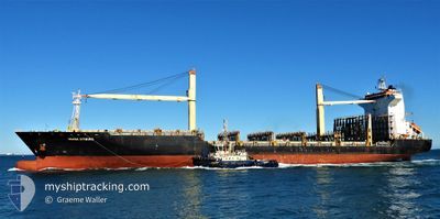
The vessel HANS (IMO: 9371652, MMSI: 636092998) is a Cargo It's sailing under the flag of [LR] Liberia.
In this page you can find informations about the vessels current position, last detected port calls, and current voyage information. If the vessels is not in coverage by AIS you will find the latest position.
The current position of HANS is detected by our AIS receivers and we are not responsible for the reliability of the data. The last position was recorded while the vessel was in Coverage by the Ais receivers of our vessel tracking app.
The current draught of HANS as reported by AIS is 9.2 meters
Weather
| Temperature | 29.5°C / 85.1°F |
|---|---|
| Wind Speed | 8 knots |
| Direction | 105° ESE |
| Pressure | 1007 hPa |
| Humidity | 76.1 % |
| Cloud Coverage | 25 % |
Featured Company
Last Port Calls
| Port | Arrival | Departure | Time In Port |
|---|---|---|---|
| 2024-04-23 07:00 | 2024-04-24 00:08 | 17 h | |
| 2024-04-21 16:48 | 2024-04-22 13:18 | 20 h | |
| 2024-04-18 16:40 | 2024-04-19 08:34 | 15 h | |
| 2024-04-16 02:23 | 2024-04-16 19:05 | 16 h | |
| 2024-04-10 23:05 | 2024-04-11 09:45 | 10 h | |
| 2024-04-04 03:49 | 2024-04-05 03:45 | 23 h | |
| 2024-03-31 17:47 | 2024-04-01 09:29 | 15 h | |
| 2024-03-29 16:33 | 2024-03-31 05:13 | 1 d | |
| 2024-03-20 18:24 | 2024-03-21 06:44 | 12 h | |
| 2024-03-09 12:27 | 2024-03-10 10:27 | 22 h |
Most Visited Ports (Last year)
| Port | Arrivals | |
|---|---|---|
| 18 | ||
| 13 | ||
| 13 | ||
| 11 | ||
| 10 | ||
| 8 |
Last Trips
| Origin | Departure | Destination | Arrival | Distance | |
|---|---|---|---|---|---|
| 2024-04-22 21:18 | 2024-04-23 15:00 | 184.60 nm | |||
| 2024-04-19 15:34 | 2024-04-22 00:48 | 602.40 nm | |||
| 2024-04-17 03:05 | 2024-04-18 23:40 | 591.94 nm | |||
| 2024-04-11 17:45 | 2024-04-16 10:23 | 1402.28 nm | |||
| 2024-04-05 11:45 | 2024-04-11 07:05 | 1721.66 nm | |||
| 2024-04-01 17:29 | 2024-04-04 11:49 | 191.33 nm | |||
| 2024-03-31 13:13 | 2024-04-01 01:47 | 190.36 nm | |||
| 2024-03-21 14:44 | 2024-03-30 00:33 | 196.49 nm | |||
| 2024-03-10 18:27 | 2024-03-21 02:24 | 2937.35 nm | |||
| 2024-03-09 09:03 | 2024-03-09 20:27 | 182.75 nm |
Events
| Tid | Hændelsen | Detaljer | Position / Dest | Info |
|---|---|---|---|---|
| 2024-04-24 14:56 | Status er ændret | Default Under way using engine |
1.33443 / 104.37860
VNHPH
|
Fart: 14.4 kn Kurs: 49° |
| 2024-04-24 14:50 | Udenfor Dækning |
1.31883 / 104.36017
South China Sea
VNHPH
|
Fart: 14.4 kn Kurs: 49° |
|
| 2024-04-24 14:49 | Ændre havområde | Malaysian part of the South China Sea Malaysian part of the Singapore Strait |
1.31727 / 104.35837
South China Sea
VNHPH
|
Fart: 14.4 kn Kurs: 49° |
| 2024-04-24 13:56 | Ændre havområde | Malaysian part of the Singapore Strait Indonesian part of the Singapore Strait |
1.26090 / 104.13992
Singapore Strait
VNHPH
|
Fart: 15.3 kn Kurs: 82° |
| 2024-04-24 11:24 | Dybgangen er ændret | 9.2 11 |
1.08035 / 103.58385
VNHPH
|
Fart: 16.2 kn Kurs: 124° |
| 2024-04-24 11:24 | Destination er ændret | VNHPH MYPKG |
1.08035 / 103.58385
VNHPH
|
Fart: 16.2 kn Kurs: 124° |
| 2024-04-24 11:24 | ETA er ændret | 2024/04/28 09:00 2024/04/23 13:00 |
1.08035 / 103.58385
VNHPH
|
Fart: 16.2 kn Kurs: 124° |
| 2024-04-24 10:49 | Ændre havområde | Indonesian part of the Singapore Strait Indonesian part of the Malacca Strait |
1.15723 / 103.44760
Singapore Strait
|
Fart: 15.8 kn Kurs: 120° |
| 2024-04-24 10:47 | Status er ændret | Under way using engine Default |
1.16172 / 103.43998
MYPKG
|
Fart: 15.8 kn Kurs: 121° |
| 2024-04-24 10:40 | Ændre havområde | Indonesian part of the Malacca Strait Malaysian part of the Malacca Strait |
1.17762 / 103.41410
Malacca Strait
|
Fart: 15.7 kn Kurs: 121° |