
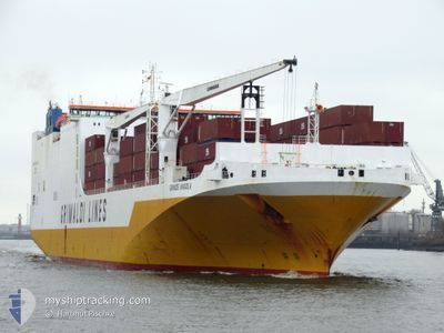
GRANDE ANGOLA
Ro-Ro Cargo
Current Trip
| Trip Time | 20 h, 36 mins |
|---|---|
| Trip Distance | 343.95 nm |
| AVG Speed | 16.7 Knots |
| MAX Speed | 18.3 Knots |
| Dybgang | 9.1 m |
| AVG Wind | 10.9 knots |
| MAX Wind | 20 knots |
| MIN Temp | 12.4°C / 54.32°F |
| MAX Temp | 15.3°C / 59.54°F |
| Position Modtaget | 22 h, 26 m siden |
Current Position
| Longitude | --- |
|---|---|
| Latitude | --- |
| Status | Under way using engine |
| Fart | 16.7 Knots |
| Kurs | 125.8° |
| Område | Tyrrhenian Sea |
| Station | T-AIS |
| Position Modtaget | 22 h, 26 m siden |
Info
Information
The current position of GRANDE ANGOLA is in Tyrrhenian Sea with coordinates 40.97541° / 12.48452° as reported on 2025-12-06 08:10 by AIS to our vessel tracker app. The vessel's current speed is 16.7 Knots and is currently inside the port of SALERNO.
The vessel GRANDE ANGOLA (IMO: 9343156, MMSI: 247233800) is a Ro-Ro Cargo that was built in 2008 ( 17 år gamle ). It's sailing under the flag of [IT] Italy.
In this page you can find informations about the vessels current position, last detected port calls, and current voyage information. If the vessels is not in coverage by AIS you will find the latest position.
The current position of GRANDE ANGOLA is detected by our AIS receivers and we are not responsible for the reliability of the data. The last position was recorded while the vessel was in Coverage by the Ais receivers of our vessel tracking app.
The current draught of GRANDE ANGOLA as reported by AIS is 9.1 meters
Weather
| Temperature | 8.6°C / 47.48°F |
|---|---|
| Wind Speed | 3 knots |
| Direction | 39° NE |
| Pressure | 1013.4 hPa |
| Humidity | 70.8 % |
| Cloud Coverage | 77 % |
Featured Company
Last Port Calls
| Port | Arrival | Departure | Time In Port |
|---|---|---|---|
| 2025-12-06 16:05 | |||
| 2025-12-04 21:26 | 2025-12-05 19:29 | 22 h | |
| 2025-12-03 09:38 | 2025-12-04 14:23 | 1 d | |
| 2025-12-01 22:54 | 2025-12-02 13:28 | 14 h | |
| 2025-11-30 06:29 | 2025-12-01 16:41 | 1 d | |
| 2025-11-28 15:23 | 2025-11-29 22:55 | 1 d | |
| 2025-11-27 01:20 | 2025-11-27 15:16 | 13 h | |
| 2025-11-17 22:23 | 2025-11-21 16:46 | 3 d | |
| 2025-11-09 22:32 | 2025-11-12 09:56 | 2 d | |
| 2025-11-07 08:20 | 2025-11-08 08:12 | 23 h |
Last Trips
| Origin | Departure | Destination | Arrival | Distance | |
|---|---|---|---|---|---|
| 2025-12-05 19:29 | 2025-12-06 16:05 | 343.95 nm | |||
| 2025-12-04 14:23 | 2025-12-04 21:26 | 85.40 nm | |||
| 2025-12-02 13:28 | 2025-12-03 09:38 | 246.42 nm | |||
| 2025-12-01 16:41 | 2025-12-01 22:54 | 81.04 nm | |||
| 2025-11-29 22:55 | 2025-11-30 06:29 | 78.69 nm | |||
| 2025-11-27 15:16 | 2025-11-28 15:23 | 350.21 nm | |||
| 2025-11-21 16:46 | 2025-11-27 01:20 | 1958.68 nm | |||
| 2025-11-12 09:56 | 2025-11-17 22:23 | 2070.67 nm | |||
| 2025-11-08 08:12 | 2025-11-09 22:32 | 528.19 nm | |||
| 2025-11-06 12:52 | 2025-11-07 08:20 | 159.30 nm |
Events
| Tid | Hændelsen | Detaljer | Position / Dest | Info |
|---|---|---|---|---|
| 2025-12-06 15:45 | STOP Sejllads |
40.67194 / 14.74236
[IT] SALERNO
|
Fart: Kurs: 299° |
|
| 2025-12-06 15:05 | Skibe i havn |
|
40.66580 / 14.74615
[IT] SALERNO
|
Fart: 5 kn Kurs: 66° |
| 2025-12-06 08:50 | Status er ændret | Default Under way using engine |
40.86916 / 12.68703
ITLIV>>>ITSAL
|
Fart: 16.7 kn Kurs: 125.8° |
| 2025-12-06 08:10 | Udenfor Dækning |
40.97541 / 12.48452
Tyrrhenian Sea
ITLIV>>>ITSAL
|
Fart: 16.7 kn Kurs: 125.8° |
|
| 2025-12-06 07:45 | Indenfor Dækning |
41.04366 / 12.35661
Tyrrhenian Sea
ITLIV>>>ITSAL
|
Fart: 17 kn Kurs: 125.4° |
|
| 2025-12-06 06:36 | Udenfor Dækning |
41.22944 / 11.99639
Tyrrhenian Sea
ITLIV>>>ITSAL
|
Fart: 17.1 kn Kurs: 123.4° |
|
| 2025-12-06 05:30 | Status er ændret | Under way using engine Default |
41.40284 / 11.64616
ITLIV>>>ITSAL
|
Fart: 16.9 kn Kurs: 130° |
| 2025-12-06 05:30 | Indenfor Dækning |
41.39184 / 11.67087
Tyrrhenian Sea
ITLIV>>>ITSAL
|
Fart: 16.9 kn Kurs: 120.9° |
|
| 2025-12-06 00:09 | Status er ændret | Default Under way using engine |
42.26132 / 9.99473
ITLIV>>>ITSAL
|
Fart: 16.8 kn Kurs: 122.6° |
| 2025-12-06 00:02 | Udenfor Dækning |
42.27949 / 9.95365
Tyrrhenian Sea
ITLIV>>>ITSAL
|
Fart: 16.8 kn Kurs: 122.6° |