
UNICLOUD
General Cargo
Current Trip
| Time Travelled | 8 days |
|---|---|
| Remaining Time | 2 days |
| Distance Travelled | 1486.08 nm |
| Remaining Distance | 752.43 nm |
| AVG Speed | 9.5 Knots |
| MAX Speed | 12.5 Knots |
| AVG Wind | 10.8 knots |
| MAX Wind | 18 knots |
| MIN Temp | 24.2°C / 75.56°F |
| MAX Temp | 29.7°C / 85.46°F |
| Dybgang | 6.3 m |
| Position Modtaget | 24 d siden |
Current Position
| Longitude | 18.99285° |
|---|---|
| Latitude | -34.60433° |
| Status | Under way using engine |
| Fart | 11.6 Knots |
| Kurs | 120.7° |
| Område | South Atlantic Ocean |
| Station | T-AIS |
| Position Modtaget | 24 d siden |
Info
Information
The current position of UNICLOUD is in South Atlantic Ocean with coordinates -34.60433° / 18.99285° as reported on 2024-03-25 20:40 by AIS to our vessel tracker app. The vessel's current speed is 11.6 Knots and is heading at the port of NACALA PORTO. The estimated time of arrival as calculated by MyShipTracking vessel tracking app is 2024-04-22 14:26 LT
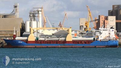
The vessel UNICLOUD (IMO: 9195470, MMSI: 236325000) is a General Cargo that was built in 2006 ( 18 år gamle ). It's sailing under the flag of [GI] Gibraltar.
In this page you can find informations about the vessels current position, last detected port calls, and current voyage information. If the vessels is not in coverage by AIS you will find the latest position.
The current position of UNICLOUD is detected by our AIS receivers and we are not responsible for the reliability of the data. The last position was recorded while the vessel was in Coverage by the Ais receivers of our vessel tracking app.
The current draught of UNICLOUD as reported by AIS is 6.3 meters
Weather
| Temperature | 24.3°C / 75.74°F |
|---|---|
| Wind Speed | 9 knots |
| Direction | 155° SSE |
| Pressure | 1018 hPa |
| Humidity | 72.1 % |
| Cloud Coverage | 5 % |
Featured Company
Last Port Calls
| Port | Arrival | Departure | Time In Port |
|---|---|---|---|
| 2024-04-05 14:59 | 2024-04-11 05:36 | 5 d | |
| 2024-04-02 18:59 | 2024-04-03 12:39 | 17 h | |
| 2024-03-18 17:49 | 2024-03-22 20:12 | 4 d | |
| 2024-03-12 07:08 | 2024-03-13 09:44 | 1 d | |
| 2024-02-10 10:36 | 2024-02-12 00:16 | 1 d | |
| 2024-02-06 10:01 | 2024-02-06 22:01 | 11 h |
Last Trips
| Origin | Departure | Destination | Arrival | Distance | |
|---|---|---|---|---|---|
| 2024-04-03 14:39 | 2024-04-05 17:59 | 551.83 nm | |||
| 2024-03-22 22:12 | 2024-04-02 20:59 | 1994.61 nm | |||
| 2024-03-13 11:44 | 2024-03-18 19:49 | 24.06 nm | |||
| 2024-02-12 00:16 | 2024-03-12 09:08 | 6527.41 nm | |||
| 2024-02-06 22:01 | 2024-02-10 10:36 | 676.57 nm | |||
| 2024-01-26 00:19 | 2024-02-06 10:01 | 2198.83 nm |
Events
| Tid | Hændelsen | Detaljer | Position / Dest | Info |
|---|---|---|---|---|
| 2024-04-15 13:45 | START Sejllads | 2.84 nm, North of FOMBONI |
-12.24468 / 43.77199
MZMNC
|
Fart: 10.7 kn Kurs: 357° |
| 2024-04-14 12:59 | STOP Sejllads | 1.59 nm, North East of FOMBONI |
-12.26830 / 43.77286
MZMNC
|
Fart: 0.2 kn Kurs: 197° |
| 2024-04-14 11:55 | START Sejllads | 5.34 nm, North of FOMBONI |
-12.20171 / 43.74076
MZMNC
|
Fart: 8.1 kn Kurs: 160° |
| 2024-04-14 10:55 | STOP Sejllads | 5.49 nm, North of FOMBONI |
-12.19866 / 43.74430
MZMNC
|
Fart: 0.3 kn Kurs: 257° |
| 2024-04-14 09:35 | START Sejllads | 17.31 nm, North of FOMBONI |
-12.00061 / 43.73657
MZMNC
|
Fart: 4.9 kn Kurs: 175° |
| 2024-04-13 21:20 | STOP Sejllads | 6.81 nm, North of FOMBONI |
-12.17821 / 43.73246
MZMNC
|
Fart: 0.3 kn Kurs: 266° |
| 2024-04-11 05:36 | Afsejlet fra sidste havn |
|
-6.81687 / 39.30472
MZMNC
|
Fart: 7.1 kn Kurs: 63° |
| 2024-04-11 05:28 | START Sejllads |
-6.82476 / 39.29271
[TZ] DAR ES SALAAM
|
Fart: 5.9 kn Kurs: 58° |