
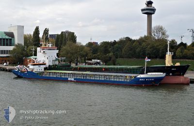
FLOKI
General Cargo
Current Trip
TR DIL
| Time Travelled | 3 h, 32 mins |
|---|---|
| Remaining Time | --- |
| Distance Travelled | 19.89 nm |
| Remaining Distance | --- |
| AVG Speed | 6.8 Knots |
| MAX Speed | 8 Knots |
| AVG Wind | 4.7 knots |
| MAX Wind | 7 knots |
| MIN Temp | 8.9°C / 48.02°F |
| MAX Temp | 9.9°C / 49.82°F |
| Dybgang | 0 m |
| Position Modtaget | 9 m siden |
Current Position
| Longitude | --- |
|---|---|
| Latitude | --- |
| Status | At anchor |
| Fart | 0.1 Knots |
| Kurs | 70° |
| Område | Sea of Marmara |
| Station | T-AIS |
| Position Modtaget | 9 m siden |
Info
Information
The current position of FLOKI is in Sea of Marmara with coordinates 40.86044° / 29.18422° as reported on 2025-12-09 04:31 by AIS to our vessel tracker app. The vessel's current speed is 0.1 Knots
The vessel FLOKI (IMO: 8503096, MMSI: 511100860) is a General Cargo that was built in 1985 ( 40 år gamle ). It's sailing under the flag of [PW] Palau.
In this page you can find informations about the vessels current position, last detected port calls, and current voyage information. If the vessels is not in coverage by AIS you will find the latest position.
The current position of FLOKI is detected by our AIS receivers and we are not responsible for the reliability of the data. The last position was recorded while the vessel was in Coverage by the Ais receivers of our vessel tracking app.
Weather
| Temperature | 9.7°C / 49.46°F |
|---|---|
| Wind Speed | 7 knots |
| Direction | 3° N |
| Pressure | 1023.4 hPa |
| Humidity | 71.1 % |
| Cloud Coverage | 100 % |
Featured Company
Last Port Calls
| Port | Arrival | Departure | Time In Port |
|---|---|---|---|
| 2025-12-08 20:26 | 2025-12-09 04:09 | 7 h | |
| 2025-12-05 16:38 | 2025-12-06 19:57 | 1 d | |
| 2025-11-26 01:19 | 2025-11-28 23:30 | 2 d | |
| 2025-11-24 07:19 | 2025-11-24 18:43 | 11 h | |
| 2025-11-22 19:15 | 2025-11-23 14:52 | 19 h | |
| 2025-11-15 14:23 | 2025-11-18 17:14 | 3 d | |
| 2025-11-13 07:28 | 2025-11-14 07:28 | 23 h | |
| 2025-11-08 12:38 | 2025-11-09 03:56 | 15 h | |
| 2025-11-03 07:06 | 2025-11-06 05:56 | 2 d | |
| 2025-10-31 09:44 | 2025-11-01 16:49 | 1 d |
Last Trips
| Origin | Departure | Destination | Arrival | Distance | |
|---|---|---|---|---|---|
| 2025-12-06 19:57 | 2025-12-08 20:26 | 283.59 nm | |||
| 2025-11-28 23:30 | 2025-12-05 16:38 | 264.42 nm | |||
| 2025-11-24 18:43 | 2025-11-26 01:19 | 226.74 nm | |||
| 2025-11-23 14:52 | 2025-11-24 07:19 | 0.97 nm | |||
| 2025-11-18 17:14 | 2025-11-22 19:15 | 304.30 nm | |||
| 2025-11-14 07:28 | 2025-11-15 14:23 | 247.02 nm | |||
| 2025-11-09 03:56 | 2025-11-13 07:28 | 391.07 nm | |||
| 2025-11-06 05:56 | 2025-11-08 12:38 | 331.57 nm | |||
| 2025-11-01 16:49 | 2025-11-03 07:06 | 272.88 nm | |||
| 2025-10-27 17:53 | 2025-10-31 09:44 | 224.17 nm |
Events
| Tid | Hændelsen | Detaljer | Position / Dest | Info |
|---|---|---|---|---|
| 2025-12-09 04:02 | STOP Sejllads | 1.54 nm, South West of KARTAL |
40.86051 / 29.18471
TR DIL
|
Fart: 0.2 kn Kurs: 20° |
| 2025-12-09 03:59 | Status er ændret | At anchor Under way using engine |
40.86026 / 29.18473
TR DIL
|
Fart: 0.6 kn Kurs: 8° |
| 2025-12-09 03:21 | Status er ændret | Under way using engine Default |
40.80469 / 29.20154
TR DIL
|
Fart: 7.2 kn Kurs: 304° |
| 2025-12-09 02:54 | Status er ændret | Default Under way using engine |
40.77334 / 29.25940
TR DIL
|
Fart: 7.2 kn Kurs: 305.9° |
| 2025-12-09 01:17 | Status er ændret | Under way using engine Moored |
40.75580 / 29.50917
TR DIL
|
Fart: 7.3 kn Kurs: 242° |
| 2025-12-09 01:14 | Status er ændret | Moored Default |
40.75822 / 29.51563
TR DIL
|
Fart: 5.9 kn Kurs: 244° |
| 2025-12-09 01:12 | Status er ændret | Default Moored |
40.75939 / 29.51878
TR DIL
|
Fart: 5.3 kn Kurs: 246.1° |
| 2025-12-09 01:10 | Status er ændret | Moored Default |
40.76098 / 29.52322
TR DIL
|
Fart: 2.2 kn Kurs: 308° |
| 2025-12-09 01:10 | START Sejllads | 0.63 nm, West of DILISKELESI |
40.76098 / 29.52322
TR DIL
|
Fart: 3.4 kn Kurs: 239° |
| 2025-12-09 01:09 | Afsejlet fra sidste havn |
|
40.76098 / 29.52322
TR DIL
|
Fart: 2.2 kn Kurs: 308° |