
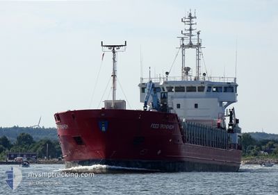
FEED TRONDHEIM
General Cargo
Current Trip
HORSEN
| Time Travelled | 1 day |
|---|---|
| Remaining Time | --- |
| Distance Travelled | 247.31 nm |
| Remaining Distance | --- |
| AVG Speed | 9.4 Knots |
| MAX Speed | 10.9 Knots |
| AVG Wind | 15.4 knots |
| MAX Wind | 22.9 knots |
| MIN Temp | 2.8°C / 37.04°F |
| MAX Temp | 6.8°C / 44.24°F |
| Dybgang | 5.7 m |
| Position Modtaget | Nu |
Current Position
| Longitude | 11.08317° |
|---|---|
| Latitude | 56.75917° |
| Status | Under way using engine |
| Fart | 9.7 Knots |
| Kurs | 225° |
| Område | Kattegat |
| Station | T-AIS |
| Position Modtaget | Nu |
Info
Information
The current position of FEED TRONDHEIM is in Kattegat with coordinates 56.75917° / 11.08317° as reported on 2024-04-20 00:43 by AIS to our vessel tracker app. The vessel's current speed is 9.7 Knots
The vessel FEED TRONDHEIM (IMO: 9226798, MMSI: 305371000) is a General Cargo that was built in 2002 ( 22 år gamle ). It's sailing under the flag of [AG] Antigua Barbuda.
In this page you can find informations about the vessels current position, last detected port calls, and current voyage information. If the vessels is not in coverage by AIS you will find the latest position.
The current position of FEED TRONDHEIM is detected by our AIS receivers and we are not responsible for the reliability of the data. The last position was recorded while the vessel was in Coverage by the Ais receivers of our vessel tracking app.
The current draught of FEED TRONDHEIM as reported by AIS is 5.7 meters
Weather
| Temperature | 4.1°C / 39.38°F |
|---|---|
| Wind Speed | 11 knots |
| Direction | 53° NE |
| Pressure | 1012 hPa |
| Humidity | 61.8 % |
| Cloud Coverage | 53 % |
Featured Company
Last Port Calls
| Port | Arrival | Departure | Time In Port |
|---|---|---|---|
| 2024-04-18 04:48 | 2024-04-18 17:12 | 12 h | |
| 2024-04-15 02:32 | 2024-04-16 11:25 | 1 d | |
| 2024-04-08 21:53 | 2024-04-09 23:16 | 1 d | |
| 2024-04-06 16:25 | 2024-04-08 15:10 | 1 d | |
| 2024-03-31 10:42 | 2024-04-01 14:09 | 1 d | |
| 2024-03-30 06:51 | 2024-03-31 05:19 | 22 h | |
| 2024-03-22 17:00 | 2024-03-26 04:47 | 3 d | |
| 2024-03-12 23:04 | 2024-03-13 14:39 | 15 h | |
| 2024-03-10 10:29 | 2024-03-11 12:31 | 1 d | |
| 2024-03-07 12:42 | 2024-03-10 06:50 | 2 d |
Most Visited Ports (Last year)
| Port | Arrivals | |
|---|---|---|
| 9 | ||
| 7 | ||
| 6 | ||
| 5 | ||
| 5 | ||
| 5 |
Last Trips
| Origin | Departure | Destination | Arrival | Distance | |
|---|---|---|---|---|---|
| 2024-04-16 13:25 | 2024-04-18 06:48 | 418.42 nm | |||
| 2024-04-10 01:16 | 2024-04-15 04:32 | 901.80 nm | |||
| 2024-04-08 17:10 | 2024-04-08 23:53 | 75.61 nm | |||
| 2024-04-01 17:09 | 2024-04-06 18:25 | 968.40 nm | |||
| 2024-03-31 08:19 | 2024-03-31 13:42 | 56.60 nm | |||
| 2024-03-26 05:47 | 2024-03-30 08:51 | 780.34 nm | |||
| 2024-03-13 15:39 | 2024-03-22 18:00 | 634.27 nm | |||
| 2024-03-11 13:31 | 2024-03-13 00:04 | 79.32 nm | |||
| 2024-03-10 07:50 | 2024-03-10 11:29 | 38.31 nm | |||
| 2024-03-01 23:03 | 2024-03-07 13:42 | 1278.16 nm |
Events
| Tid | Hændelsen | Detaljer | Position / Dest | Info |
|---|---|---|---|---|
| 2024-04-19 21:02 | Ændre havområde | Danish part of the Kattegat Swedish part of the Kattegat |
57.22433 / 11.57517
Kattegat
HORSEN
|
Fart: 9.1 kn Kurs: 188° |
| 2024-04-19 18:41 | START Sejllads | 3.19 nm, West of VRANGO |
57.59216 / 11.68433
HORSEN
|
Fart: 4.7 kn Kurs: 256° |
| 2024-04-19 18:34 | Status er ændret | Under way using engine At anchor |
57.59100 / 11.68750
HORSEN
|
Fart: Kurs: 46° |
| 2024-04-19 17:46 | Destination er ændret | HORSEN GOTENBORG ROAD |
57.59050 / 11.68633
HORSEN
|
Fart: Kurs: 48° |
| 2024-04-19 17:46 | ETA er ændret | 2024/04/20 12:00 2024/04/19 14:00 |
57.59050 / 11.68633
HORSEN
|
Fart: Kurs: 48° |
| 2024-04-19 13:59 | STOP Sejllads | 3.07 nm, West of VRANGO |
57.59151 / 11.68767
GOTENBORG ROAD
|
Fart: Kurs: 93° |
| 2024-04-19 13:58 | Status er ændret | At anchor Under way using engine |
57.59167 / 11.68733
GOTENBORG ROAD
|
Fart: 1.5 kn Kurs: 104° |
| 2024-04-19 12:01 | Ændre havområde | Swedish part of the Kattegat Danish part of the Kattegat |
57.71250 / 11.14983
Kattegat
GOTENBORG ROAD
|
Fart: 9.3 kn Kurs: 117° |
| 2024-04-19 11:01 | Ændre havområde | Danish part of the Kattegat Danish part of the Skaggerak |
57.78783 / 10.89183
Kattegat
GOTENBORG ROAD
|
Fart: 9.7 kn Kurs: 127° |
| 2024-04-19 06:32 | Destination er ændret | GOTENBORG ROAD HORSENS |
57.83717 / 9.61117
GOTENBORG ROAD
|
Fart: 9 kn Kurs: 99° |