
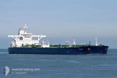
FARHAH
Crude Oil Tanker
Current Trip
| Time Travelled | 2 days |
|---|---|
| Remaining Time | 8 h, 1 mins |
| Distance Travelled | 539.25 nm |
| Remaining Distance | 468.81 nm |
| AVG Speed | 12.6 Knots |
| MAX Speed | 14.5 Knots |
| AVG Wind | 11.2 knots |
| MAX Wind | 22.9 knots |
| MIN Temp | 21.4°C / 70.52°F |
| MAX Temp | 30.8°C / 87.44°F |
| Dybgang | 10.9 m |
| Position Modtaget | 12 d siden |
Current Position
| Longitude | 38.35184° |
|---|---|
| Latitude | 22.45155° |
| Status | Under way using engine |
| Fart | 12 Knots |
| Kurs | 4.2° |
| Område | Red Sea |
| Station | T-AIS |
| Position Modtaget | 12 d siden |
Info
Information
The current position of FARHAH is in Red Sea with coordinates 22.45155° / 38.35184° as reported on 2024-04-10 20:19 by AIS to our vessel tracker app. The vessel's current speed is 12 Knots and is heading at the port of YANBU. The estimated time of arrival as calculated by MyShipTracking vessel tracking app is 2024-04-24 04:18 LT
The vessel FARHAH (IMO: 9484742, MMSI: 403537000) is a Crude Oil Tanker that was built in 2010 ( 14 år gamle ). It's sailing under the flag of [SA] Saudi Arabia.
In this page you can find informations about the vessels current position, last detected port calls, and current voyage information. If the vessels is not in coverage by AIS you will find the latest position.
The current position of FARHAH is detected by our AIS receivers and we are not responsible for the reliability of the data. The last position was recorded while the vessel was in Coverage by the Ais receivers of our vessel tracking app.
The current draught of FARHAH as reported by AIS is 10.9 meters
Weather
| Temperature | 26.2°C / 79.16°F |
|---|---|
| Wind Speed | 6 knots |
| Direction | 159° SSE |
| Pressure | 1012.5 hPa |
| Humidity | 34.8 % |
| Cloud Coverage | 5 % |
Featured Company
Last Port Calls
| Port | Arrival | Departure | Time In Port |
|---|---|---|---|
| 2024-04-20 21:47 | |||
| 2024-03-07 10:39 | 2024-03-08 00:09 | 13 h |
Most Visited Ports (Last year)
| Port | Arrivals | |
|---|---|---|
| 2 | ||
| 1 | ||
| 1 | ||
| 1 |
Last Trips
| Origin | Departure | Destination | Arrival | Distance | |
|---|---|---|---|---|---|
| 2024-01-29 18:26 | 2024-03-07 13:39 | 7808.12 nm |
Events
| Tid | Hændelsen | Detaljer | Position / Dest | Info |
|---|---|---|---|---|
| 2024-04-22 23:26 | STOP Sejllads | 5.48 nm, South East of SOKHNA |
29.56456 / 32.40831
SAYNB
|
Fart: 0.1 kn Kurs: 344° |
| 2024-04-22 22:46 | START Sejllads | 6.24 nm, South East of SOKHNA |
29.55506 / 32.41884
SAYNB
|
Fart: 3.3 kn Kurs: 316° |
| 2024-04-22 16:10 | STOP Sejllads | 8.71 nm, South East of SOKHNA |
29.51947 / 32.44292
SAYNB
|
Fart: Kurs: 236° |
| 2024-04-20 21:51 | START Sejllads | 0.79 nm, West of AL MUAJJIZ |
23.80139 / 38.39321
SAYNB
|
Fart: 4.3 kn Kurs: 219° |
| 2024-04-20 21:47 | Afsejlet fra sidste havn |
|
23.80441 / 38.39621
SAYNB
|
Fart: 2.4 kn Kurs: 267° |
| 2024-04-18 02:42 | STOP Sejllads |
23.21895 / 38.43669
SAYNB
|
Fart: 0.3 kn Kurs: 257° |
|
| 2024-04-17 10:24 | START Sejllads |
23.47695 / 38.16080
SAYNB
|
Fart: 3.4 kn Kurs: 33° |
|
| 2024-04-17 00:44 | STOP Sejllads |
23.41978 / 38.14813
SAYNB
|
Fart: 0.3 kn Kurs: 71° |