
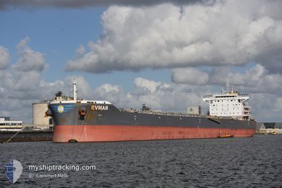
EVMAR
Cargo
Current Trip
PORT KAMSAR
| Time Travelled | 4 days |
|---|---|
| Remaining Time | --- |
| Distance Travelled | 1322.60 nm |
| Remaining Distance | --- |
| AVG Speed | 11 Knots |
| MAX Speed | 12.2 Knots |
| AVG Wind | 9.9 knots |
| MAX Wind | 15.9 knots |
| MIN Temp | 21.4°C / 70.52°F |
| MAX Temp | 26.6°C / 79.88°F |
| Dybgang | 8.5 m |
| Position Modtaget | 4 d siden |
Current Position
| Longitude | -17.02021° |
|---|---|
| Latitude | 10.69756° |
| Status | Under way using engine |
| Fart | 11.1 Knots |
| Kurs | 333.3° |
| Område | North Atlantic Ocean |
| Station | T-AIS |
| Position Modtaget | 4 d siden |
Info
Information
The current position of EVMAR is in North Atlantic Ocean with coordinates 10.69756° / -17.02021° as reported on 2024-04-21 10:41 by AIS to our vessel tracker app. The vessel's current speed is 11.1 Knots
The vessel EVMAR (IMO: 9738026, MMSI: 538006108) is a Cargo It's sailing under the flag of [MH] Marshall Is.
In this page you can find informations about the vessels current position, last detected port calls, and current voyage information. If the vessels is not in coverage by AIS you will find the latest position.
The current position of EVMAR is detected by our AIS receivers and we are not responsible for the reliability of the data. The last position was recorded while the vessel was in Coverage by the Ais receivers of our vessel tracking app.
The current draught of EVMAR as reported by AIS is 8.5 meters
Weather
| Temperature | 22.5°C / 72.5°F |
|---|---|
| Wind Speed | 13 knots |
| Direction | 96° E |
| Pressure | 1015.5 hPa |
| Humidity | 77.1 % |
| Cloud Coverage | 100 % |
Featured Company
Last Port Calls
| Port | Arrival | Departure | Time In Port |
|---|---|---|---|
| 2024-04-18 03:46 | 2024-04-20 17:47 | 2 d | |
| 2024-04-07 00:38 | 2024-04-08 13:56 | 1 d | |
| 2024-03-23 04:38 | 2024-03-26 16:24 | 3 d | |
| 2024-03-20 05:51 | 2024-03-22 19:37 | 2 d | |
| 2024-03-03 01:48 | 2024-03-04 20:37 | 1 d | |
| 2024-02-20 10:32 | 2024-02-22 04:08 | 1 d | |
| 2024-02-03 07:04 |
Most Visited Ports (Last year)
| Port | Arrivals | |
|---|---|---|
| 2 | ||
| 1 | ||
| 1 | ||
| 1 | ||
| 1 | ||
| 1 |
Last Trips
| Origin | Departure | Destination | Arrival | Distance | |
|---|---|---|---|---|---|
| 2024-04-08 13:56 | 2024-04-18 03:46 | 1754.08 nm | |||
| 2024-03-26 17:24 | 2024-04-07 00:38 | 1573.90 nm | |||
| 2024-03-22 20:37 | 2024-03-23 05:38 | 66.87 nm | |||
| 2024-03-04 15:37 | 2024-03-20 06:51 | 3825.41 nm | |||
| 2024-02-21 23:08 | 2024-03-02 20:48 | 81.56 nm | |||
| 2024-02-03 08:04 | 2024-02-20 05:32 | 3772.37 nm |
Events
| Tid | Hændelsen | Detaljer | Position / Dest | Info |
|---|---|---|---|---|
| 2024-04-21 10:44 | Status er ændret | Default Under way using engine |
10.70500 / -17.02333
PORT KAMSAR
|
Fart: 11.1 kn Kurs: 333.3° |
| 2024-04-21 10:41 | Status er ændret | Under way using engine Default |
10.69756 / -17.02021
PORT KAMSAR
|
Fart: 11.1 kn Kurs: 332° |
| 2024-04-21 10:41 | Udenfor Dækning |
10.69756 / -17.02021
North Atlantic Ocean
|
Fart: 11.1 kn Kurs: 333.3° |
|
| 2024-04-21 10:41 | Ændre havområde | Guinea Bissau part of the North Atlantic Ocean Western Saharan part of the North Atlantic Ocean |
10.69756 / -17.02021
North Atlantic Ocean
|
Fart: 11.1 kn Kurs: 333.3° |
| 2024-04-21 10:23 | Indenfor Dækning |
10.69756 / -17.02021
North Atlantic Ocean
|
Fart: 11.1 kn Kurs: 333.3° |
|
| 2024-04-20 17:47 | START Sejllads | 0.65 nm, South West of KAMSAR |
10.62833 / -14.63500
PORT KAMSAR
|
Fart: 5 kn Kurs: -1° |
| 2024-04-20 17:47 | Afsejlet fra sidste havn |
|
10.62833 / -14.63500
PORT KAMSAR
|
Fart: 3 kn Kurs: -1° |
| 2024-04-19 03:17 | Status er ændret | Default Moored |
10.64167 / -14.62833
[GN] KAMSAR
|
Fart: Kurs: 200° |
| 2024-04-19 03:10 | Indenfor Dækning |
10.64173 / -14.62903
North Atlantic Ocean
[GN] KAMSAR
|
Fart: Kurs: 11.4° |
|
| 2024-04-19 03:10 | Udenfor Dækning |
10.64173 / -14.62903
North Atlantic Ocean
[GN] KAMSAR
|
Fart: Kurs: 11.4° |