
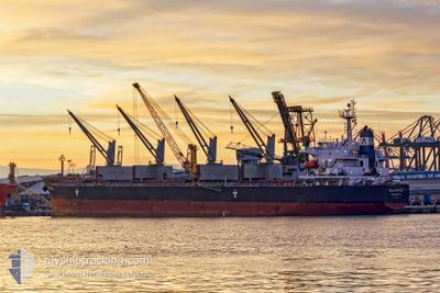
ELEOUSSA
Bulk Carrier
Current Trip
| Time Travelled | 18 days |
|---|---|
| Remaining Time | --- |
| Distance Travelled | 3511.26 nm |
| Remaining Distance | 1384.93 nm |
| AVG Speed | 11 Knots |
| MAX Speed | 16.1 Knots |
| AVG Wind | 6.5 knots |
| MAX Wind | 17 knots |
| MIN Temp | 11.3°C / 52.34°F |
| MAX Temp | 31.5°C / 88.7°F |
| Dybgang | 12.5 m |
| Position Modtaget | 4 d siden |
Current Position
| Longitude | 39.23895° |
|---|---|
| Latitude | 18.61376° |
| Status | Under way using engine |
| Fart | 12.1 Knots |
| Kurs | 151.4° |
| Område | Red Sea |
| Station | T-AIS |
| Position Modtaget | 4 d siden |
Info
Information
The current position of ELEOUSSA is in Red Sea with coordinates 18.61376° / 39.23895° as reported on 2024-04-21 05:29 by AIS to our vessel tracker app. The vessel's current speed is 12.1 Knots and is heading at the port of MOMBASA. The estimated time of arrival as calculated by MyShipTracking vessel tracking app is 2024-05-01 02:00 LT
The vessel ELEOUSSA (IMO: 9323900, MMSI: 229462000) is a Bulk Carrier that was built in 2008 ( 16 år gamle ). It's sailing under the flag of [MT] Malta.
In this page you can find informations about the vessels current position, last detected port calls, and current voyage information. If the vessels is not in coverage by AIS you will find the latest position.
The current position of ELEOUSSA is detected by our AIS receivers and we are not responsible for the reliability of the data. The last position was recorded while the vessel was in Coverage by the Ais receivers of our vessel tracking app.
The current draught of ELEOUSSA as reported by AIS is 12.5 meters
Weather
| Temperature | 28.8°C / 83.84°F |
|---|---|
| Wind Speed | 3 knots |
| Direction | 79° E |
| Pressure | 1006.7 hPa |
| Humidity | 66.1 % |
| Cloud Coverage | 15 % |
Featured Company
Last Port Calls
| Port | Arrival | Departure | Time In Port |
|---|---|---|---|
| 2024-04-18 03:33 | 2024-04-18 12:56 | 9 h | |
| 2024-04-07 09:02 | |||
| 2024-03-17 09:46 | 2024-03-26 18:36 | 9 d | |
| 2024-03-09 01:19 | |||
| 2024-02-15 02:29 |
Most Visited Ports (Last year)
| Port | Arrivals | |
|---|---|---|
| 6 | ||
| 2 | ||
| 2 | ||
| 1 | ||
| 1 | ||
| 1 |
Last Trips
| Origin | Departure | Destination | Arrival | Distance | |
|---|---|---|---|---|---|
| 2024-04-07 12:02 | 2024-04-18 05:33 | 1358.93 nm | |||
| 2024-03-09 02:19 | 2024-03-17 11:46 | 1470.04 nm |
Events
| Tid | Hændelsen | Detaljer | Position / Dest | Info |
|---|---|---|---|---|
| 2024-04-21 05:39 | Status er ændret | Default Under way using engine |
18.58299 / 39.25570
KEMBA
|
Fart: 12.1 kn Kurs: 151.4° |
| 2024-04-21 05:29 | Udenfor Dækning |
18.61376 / 39.23895
Red Sea
KEMBA
|
Fart: 12.1 kn Kurs: 151.4° |
|
| 2024-04-21 04:56 | Status er ændret | Under way using engine Default |
18.71231 / 39.18668
KEMBA
|
Fart: 12.4 kn Kurs: 158° |
| 2024-04-21 04:44 | Indenfor Dækning |
18.70812 / 39.18887
Red Sea
KEMBA
|
Fart: 12.3 kn Kurs: 153.5° |
|
| 2024-04-21 02:53 | Status er ændret | Default Under way using engine |
19.09489 / 39.00238
KEMBA
|
Fart: 12.5 kn Kurs: 155° |
| 2024-04-21 02:49 | Udenfor Dækning |
19.10856 / 38.99549
Red Sea
KEMBA
|
Fart: 12.5 kn Kurs: 155° |
|
| 2024-04-21 02:39 | Status er ændret | Under way using engine Default |
19.13907 / 38.98038
KEMBA
|
Fart: 12.6 kn Kurs: 154° |
| 2024-04-21 01:51 | Status er ændret | Default Under way using engine |
19.29417 / 38.90545
KEMBA
|
Fart: 12.6 kn Kurs: 153.8° |
| 2024-04-21 01:43 | Status er ændret | Under way using engine Default |
19.31849 / 38.89310
KEMBA
|
Fart: 12.5 kn Kurs: 155° |
| 2024-04-21 01:16 | Status er ændret | Default Under way using engine |
19.40412 / 38.85140
KEMBA
|
Fart: 12.2 kn Kurs: 155.1° |