
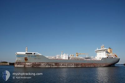
EK-RIVER
Tanker
Current Trip
| Trip Time | 1 day |
|---|---|
| Trip Distance | 527.69 nm |
| AVG Speed | 10.5 Knots |
| MAX Speed | 14.2 Knots |
| Dybgang | 7.3 m |
| AVG Wind | 12 knots |
| MAX Wind | 24.8 knots |
| MIN Temp | 0.9°C / 33.62°F |
| MAX Temp | 8°C / 46.4°F |
| Position Modtaget | 15 h, 40 m siden |
Current Position
| Longitude | 25.55525° |
|---|---|
| Latitude | 60.31267° |
| Status | Under way using engine |
| Fart | |
| Kurs | 128° |
| Område | Gulf of Finland |
| Station | T-AIS |
| Position Modtaget | 15 h, 40 m siden |
Info
Information
The current position of EK-RIVER is in Gulf of Finland with coordinates 60.31267° / 25.55525° as reported on 2024-04-15 11:50 by AIS to our vessel tracker app. The vessel's current speed is 0 Knots and is currently inside the port of PORVOO.
The vessel EK-RIVER (IMO: 9808259, MMSI: 257037140) is a Tanker It's sailing under the flag of [NO] Norway.
In this page you can find informations about the vessels current position, last detected port calls, and current voyage information. If the vessels is not in coverage by AIS you will find the latest position.
The current position of EK-RIVER is detected by our AIS receivers and we are not responsible for the reliability of the data. The last position was recorded while the vessel was in Coverage by the Ais receivers of our vessel tracking app.
The current draught of EK-RIVER as reported by AIS is 7.3 meters
Weather
| Temperature | 2.5°C / 36.5°F |
|---|---|
| Wind Speed | 4 knots |
| Direction | 7° N |
| Pressure | 997.9 hPa |
| Humidity | 93.6 % |
| Cloud Coverage | 100 % |
Featured Company
Last Port Calls
| Port | Arrival | Departure | Time In Port |
|---|---|---|---|
| 2024-04-15 11:39 | |||
| 2024-04-12 02:54 | 2024-04-13 13:24 | 1 d | |
| 2024-04-08 20:38 | 2024-04-10 04:10 | 1 d | |
| 2024-04-06 04:59 | 2024-04-06 21:13 | 16 h | |
| 2024-04-05 00:21 | 2024-04-05 15:57 | 15 h | |
| 2024-03-29 13:31 | 2024-03-31 04:04 | 1 d | |
| 2024-03-27 22:02 | 2024-03-29 08:31 | 1 d | |
| 2024-03-26 12:51 | 2024-03-27 16:58 | 1 d | |
| 2024-03-21 23:54 | 2024-03-23 05:00 | 1 d | |
| 2024-03-20 07:21 | 2024-03-21 05:15 | 21 h |
Last Trips
| Origin | Departure | Destination | Arrival | Distance | |
|---|---|---|---|---|---|
| 2024-04-13 16:24 | 2024-04-15 14:39 | 527.69 nm | |||
| 2024-04-10 07:10 | 2024-04-12 05:54 | 521.76 nm | |||
| 2024-04-07 00:13 | 2024-04-08 23:38 | 530.08 nm | |||
| 2024-04-05 18:57 | 2024-04-06 07:59 | 122.59 nm | |||
| 2024-03-31 07:04 | 2024-04-05 03:21 | 629.55 nm | |||
| 2024-03-29 10:31 | 2024-03-29 15:31 | 56.06 nm | |||
| 2024-03-27 18:58 | 2024-03-28 00:02 | 56.21 nm | |||
| 2024-03-23 07:00 | 2024-03-26 14:51 | 224.52 nm | |||
| 2024-03-21 07:15 | 2024-03-22 01:54 | 224.48 nm | |||
| 2024-03-16 17:39 | 2024-03-20 09:21 | 539.89 nm |
Events
| Tid | Hændelsen | Detaljer | Position / Dest | Info |
|---|---|---|---|---|
| 2024-04-15 11:54 | Status er ændret | Default Under way using engine |
60.31271 / 25.55525
[FI] PORVOO
|
Fart: Kurs: 128° |
| 2024-04-15 11:50 | Udenfor Dækning |
60.31267 / 25.55525
Gulf of Finland
[FI] PORVOO
|
Fart: Kurs: 152.6° |
|
| 2024-04-15 11:46 | STOP Sejllads |
60.31269 / 25.55510
[FI] PORVOO
|
Fart: 0.1 kn Kurs: 126° |
|
| 2024-04-15 11:39 | Skibe i havn |
|
60.31020 / 25.55873
[FI] PORVOO
|
Fart: 2.6 kn Kurs: 147° |
| 2024-04-15 08:50 | Ændre havområde | Finnish part of the Gulf of Finland Estonian part of the Gulf of Finland |
59.88093 / 25.36313
Gulf of Finland
FIKOK>FISKV
|
Fart: 10.9 kn Kurs: 43.7° |
| 2024-04-15 05:57 | Ændre havområde | Estonian part of the Gulf of Finland Finnish part of the Gulf of Finland |
59.72378 / 24.36064
Gulf of Finland
FIKOK>FISKV
|
Fart: 11.5 kn Kurs: 77.6° |
| 2024-04-15 03:48 | Status er ændret | Under way using engine Default |
59.60345 / 23.58670
FIKOK>FISKV
|
Fart: 11.4 kn Kurs: 74° |
| 2024-04-15 03:38 | Status er ændret | Default Under way using engine |
59.59446 / 23.52914
FIKOK>FISKV
|
Fart: 11.4 kn Kurs: 73.5° |
| 2024-04-15 02:37 | Fundet i havområde | Finnish part of the Gulf of Finland |
59.53959 / 23.16807
Gulf of Finland
FIKOK>FISKV
|
Fart: 11.3 kn Kurs: 70.4° |
| 2024-04-15 00:37 | Ændre havområde | Finnish part of the Baltic Sea Estonian part of the Baltic Sea |
59.39830 / 22.46914
Baltic Sea
FIKOK>FISKV
|
Fart: 11.5 kn Kurs: 63° |