
EIGER
Cargo
Current Trip
| Time Travelled | 5 h, 19 mins |
|---|---|
| Remaining Time | --- |
| Distance Travelled | 19.43 nm |
| Remaining Distance | --- |
| AVG Speed | 9.2 Knots |
| MAX Speed | 10.5 Knots |
| AVG Wind | 15.8 knots |
| MAX Wind | 16.6 knots |
| MIN Temp | 6.8°C / 44.24°F |
| MAX Temp | 9°C / 48.2°F |
| Dybgang | 2 m |
| Position Modtaget | 2 h, 47 m siden |
Current Position
| Longitude | 7.53489° |
|---|---|
| Latitude | 47.80179° |
| Status | Under way using engine |
| Fart | 10.5 Knots |
| Kurs | 24.3° |
| Område | North Sea |
| Station | T-AIS |
| Position Modtaget | 2 h, 47 m siden |
Info
Information
The current position of EIGER is in North Sea with coordinates 47.80179° / 7.53489° as reported on 2024-04-19 15:58 by AIS to our vessel tracker app. The vessel's current speed is 10.5 Knots
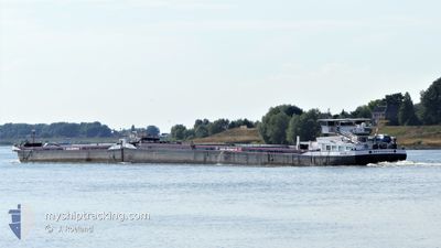
The vessel EIGER (MMSI: 244660203) is a Cargo It's sailing under the flag of [NL] Netherlands.
In this page you can find informations about the vessels current position, last detected port calls, and current voyage information. If the vessels is not in coverage by AIS you will find the latest position.
The current position of EIGER is detected by our AIS receivers and we are not responsible for the reliability of the data. The last position was recorded while the vessel was in Coverage by the Ais receivers of our vessel tracking app.
The current draught of EIGER as reported by AIS is 2 meters
Weather
| Temperature | 7°C / 44.6°F |
|---|---|
| Wind Speed | 7 knots |
| Direction | 234° SW |
| Pressure | 1013.6 hPa |
| Humidity | 90.9 % |
| Cloud Coverage | 100 % |
Featured Company
Last Port Calls
| Port | Arrival | Departure | Time In Port |
|---|---|---|---|
| 2024-04-18 11:48 | 2024-04-19 13:26 | 1 d | |
| 2024-04-18 11:12 | 2024-04-18 11:30 | 18 m | |
| 2024-04-18 09:38 | 2024-04-18 10:44 | 1 h | |
| 2024-04-18 08:24 | 2024-04-18 09:00 | 35 m | |
| 2024-04-17 18:16 | 2024-04-18 07:58 | 13 h | |
| 2024-04-16 16:57 | 2024-04-16 18:38 | 1 h | |
| 2024-04-14 00:51 | 2024-04-14 01:36 | 44 m | |
| 2024-04-13 06:15 | 2024-04-13 06:34 | 19 m | |
| 2024-04-13 01:08 | 2024-04-13 04:17 | 3 h | |
| 2024-04-12 00:37 | 2024-04-12 14:15 | 13 h |
Most Visited Ports (Last year)
| Port | Arrivals | |
|---|---|---|
| 38 | ||
| 36 | ||
| 34 | ||
| 24 | ||
| 22 | ||
| 14 |
Last Trips
| Origin | Departure | Destination | Arrival | Distance | |
|---|---|---|---|---|---|
| 2024-04-18 13:30 | 2024-04-18 13:48 | 0.94 nm | |||
| 2024-04-18 12:44 | 2024-04-18 13:12 | 0.87 nm | |||
| 2024-04-18 11:00 | 2024-04-18 11:38 | 1.20 nm | |||
| 2024-04-18 09:58 | 2024-04-18 10:24 | 0.24 nm | |||
| 2024-04-16 20:38 | 2024-04-17 20:16 | 22.99 nm | |||
| 2024-04-14 03:36 | 2024-04-16 18:57 | 233.47 nm | |||
| 2024-04-13 08:34 | 2024-04-14 02:51 | 92.57 nm | |||
| 2024-04-13 06:17 | 2024-04-13 08:15 | 9.03 nm | |||
| 2024-04-12 16:15 | 2024-04-13 03:08 | 74.41 nm | |||
| 2024-04-12 02:30 | 2024-04-12 02:37 | 1.01 nm |
Events
| Tid | Hændelsen | Detaljer | Position / Dest | Info |
|---|---|---|---|---|
| 2024-04-19 17:16 | STOP Sejllads | 7.7 nm, South of BREISACH |
47.90500 / 7.56833
BASEL
|
Fart: Kurs: -1° |
| 2024-04-19 17:04 | START Sejllads | 8.4 nm, South of BREISACH |
47.89333 / 7.56167
BASEL
|
Fart: 7 kn Kurs: 23° |
| 2024-04-19 16:43 | STOP Sejllads | 8.81 nm, South of BREISACH |
47.88667 / 7.55833
BASEL
|
Fart: Kurs: -1° |
| 2024-04-19 16:04 | Status er ændret | Default Under way using engine |
47.81667 / 7.54333
BASEL
|
Fart: 10.5 kn Kurs: 24.3° |
| 2024-04-19 15:58 | Udenfor Dækning |
47.80179 / 7.53489
North Sea
|
Fart: 10.5 kn Kurs: 24.3° |
|
| 2024-04-19 15:47 | START Sejllads | 10.81 nm, North of HUNINGUE |
47.77430 / 7.52541
BASEL
|
Fart: 6.9 kn Kurs: 356.6° |
| 2024-04-19 15:28 | STOP Sejllads | 10.43 nm, North of HUNINGUE |
47.76796 / 7.52622
BASEL
|
Fart: 0.1 kn Kurs: 511° |
| 2024-04-19 14:27 | START Sejllads | 4.19 nm, North West of HUNINGUE |
47.65340 / 7.52555
BASEL
|
Fart: 3.6 kn Kurs: 317.4° |
| 2024-04-19 14:25 | Status er ændret | Under way using engine Moored |
47.65222 / 7.52699
BASEL
|
Fart: 0.1 kn Kurs: 511° |
| 2024-04-19 14:17 | Status er ændret | Moored Under way using engine |
47.65199 / 7.52726
BASEL
|
Fart: Kurs: 511° |