
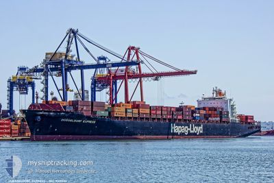
DUSSELDORF EXPRESS
Container Ship
Current Trip
| Time Travelled | 9 days |
|---|---|
| Remaining Time | 7 days |
| Distance Travelled | 3599.68 nm |
| Remaining Distance | 3146.84 nm |
| AVG Speed | 17.7 Knots |
| MAX Speed | 20 Knots |
| AVG Wind | 14.6 knots |
| MAX Wind | 27.3 knots |
| MIN Temp | 4.3°C / 39.74°F |
| MAX Temp | 25.7°C / 78.26°F |
| Dybgang | 11.2 m |
| Position Modtaget | 7 d siden |
Current Position
| Longitude | -52.10218° |
|---|---|
| Latitude | -32.12329° |
| Status | Under way using engine |
| Fart | |
| Kurs | 183° |
| Område | South Atlantic Ocean |
| Station | T-AIS |
| Position Modtaget | 7 d siden |
Info
Information
The current position of DUSSELDORF EXPRESS is in South Atlantic Ocean with coordinates -32.12329° / -52.10218° as reported on 2024-04-11 20:40 by AIS to our vessel tracker app. The vessel's current speed is 0 Knots and is heading at the port of RIO GRANDE. The estimated time of arrival as calculated by MyShipTracking vessel tracking app is 2024-04-27 05:38 LT
The vessel DUSSELDORF EXPRESS (IMO: 9143556, MMSI: 310768000) is a Container Ship that was built in 1998 ( 26 år gamle ). It's sailing under the flag of [BM] Bermuda.
In this page you can find informations about the vessels current position, last detected port calls, and current voyage information. If the vessels is not in coverage by AIS you will find the latest position.
The current position of DUSSELDORF EXPRESS is detected by our AIS receivers and we are not responsible for the reliability of the data. The last position was recorded while the vessel was in Coverage by the Ais receivers of our vessel tracking app.
The current draught of DUSSELDORF EXPRESS as reported by AIS is 11.2 meters
Weather
| Temperature | 15.7°C / 60.26°F |
|---|---|
| Wind Speed | 5 knots |
| Direction | 207° SSW |
| Pressure | 1016.1 hPa |
| Humidity | 75.9 % |
| Cloud Coverage | 100 % |
Featured Company
Last Port Calls
| Port | Arrival | Departure | Time In Port |
|---|---|---|---|
| 2024-04-08 15:59 | 2024-04-09 20:31 | 1 d | |
| 2024-04-07 09:42 | 2024-04-07 09:50 | 7 m | |
| 2024-04-04 16:32 | 2024-04-05 22:09 | 1 d | |
| 2024-03-18 18:45 | 2024-03-19 12:17 | 17 h | |
| 2024-03-13 06:37 | 2024-03-15 03:34 | 1 d | |
| 2024-02-25 18:25 | 2024-02-26 13:39 | 19 h | |
| 2024-02-20 00:59 | 2024-02-21 18:46 | 1 d | |
| 2024-02-17 02:27 | 2024-02-17 02:34 | 7 m | |
| 2024-02-14 21:28 | 2024-02-15 16:44 | 19 h | |
| 2024-02-05 10:41 | 2024-02-06 08:22 | 21 h |
Most Visited Ports (Last year)
| Port | Arrivals | |
|---|---|---|
| 8 | ||
| 6 | ||
| 4 | ||
| 4 | ||
| 4 | ||
| 4 |
Last Trips
| Origin | Departure | Destination | Arrival | Distance | |
|---|---|---|---|---|---|
| 2024-04-07 06:50 | 2024-04-08 12:59 | 237.81 nm | |||
| 2024-04-05 19:09 | 2024-04-07 06:42 | 390.08 nm | |||
| 2024-03-19 07:17 | 2024-04-04 13:32 | 4944.74 nm | |||
| 2024-03-15 00:34 | 2024-03-18 13:45 | 1356.60 nm | |||
| 2024-02-26 10:39 | 2024-03-13 03:37 | 3573.85 nm | |||
| 2024-02-21 15:46 | 2024-02-25 15:25 | 178.60 nm | |||
| 2024-02-16 23:34 | 2024-02-19 21:59 | 266.92 nm | |||
| 2024-02-15 13:44 | 2024-02-16 23:27 | 383.72 nm | |||
| 2024-02-06 05:22 | 2024-02-14 18:28 | 3264.73 nm | |||
| 2024-02-05 06:58 | 2024-02-05 07:41 | 2.14 nm |
Events
| Tid | Hændelsen | Detaljer | Position / Dest | Info |
|---|---|---|---|---|
| 2024-04-12 15:55 | START Sejllads | 5.92 nm, South of RIO GRANDE |
-32.12631 / -52.10053
BRRIG
|
Fart: 3.5 kn Kurs: 173° |
| 2024-04-11 20:50 | Status er ændret | Default Under way using engine |
-32.12330 / -52.10217
BRRIG
|
Fart: Kurs: 183° |
| 2024-04-11 20:40 | Udenfor Dækning |
-32.12329 / -52.10218
South Atlantic Ocean
|
Fart: Kurs: 183° |
|
| 2024-04-11 19:13 | Status er ændret | Under way using engine Default |
-32.12329 / -52.10214
BRRIG
|
Fart: Kurs: 183° |
| 2024-04-11 18:57 | Indenfor Dækning |
-32.12329 / -52.10215
South Atlantic Ocean
|
Fart: Kurs: 183° |
|
| 2024-04-11 16:20 | Status er ændret | Default Under way using engine |
-32.12327 / -52.10216
BRRIG
|
Fart: Kurs: 183° |
| 2024-04-11 16:19 | Udenfor Dækning |
-32.12328 / -52.10215
South Atlantic Ocean
|
Fart: Kurs: 183° |
|
| 2024-04-11 14:48 | Dybgangen er ændret | 11.2 11 |
-32.12328 / -52.10216
BRRIG
|
Fart: Kurs: 183° |
| 2024-04-11 14:48 | ETA er ændret | 2024/04/11 05:30 2024/04/11 15:00 |
-32.12328 / -52.10216
BRRIG
|
Fart: Kurs: 183° |
| 2024-04-11 14:33 | Status er ændret | Under way using engine Default |
-32.12337 / -52.10220
BRRIG
|
Fart: Kurs: 183° |