
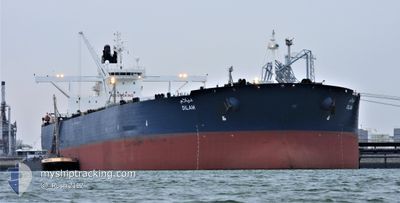
DILAM
Crude Oil Tanker
Current Trip
| Time Travelled | 5 days |
|---|---|
| Remaining Time | --- |
| Distance Travelled | 981.23 nm |
| Remaining Distance | --- |
| AVG Speed | 11.7 Knots |
| MAX Speed | 19.8 Knots |
| AVG Wind | 12.3 knots |
| MAX Wind | 24.5 knots |
| MIN Temp | 20.4°C / 68.72°F |
| MAX Temp | 28.3°C / 82.94°F |
| Dybgang | 10.3 m |
| Position Modtaget | 14 d siden |
Current Position
| Longitude | 38.43260° |
|---|---|
| Latitude | 22.64381° |
| Status | Under way using engine |
| Fart | 12 Knots |
| Kurs | 359.1° |
| Område | Red Sea |
| Station | T-AIS |
| Position Modtaget | 14 d siden |
Info
Information
The current position of DILAM is in Red Sea with coordinates 22.64381° / 38.43260° as reported on 2024-04-06 00:44 by AIS to our vessel tracker app. The vessel's current speed is 12 Knots and is heading at the port of YANBU.
The vessel DILAM (IMO: 9448700, MMSI: 403540000) is a Crude Oil Tanker that was built in 2010 ( 14 år gamle ). It's sailing under the flag of [SA] Saudi Arabia.
In this page you can find informations about the vessels current position, last detected port calls, and current voyage information. If the vessels is not in coverage by AIS you will find the latest position.
The current position of DILAM is detected by our AIS receivers and we are not responsible for the reliability of the data. The last position was recorded while the vessel was in Coverage by the Ais receivers of our vessel tracking app.
The current draught of DILAM as reported by AIS is 10.3 meters
Weather
| Temperature | 25.2°C / 77.36°F |
|---|---|
| Wind Speed | 12 knots |
| Direction | 309° NW |
| Pressure | 1006.6 hPa |
| Humidity | 73.5 % |
| Cloud Coverage | --- |
Featured Company
Last Port Calls
| Port | Arrival | Departure | Time In Port |
|---|---|---|---|
| 2024-04-12 23:13 | 2024-04-14 15:48 | 1 d | |
| 2024-03-03 08:46 | 2024-03-04 05:20 | 20 h | |
| 2024-02-08 01:42 | 2024-02-10 00:38 | 1 d |
Most Visited Ports (Last year)
| Port | Arrivals | |
|---|---|---|
| 6 | ||
| 1 | ||
| 1 | ||
| 1 | ||
| 1 | ||
| 1 |
Last Trips
| Origin | Departure | Destination | Arrival | Distance | |
|---|---|---|---|---|---|
| 2024-03-04 08:20 | 2024-04-13 02:13 | 3197.03 nm | |||
| 2024-02-10 09:38 | 2024-03-03 11:46 | 6292.33 nm | |||
| 2024-01-17 14:40 | 2024-02-08 10:42 | 6265.57 nm |
Events
| Tid | Hændelsen | Detaljer | Position / Dest | Info |
|---|---|---|---|---|
| 2024-04-16 15:09 | STOP Sejllads | 5.43 nm, South East of SOKHNA |
29.56463 / 32.40628
SA YNB
|
Fart: 0.3 kn Kurs: 14° |
| 2024-04-16 14:08 | START Sejllads | 6.82 nm, South East of SOKHNA |
29.54616 / 32.42358
SA YNB
|
Fart: 3.6 kn Kurs: 300° |
| 2024-04-16 13:44 | STOP Sejllads | 7.31 nm, South East of SOKHNA |
29.54321 / 32.43610
SA YNB
|
Fart: 0.3 kn Kurs: 288° |
| 2024-04-14 15:49 | START Sejllads | 0.99 nm, West of AL MUAJJIZ |
23.80871 / 38.38967
SA YNB
|
Fart: 3.1 kn Kurs: 202° |
| 2024-04-14 15:48 | Afsejlet fra sidste havn |
|
23.80871 / 38.38967
SA YNB
|
Fart: 3 kn Kurs: 293° |
| 2024-04-12 23:21 | STOP Sejllads |
23.80477 / 38.40296
[SA] AL MUAJJIZ
|
Fart: 0.3 kn Kurs: 323° |
|
| 2024-04-12 23:13 | Skibe i havn |
|
23.80417 / 38.40298
[SA] AL MUAJJIZ
|
Fart: 0.5 kn Kurs: 327° |
| 2024-04-10 05:00 | START Sejllads |
23.04625 / 38.20566
SA YNB
|
Fart: 3.3 kn Kurs: 349° |