
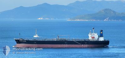
DIAMOND EXPRESS
Oil Products Tanker
Current Trip
| Time Travelled | 13 days |
|---|---|
| Remaining Time | 2 h, 16 mins |
| Distance Travelled | 2650.05 nm |
| Remaining Distance | 28.45 nm |
| AVG Speed | 11.2 Knots |
| MAX Speed | 13.6 Knots |
| AVG Wind | 9.9 knots |
| MAX Wind | 25 knots |
| MIN Temp | 11.9°C / 53.42°F |
| MAX Temp | 29.7°C / 85.46°F |
| Dybgang | 7.3 m |
| Position Modtaget | 1 m siden |
Current Position
| Longitude | 129.46092° |
|---|---|
| Latitude | 35.01335° |
| Status | Under way using engine |
| Fart | 11 Knots |
| Kurs | 61° |
| Område | Japan Sea |
| Station | T-AIS |
| Position Modtaget | 1 m siden |
Info
Information
The current position of DIAMOND EXPRESS is in Japan Sea with coordinates 35.01335° / 129.46092° as reported on 2024-04-23 20:00 by AIS to our vessel tracker app. The vessel's current speed is 11 Knots and is heading at the port of ONSAN. The estimated time of arrival as calculated by MyShipTracking vessel tracking app is 2024-04-23 22:17 LT
The vessel DIAMOND EXPRESS (IMO: 9409493, MMSI: 477694500) is a Oil Products Tanker that was built in 2009 ( 15 år gamle ). It's sailing under the flag of [HK] Hong Kong.
In this page you can find informations about the vessels current position, last detected port calls, and current voyage information. If the vessels is not in coverage by AIS you will find the latest position.
The current position of DIAMOND EXPRESS is detected by our AIS receivers and we are not responsible for the reliability of the data. The last position was recorded while the vessel was in Coverage by the Ais receivers of our vessel tracking app.
The current draught of DIAMOND EXPRESS as reported by AIS is 7.3 meters
Weather
| Temperature | 14.4°C / 57.92°F |
|---|---|
| Wind Speed | 17 knots |
| Direction | 356° N |
| Pressure | 1007.6 hPa |
| Humidity | 82.6 % |
| Cloud Coverage | 100 % |
Featured Company
Last Port Calls
| Port | Arrival | Departure | Time In Port |
|---|---|---|---|
| 2024-04-08 21:27 | 2024-04-10 15:38 | 1 d | |
| 2024-03-30 09:36 | 2024-04-02 21:05 | 3 d | |
| 2024-03-21 08:12 | 2024-03-22 14:33 | 1 d | |
| 2024-03-18 22:00 | 2024-03-20 08:56 | 1 d | |
| 2024-03-16 08:55 | 2024-03-17 10:17 | 1 d | |
| 2024-03-13 15:47 | 2024-03-14 16:52 | 1 d | |
| 2024-03-11 03:58 | 2024-03-12 03:06 | 23 h | |
| 2024-03-08 17:28 | 2024-03-10 07:59 | 1 d | |
| 2024-03-06 08:07 | 2024-03-07 04:00 | 19 h | |
| 2024-03-02 13:24 | 2024-03-04 14:23 | 2 d |
Most Visited Ports (Last year)
| Port | Arrivals | |
|---|---|---|
| 5 | ||
| 5 | ||
| 5 | ||
| 5 | ||
| 3 | ||
| 2 |
Last Trips
| Origin | Departure | Destination | Arrival | Distance | |
|---|---|---|---|---|---|
| 2024-04-03 02:35 | 2024-04-09 05:27 | 1574.79 nm | |||
| 2024-03-22 22:33 | 2024-03-30 15:06 | 1267.18 nm | |||
| 2024-03-20 16:56 | 2024-03-21 16:12 | 248.14 nm | |||
| 2024-03-17 18:17 | 2024-03-19 06:00 | 221.40 nm | |||
| 2024-03-15 00:52 | 2024-03-16 16:55 | 33.52 nm | |||
| 2024-03-12 11:06 | 2024-03-13 23:47 | 406.75 nm | |||
| 2024-03-10 15:59 | 2024-03-11 11:58 | 227.68 nm | |||
| 2024-03-07 12:00 | 2024-03-09 01:28 | 193.17 nm | |||
| 2024-03-04 22:23 | 2024-03-06 16:07 | 27.02 nm | |||
| 2024-02-29 20:53 | 2024-03-02 21:24 | 419.23 nm |
Events
| Tid | Hændelsen | Detaljer | Position / Dest | Info |
|---|---|---|---|---|
| 2024-04-23 19:18 | Dybgangen er ændret | 7.3 11.5 |
34.94350 / 129.32878
KR YOS >KR ONS
|
Fart: 11.2 kn Kurs: 51° |
| 2024-04-23 19:18 | Destination er ændret | KR YOS >KR ONS MY TBI >> KR YOS |
34.94350 / 129.32878
KR YOS >KR ONS
|
Fart: 11.2 kn Kurs: 51° |
| 2024-04-23 19:18 | ETA er ændret | 2024/04/27 03:00 2024/04/19 11:00 |
34.94350 / 129.32878
KR YOS >KR ONS
|
Fart: 11.2 kn Kurs: 51° |
| 2024-04-23 17:59 | Status er ændret | Under way using engine Default |
34.79130 / 129.08877
MY TBI >> KR YOS
|
Fart: 11.2 kn Kurs: 55° |
| 2024-04-23 17:50 | Status er ændret | Default Under way using engine |
34.77615 / 129.06253
MY TBI >> KR YOS
|
Fart: 11.2 kn Kurs: 55° |
| 2024-04-23 17:47 | Status er ændret | Under way using engine Default |
34.77078 / 129.05312
MY TBI >> KR YOS
|
Fart: 11.1 kn Kurs: 55° |
| 2024-04-23 17:43 | Status er ændret | Default Under way using engine |
34.76248 / 129.03847
MY TBI >> KR YOS
|
Fart: 11.3 kn Kurs: 54° |
| 2024-04-23 17:21 | Status er ændret | Under way using engine Default |
34.72065 / 128.97172
MY TBI >> KR YOS
|
Fart: 11.7 kn Kurs: 52° |
| 2024-04-23 17:12 | Indenfor Dækning |
34.72328 / 128.97588
Japan Sea
|
Fart: 11.6 kn Kurs: 52° |
|
| 2024-04-23 09:49 | START Sejllads | 5.24 nm, South East of GWANGYANG |
34.85277 / 127.78648
MY TBI >> KR YOS
|
Fart: 3.3 kn Kurs: 170° |