
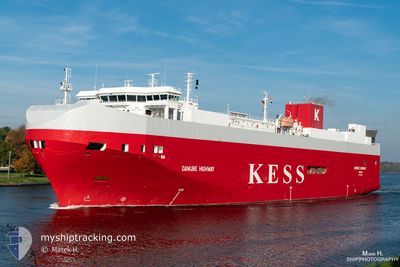
DANUBE HIGHWAY
Vehicles Carrier
Current Trip
| Time Travelled | 1 day |
|---|---|
| Remaining Time | 9 h, 15 mins |
| Distance Travelled | 832.77 nm |
| Remaining Distance | 156.49 nm |
| AVG Speed | 16.9 Knots |
| MAX Speed | 20.7 Knots |
| AVG Wind | 9.9 knots |
| MAX Wind | 21 knots |
| MIN Temp | 0.8°C / 33.44°F |
| MAX Temp | 6.3°C / 43.34°F |
| Dybgang | 6.6 m |
| Position Modtaget | 2 m siden |
Current Position
| Longitude | 6.86152° |
|---|---|
| Latitude | 55.57379° |
| Status | Under way using engine |
| Fart | 15.9 Knots |
| Kurs | 208.1° |
| Område | North Sea |
| Station | T-AIS |
| Position Modtaget | 2 m siden |
Info
Information
The current position of DANUBE HIGHWAY is in North Sea with coordinates 55.57379° / 6.86152° as reported on 2024-04-19 22:09 by AIS to our vessel tracker app. The vessel's current speed is 15.9 Knots and is heading at the port of EMDEN. The estimated time of arrival as calculated by MyShipTracking vessel tracking app is 2024-04-20 07:26 LT
The vessel DANUBE HIGHWAY (IMO: 9316309, MMSI: 308803000) is a Vehicles Carrier that was built in 2006 ( 18 år gamle ). It's sailing under the flag of [BS] Bahamas.
In this page you can find informations about the vessels current position, last detected port calls, and current voyage information. If the vessels is not in coverage by AIS you will find the latest position.
The current position of DANUBE HIGHWAY is detected by our AIS receivers and we are not responsible for the reliability of the data. The last position was recorded while the vessel was in Coverage by the Ais receivers of our vessel tracking app.
The current draught of DANUBE HIGHWAY as reported by AIS is 6.6 meters
Weather
| Temperature | 6.3°C / 43.34°F |
|---|---|
| Wind Speed | 14 knots |
| Direction | 359° N |
| Pressure | 1012.6 hPa |
| Humidity | 63.7 % |
| Cloud Coverage | 52 % |
Featured Company
Last Port Calls
| Port | Arrival | Departure | Time In Port |
|---|---|---|---|
| 2024-04-17 09:52 | 2024-04-17 23:12 | 13 h | |
| 2024-04-17 01:56 | 2024-04-17 06:25 | 4 h | |
| 2024-04-15 03:53 | 2024-04-15 16:31 | 12 h | |
| 2024-04-11 23:16 | 2024-04-12 21:49 | 22 h | |
| 2024-04-11 03:46 | 2024-04-11 14:12 | 10 h | |
| 2024-04-08 13:23 | 2024-04-10 02:47 | 1 d | |
| 2024-04-04 05:52 | 2024-04-04 12:45 | 6 h | |
| 2024-03-31 13:51 | 2024-04-02 19:22 | 2 d | |
| 2024-03-29 02:52 | 2024-03-29 23:00 | 20 h | |
| 2024-03-28 11:49 | 2024-03-28 20:11 | 8 h |
Last Trips
| Origin | Departure | Destination | Arrival | Distance | |
|---|---|---|---|---|---|
| 2024-04-17 09:25 | 2024-04-17 12:52 | 46.23 nm | |||
| 2024-04-15 18:31 | 2024-04-17 04:56 | 518.50 nm | |||
| 2024-04-12 23:49 | 2024-04-15 05:53 | 671.56 nm | |||
| 2024-04-11 15:12 | 2024-04-12 01:16 | 98.18 nm | |||
| 2024-04-10 04:47 | 2024-04-11 04:46 | 310.80 nm | |||
| 2024-04-04 15:45 | 2024-04-08 15:23 | 1020.58 nm | |||
| 2024-04-02 21:22 | 2024-04-04 08:52 | 505.87 nm | |||
| 2024-03-30 00:00 | 2024-03-31 15:51 | 671.15 nm | |||
| 2024-03-28 20:11 | 2024-03-29 03:52 | 102.21 nm | |||
| 2024-03-26 22:46 | 2024-03-28 11:49 | 313.15 nm |
Events
| Tid | Hændelsen | Detaljer | Position / Dest | Info |
|---|---|---|---|---|
| 2024-04-19 15:14 | Ændre havområde | Danish part of the North Sea Danish part of the Skaggerak |
57.19781 / 8.46299
North Sea
EMDEN
|
Fart: 16.4 kn Kurs: 216.1° |
| 2024-04-19 09:58 | Ændre havområde | Danish part of the Skaggerak Danish part of the Kattegat |
57.79554 / 10.91850
Skaggerak
EMDEN
|
Fart: 18.3 kn Kurs: 319° |
| 2024-04-19 09:07 | Ændre havområde | Danish part of the Kattegat Swedish part of the Kattegat |
57.59795 / 11.25145
Kattegat
EMDEN
|
Fart: 18.8 kn Kurs: 316.6° |
| 2024-04-19 02:37 | Ændre havområde | Swedish part of the Kattegat Danish part of the Kattegat |
55.82161 / 12.73053
Kattegat
EMDEN
|
Fart: 18.6 kn Kurs: 16° |
| 2024-04-19 01:17 | Ændre havområde | Danish part of the Kattegat Swedish part of the Kattegat |
55.51837 / 12.72152
Kattegat
EMDEN
|
Fart: 9.8 kn Kurs: 352.9° |
| 2024-04-19 00:28 | Ændre havområde | Swedish part of the Kattegat Swedish part of the Baltic Sea |
55.33694 / 12.66382
Kattegat
EMDEN
|
Fart: 16.2 kn Kurs: 9° |
| 2024-04-18 20:11 | Ændre havområde | Swedish part of the Baltic Sea Danish part of the Kattegat |
55.47301 / 14.69662
Baltic Sea
EMDEN
|
Fart: 18.2 kn Kurs: 239.5° |
| 2024-04-18 19:05 | Ændre havområde | Danish part of the Kattegat Swedish part of the Baltic Sea |
55.64340 / 15.20294
Kattegat
EMDEN
|
Fart: 18.2 kn Kurs: 240.3° |
| 2024-04-18 15:20 | Ændre havområde | Swedish part of the Baltic Sea Finnish part of the Baltic Sea |
56.23613 / 16.94374
Baltic Sea
EMDEN
|
Fart: 18.3 kn Kurs: 235.5° |
| 2024-04-18 15:18 | Indenfor Dækning |
56.23613 / 16.94374
Baltic Sea
EMDEN
|
Fart: 18.3 kn Kurs: 235.5° |