
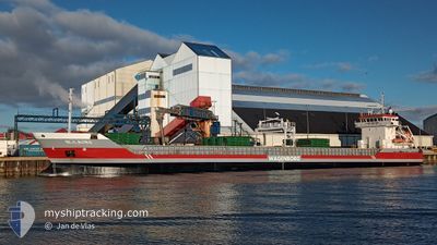
NIJLBORG
General Cargo
Current Trip
| Time Travelled | 22 h, 46 mins |
|---|---|
| Remaining Time | 2 days |
| Distance Travelled | 219.01 nm |
| Remaining Distance | 613.79 nm |
| AVG Speed | 10.1 Knots |
| MAX Speed | 11 Knots |
| AVG Wind | 14 knots |
| MAX Wind | 22.9 knots |
| MIN Temp | 1.5°C / 34.7°F |
| MAX Temp | 6.3°C / 43.34°F |
| Dybgang | 6.4 m |
| Position Modtaget | 4 h, 1 m siden |
Current Position
| Longitude | 16.78706° |
|---|---|
| Latitude | 56.07217° |
| Status | Under way using engine |
| Fart | 10.2 Knots |
| Kurs | 24° |
| Område | Baltic Sea |
| Station | T-AIS |
| Position Modtaget | 4 h, 1 m siden |
Info
Information
The current position of NIJLBORG is in Baltic Sea with coordinates 56.07217° / 16.78706° as reported on 2024-04-20 00:41 by AIS to our vessel tracker app. The vessel's current speed is 10.2 Knots and is heading at the port of ROYTTA. The estimated time of arrival as calculated by MyShipTracking vessel tracking app is 2024-04-22 16:05 LT
The vessel NIJLBORG (IMO: 9313802, MMSI: 246371000) is a General Cargo that was built in 2005 ( 19 år gamle ). It's sailing under the flag of [NL] Netherlands.
In this page you can find informations about the vessels current position, last detected port calls, and current voyage information. If the vessels is not in coverage by AIS you will find the latest position.
The current position of NIJLBORG is detected by our AIS receivers and we are not responsible for the reliability of the data. The last position was recorded while the vessel was in Coverage by the Ais receivers of our vessel tracking app.
The current draught of NIJLBORG as reported by AIS is 6.4 meters
Weather
| Temperature | 1.8°C / 35.24°F |
|---|---|
| Wind Speed | 18 knots |
| Direction | 350° N |
| Pressure | 1009.7 hPa |
| Humidity | 70.7 % |
| Cloud Coverage | 97 % |
Featured Company
Last Port Calls
| Port | Arrival | Departure | Time In Port |
|---|---|---|---|
| 2024-04-16 14:42 | 2024-04-19 05:56 | 2 d | |
| 2024-04-14 10:30 | 2024-04-15 20:33 | 1 d | |
| 2024-04-11 09:19 | 2024-04-13 14:44 | 2 d | |
| 2024-03-21 19:45 | 2024-03-23 15:44 | 1 d | |
| 2024-03-15 12:34 | 2024-03-20 04:11 | 4 d | |
| 2024-03-10 07:47 | 2024-03-15 00:14 | 4 d | |
| 2024-03-02 16:46 | 2024-03-05 09:53 | 2 d | |
| 2024-02-25 23:29 | 2024-02-25 23:31 | 2 m | |
| 2024-02-21 13:50 | 2024-02-24 09:55 | 2 d | |
| 2024-02-21 12:05 | 2024-02-21 13:08 | 1 h |
Most Visited Ports (Last year)
| Port | Arrivals | |
|---|---|---|
| 7 | ||
| 4 | ||
| 3 | ||
| 3 | ||
| 2 | ||
| 2 |
Last Trips
| Origin | Departure | Destination | Arrival | Distance | |
|---|---|---|---|---|---|
| 2024-04-15 22:33 | 2024-04-16 16:42 | 200.36 nm | |||
| 2024-04-13 16:44 | 2024-04-14 12:30 | 227.44 nm | |||
| 2024-03-23 16:44 | 2024-04-11 11:19 | 1769.42 nm | |||
| 2024-03-20 05:11 | 2024-03-21 20:45 | 106.85 nm | |||
| 2024-03-15 01:14 | 2024-03-15 13:34 | 124.82 nm | |||
| 2024-03-05 11:53 | 2024-03-10 08:47 | 1193.99 nm | |||
| 2024-02-26 00:31 | 2024-03-02 18:46 | 699.44 nm | |||
| 2024-02-24 10:55 | 2024-02-26 00:29 | 359.32 nm | |||
| 2024-02-21 14:08 | 2024-02-21 14:50 | 8.94 nm | |||
| 2024-02-21 12:46 | 2024-02-21 13:05 | 1.84 nm |
Events
| Tid | Hændelsen | Detaljer | Position / Dest | Info |
|---|---|---|---|---|
| 2024-04-20 00:48 | Status er ændret | Default Under way using engine |
56.09170 / 16.80238
FITOR
|
Fart: 10.2 kn Kurs: 24° |
| 2024-04-20 00:41 | Udenfor Dækning |
56.07217 / 16.78706
Baltic Sea
FITOR
|
Fart: 10.2 kn Kurs: 24° |
|
| 2024-04-20 00:37 | Status er ændret | Under way using engine Default |
56.06142 / 16.77679
FITOR
|
Fart: 10.1 kn Kurs: 51° |
| 2024-04-20 00:08 | Status er ændret | Default Under way using engine |
56.00835 / 16.67031
FITOR
|
Fart: 10.1 kn Kurs: 42° |
| 2024-04-19 20:14 | Fundet i havområde | Swedish part of the Baltic Sea |
55.47485 / 16.01619
Baltic Sea
FITOR
|
Fart: 9.6 kn Kurs: 32.3° |
| 2024-04-19 15:38 | Ændre havområde | Danish part of the Kattegat Polish part of the Baltic Sea |
54.82827 / 15.29590
Kattegat
FITOR
|
Fart: 10.3 kn Kurs: 32.3° |
| 2024-04-19 12:06 | Indenfor Dækning |
54.31495 / 14.70560
Baltic Sea
FITOR
|
Fart: 10.4 kn Kurs: 30.5° |
|
| 2024-04-19 07:13 | Udenfor Dækning |
53.64799 / 14.55387
Baltic Sea
FITOR
|
Fart: 10.7 kn Kurs: 321.7° |
|
| 2024-04-19 05:56 | Afsejlet fra sidste havn |
|
53.46316 / 14.59993
FITOR
|
Fart: 8.4 kn Kurs: 20° |
| 2024-04-19 05:22 | Status er ændret | Under way using engine Moored |
53.41302 / 14.58803
[PL] SZCZECIN
|
Fart: 3.2 kn Kurs: 97° |