
CYCLADES
Cargo
Current Trip
INBOM
| Time Travelled | 5 days |
|---|---|
| Remaining Time | --- |
| Distance Travelled | 348.39 nm |
| Remaining Distance | --- |
| AVG Speed | 9.1 Knots |
| MAX Speed | 11.2 Knots |
| AVG Wind | 10.6 knots |
| MAX Wind | 15 knots |
| MIN Temp | 27°C / 80.6°F |
| MAX Temp | 30.8°C / 87.44°F |
| Dybgang | 12.5 m |
| Position Modtaget | 3 d siden |
Current Position
| Longitude | 39.13421° |
|---|---|
| Latitude | 19.12007° |
| Status | Under way using engine |
| Fart | 9.2 Knots |
| Kurs | 334.6° |
| Område | Red Sea |
| Station | T-AIS |
| Position Modtaget | 3 d siden |
Info
Information
The current position of CYCLADES is in Red Sea with coordinates 19.12007° / 39.13421° as reported on 2024-04-17 07:50 by AIS to our vessel tracker app. The vessel's current speed is 9.2 Knots
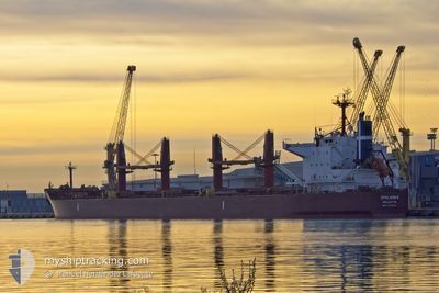
The vessel CYCLADES (IMO: 9799616, MMSI: 248195000) is a Cargo It's sailing under the flag of [MT] Malta.
In this page you can find informations about the vessels current position, last detected port calls, and current voyage information. If the vessels is not in coverage by AIS you will find the latest position.
The current position of CYCLADES is detected by our AIS receivers and we are not responsible for the reliability of the data. The last position was recorded while the vessel was in Coverage by the Ais receivers of our vessel tracking app.
The current draught of CYCLADES as reported by AIS is 12.5 meters
Weather
| Temperature | 27.1°C / 80.78°F |
|---|---|
| Wind Speed | 7 knots |
| Direction | 324° NW |
| Pressure | 1007.2 hPa |
| Humidity | 71 % |
| Cloud Coverage | --- |
Featured Company
Last Port Calls
| Port | Arrival | Departure | Time In Port |
|---|---|---|---|
| 2024-04-09 12:46 | 2024-04-15 05:37 | 5 d | |
| 2024-03-09 17:58 | |||
| 2024-02-01 05:34 | 2024-02-01 14:45 | 9 h |
Most Visited Ports (Last year)
| Port | Arrivals | |
|---|---|---|
| 5 | ||
| 2 | ||
| 1 | ||
| 1 | ||
| 1 | ||
| 1 |
Last Trips
| Origin | Departure | Destination | Arrival | Distance | |
|---|---|---|---|---|---|
| 2024-03-09 19:58 | 2024-04-09 15:46 | 4118.47 nm | |||
| 2024-01-28 16:55 | 2024-02-01 07:34 | 817.14 nm |
Events
| Tid | Hændelsen | Detaljer | Position / Dest | Info |
|---|---|---|---|---|
| 2024-04-17 08:04 | Status er ændret | Default Under way using engine |
19.15243 / 39.11875
INBOM
|
Fart: 9.2 kn Kurs: 334.6° |
| 2024-04-17 07:50 | Status er ændret | Under way using engine Default |
19.12007 / 39.13421
INBOM
|
Fart: 9.2 kn Kurs: 337° |
| 2024-04-17 07:50 | Udenfor Dækning |
19.12007 / 39.13421
Red Sea
|
Fart: 9.2 kn Kurs: 334.6° |
|
| 2024-04-17 07:24 | Status er ændret | Default Under way using engine |
19.06039 / 39.16068
INBOM
|
Fart: 9.2 kn Kurs: 336.8° |
| 2024-04-17 06:53 | Status er ændret | Under way using engine Default |
18.98521 / 39.19485
INBOM
|
Fart: 9 kn Kurs: 336° |
| 2024-04-17 06:35 | Indenfor Dækning |
18.98521 / 39.19485
Red Sea
|
Fart: 9 kn Kurs: 337.7° |
|
| 2024-04-17 00:33 | START Sejllads |
18.06895 / 39.61496
INBOM
|
Fart: 4.8 kn Kurs: 335° |
|
| 2024-04-16 19:14 | STOP Sejllads |
18.12667 / 39.63667
INBOM
|
Fart: Kurs: -1° |
|
| 2024-04-16 17:14 | START Sejllads |
17.98500 / 39.73333
INBOM
|
Fart: 6 kn Kurs: 340° |
|
| 2024-04-16 15:26 | STOP Sejllads |
17.99500 / 39.74833
INBOM
|
Fart: Kurs: -1° |