
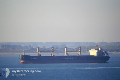
CS SONOMA
Bulk Carrier
Current Trip
| Time Travelled | 51 days |
|---|---|
| Remaining Time | 5 days |
| Distance Travelled | 13305.34 nm |
| Remaining Distance | 1578.07 nm |
| AVG Speed | 10.7 Knots |
| MAX Speed | 13.6 Knots |
| AVG Wind | 12.7 knots |
| MAX Wind | 29.8 knots |
| MIN Temp | 8.9°C / 48.02°F |
| MAX Temp | 30.2°C / 86.36°F |
| Dybgang | 11.9 m |
| Position Modtaget | 17 m siden |
Current Position
| Longitude | -3.22877° |
|---|---|
| Latitude | 36.15768° |
| Status | Under way using engine |
| Fart | 12.1 Knots |
| Kurs | 81° |
| Område | Alboran Sea |
| Station | T-AIS |
| Position Modtaget | 17 m siden |
Info
Information
The current position of CS SONOMA is in Alboran Sea with coordinates 36.15768° / -3.22877° as reported on 2024-04-24 11:38 by AIS to our vessel tracker app. The vessel's current speed is 12.1 Knots and is heading at the port of KOPER. The estimated time of arrival as calculated by MyShipTracking vessel tracking app is 2024-04-29 20:08 LT
The vessel CS SONOMA (IMO: 9569944, MMSI: 311033300) is a Bulk Carrier that was built in 2010 ( 14 år gamle ). It's sailing under the flag of [BS] Bahamas.
In this page you can find informations about the vessels current position, last detected port calls, and current voyage information. If the vessels is not in coverage by AIS you will find the latest position.
The current position of CS SONOMA is detected by our AIS receivers and we are not responsible for the reliability of the data. The last position was recorded while the vessel was in Coverage by the Ais receivers of our vessel tracking app.
The current draught of CS SONOMA as reported by AIS is 11.9 meters
Weather
| Temperature | 16.9°C / 62.42°F |
|---|---|
| Wind Speed | 7 knots |
| Direction | 123° ESE |
| Pressure | 1018.5 hPa |
| Humidity | 75.1 % |
| Cloud Coverage | 21 % |
Featured Company
Last Trips
Events
| Tid | Hændelsen | Detaljer | Position / Dest | Info |
|---|---|---|---|---|
| 2024-04-24 11:42 | Status er ændret | Default Under way using engine |
36.15998 / -3.20972
SI KOP
|
Fart: 12.1 kn Kurs: 81° |
| 2024-04-24 11:27 | ETA er ændret | 2024/04/29 17:00 2024/04/30 03:00 |
36.15245 / -3.27363
SI KOP
|
Fart: 12.2 kn Kurs: 83° |
| 2024-04-24 10:45 | Status er ændret | Under way using engine Default |
36.13970 / -3.45070
SI KOP
|
Fart: 12.3 kn Kurs: 84° |
| 2024-04-24 10:10 | Status er ændret | Default Under way using engine |
36.12928 / -3.59653
SI KOP
|
Fart: 12.3 kn Kurs: 84° |
| 2024-04-24 10:03 | Status er ændret | Under way using engine Default |
36.12713 / -3.62675
SI KOP
|
Fart: 12.4 kn Kurs: 84° |
| 2024-04-24 09:55 | Status er ændret | Default Under way using engine |
36.12438 / -3.66195
SI KOP
|
Fart: 12.4 kn Kurs: 85° |
| 2024-04-24 09:53 | Status er ændret | Under way using engine Default |
36.12375 / -3.67075
SI KOP
|
Fart: 12.4 kn Kurs: 84° |
| 2024-04-24 09:38 | Status er ændret | Default Under way using engine |
36.11902 / -3.73240
SI KOP
|
Fart: 12.5 kn Kurs: 84° |
| 2024-04-24 09:33 | Status er ændret | Under way using engine Default |
36.11707 / -3.75717
SI KOP
|
Fart: 12.4 kn Kurs: 84° |
| 2024-04-24 09:18 | Status er ændret | Default Under way using engine |
36.11257 / -3.81985
SI KOP
|
Fart: 13 kn Kurs: 85° |