
CRINIS
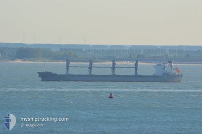
Bulk Carrier
Current Trip
| Trip Time | 23 days |
|---|---|
| Trip Distance | 1307.51 nm |
| AVG Speed | 11 Knots |
| MAX Speed | 14.1 Knots |
| Dybgang | 9.8 m |
| AVG Wind | 8.2 knots |
| MAX Wind | 26 knots |
| MIN Temp | 9.8°C / 49.64°F |
| MAX Temp | 27°C / 80.6°F |
| Position Modtaget | 4 d siden |
Current Position
| Longitude | 10.43872° |
|---|---|
| Latitude | 36.79749° |
| Status | At anchor |
| Fart | 0.1 Knots |
| Kurs | 24° |
| Område | Mediterranean Sea - Western Basin |
| Station | T-AIS |
| Position Modtaget | 4 d siden |
Info
Information
The current position of CRINIS is in Mediterranean Sea - Western Basin with coordinates 36.79749° / 10.43872° as reported on 2024-04-20 15:25 by AIS to our vessel tracker app. The vessel's current speed is 0.1 Knots and is currently inside the port of RADES.
The vessel CRINIS (IMO: 9598165, MMSI: 636015289) is a Bulk Carrier that was built in 2011 ( 13 år gamle ). It's sailing under the flag of [LR] Liberia.
In this page you can find informations about the vessels current position, last detected port calls, and current voyage information. If the vessels is not in coverage by AIS you will find the latest position.
The current position of CRINIS is detected by our AIS receivers and we are not responsible for the reliability of the data. The last position was recorded while the vessel was in Coverage by the Ais receivers of our vessel tracking app.
The current draught of CRINIS as reported by AIS is 9.8 meters
Weather
| Temperature | 9°C / 48.2°F |
|---|---|
| Wind Speed | 7 knots |
| Direction | 236° SW |
| Pressure | 1014.6 hPa |
| Humidity | 74.6 % |
| Cloud Coverage | 70 % |
Featured Company
Most Visited Ports (Last year)
| Port | Arrivals | |
|---|---|---|
| 2 | ||
| 2 | ||
| 1 | ||
| 1 | ||
| 1 | ||
| 1 |
Last Trips
| Origin | Departure | Destination | Arrival | Distance | |
|---|---|---|---|---|---|
| 2024-04-01 07:17 | 2024-04-24 13:52 | 1307.51 nm | |||
| 2024-03-17 00:18 | 2024-03-29 20:08 | 425.03 nm | |||
| 2024-02-29 20:39 | 2024-03-12 11:25 | 3067.02 nm | |||
| 2024-02-23 08:59 | 2024-02-25 07:09 | 514.70 nm | |||
| 2024-01-21 13:05 | 2024-02-18 14:19 | 5115.95 nm |
Events
| Tid | Hændelsen | Detaljer | Position / Dest | Info |
|---|---|---|---|---|
| 2024-04-24 12:52 | Skibe i havn |
|
36.80649 / 10.30478
[TN] RADES
|
Fart: 5 kn Kurs: 288° |
| 2024-04-20 15:38 | Status er ændret | Default At anchor |
36.79745 / 10.43886
RO CND > TN RDS
|
Fart: 0.1 kn Kurs: 24° |
| 2024-04-20 15:25 | Udenfor Dækning |
36.79749 / 10.43872
Mediterranean Sea - Western Basin
|
Fart: 0.1 kn Kurs: 129.1° |
|
| 2024-04-20 15:01 | Indenfor Dækning |
36.79741 / 10.43897
Mediterranean Sea - Western Basin
|
Fart: Kurs: 86.6° |
|
| 2024-04-20 13:56 | STOP Sejllads | 5.93 nm, South East of SIDI BOU SAID |
36.79736 / 10.43956
RO CND > TN RDS
|
Fart: Kurs: 305° |
| 2024-04-20 13:21 | START Sejllads | 5.58 nm, South East of SIDI BOU SAID |
36.79932 / 10.43157
RO CND > TN RDS
|
Fart: 3.2 kn Kurs: 90° |
| 2024-04-20 12:03 | STOP Sejllads | 3.88 nm, East of RADES |
36.79219 / 10.38188
RO CND > TN RDS
|
Fart: 0.3 kn Kurs: 338° |
| 2024-04-20 10:45 | START Sejllads | 6.09 nm, South East of SIDI BOU SAID |
36.82215 / 10.46522
RO CND > TN RDS
|
Fart: 8.7 kn Kurs: 242° |