
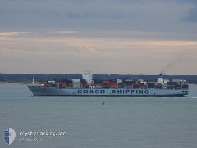
COSCOSHIPPING DANUBE
Cargo A
Current Trip
BRPNG
| Time Travelled | 16 h, 55 mins |
|---|---|
| Remaining Time | --- |
| Distance Travelled | 276.55 nm |
| Remaining Distance | --- |
| AVG Speed | 16.5 Knots |
| MAX Speed | 17.7 Knots |
| AVG Wind | 5.2 knots |
| MAX Wind | 12 knots |
| MIN Temp | 21.4°C / 70.52°F |
| MAX Temp | 24.3°C / 75.74°F |
| Dybgang | 10.6 m |
| Position Modtaget | 1 d siden |
Current Position
| Longitude | -46.28893° |
|---|---|
| Latitude | -23.97974° |
| Status | Under way using engine |
| Fart | 7.8 Knots |
| Kurs | 185° |
| Område | South Atlantic Ocean |
| Station | T-AIS |
| Position Modtaget | 1 d siden |
Info
Information
The current position of COSCOSHIPPING DANUBE is in South Atlantic Ocean with coordinates -23.97974° / -46.28893° as reported on 2024-04-22 06:58 by AIS to our vessel tracker app. The vessel's current speed is 7.8 Knots
The vessel COSCOSHIPPING DANUBE (IMO: 9731913, MMSI: 477858800) is a Cargo A It's sailing under the flag of [HK] Hong Kong.
In this page you can find informations about the vessels current position, last detected port calls, and current voyage information. If the vessels is not in coverage by AIS you will find the latest position.
The current position of COSCOSHIPPING DANUBE is detected by our AIS receivers and we are not responsible for the reliability of the data. The last position was recorded while the vessel was in Coverage by the Ais receivers of our vessel tracking app.
The current draught of COSCOSHIPPING DANUBE as reported by AIS is 10.6 meters
Weather
| Temperature | 23.3°C / 73.94°F |
|---|---|
| Wind Speed | 3 knots |
| Direction | 295° WNW |
| Pressure | 1011.8 hPa |
| Humidity | 81.8 % |
| Cloud Coverage | 29 % |
Featured Company
Last Port Calls
| Port | Arrival | Departure | Time In Port |
|---|---|---|---|
| 2024-04-22 23:32 | 2024-04-23 11:07 | 11 h | |
| 2024-04-21 05:05 | 2024-04-22 07:23 | 1 d | |
| 2024-04-17 10:22 | 2024-04-17 10:29 | 6 m | |
| 2024-03-25 23:57 | 2024-03-26 22:43 | 22 h | |
| 2024-03-21 21:46 | 2024-03-22 09:57 | 12 h | |
| 2024-03-21 04:56 | 2024-03-21 17:20 | 12 h | |
| 2024-03-15 10:35 | |||
| 2024-03-12 04:15 | 2024-03-12 18:16 | 14 h | |
| 2024-03-07 07:26 | 2024-03-08 09:24 | 1 d | |
| 2024-02-11 20:09 | 2024-02-13 08:38 | 1 d |
Last Trips
| Origin | Departure | Destination | Arrival | Distance | |
|---|---|---|---|---|---|
| 2024-04-22 04:23 | 2024-04-22 20:32 | 167.50 nm | |||
| 2024-04-17 07:29 | 2024-04-21 02:05 | 238.92 nm | |||
| 2024-03-27 06:43 | 2024-04-17 07:22 | 8875.39 nm | |||
| 2024-03-22 17:57 | 2024-03-26 07:57 | 1453.40 nm | |||
| 2024-03-22 01:20 | 2024-03-22 05:46 | 45.79 nm | |||
| 2024-03-22 01:20 | 2024-03-21 12:56 | 45.79 nm | |||
| 2024-03-13 02:16 | 2024-03-15 18:35 | 820.28 nm | |||
| 2024-03-08 17:24 | 2024-03-12 12:15 | 1458.41 nm | |||
| 2024-02-13 05:38 | 2024-03-07 15:26 | 8803.84 nm | |||
| 2024-02-10 22:03 | 2024-02-11 17:09 | 175.26 nm |
Events
| Tid | Hændelsen | Detaljer | Position / Dest | Info |
|---|---|---|---|---|
| 2024-04-23 11:17 | START Sejllads | 1.15 nm, East of PARANAGUA |
-25.49616 / -48.49704
BRPNG
|
Fart: 6.9 kn Kurs: 74° |
| 2024-04-23 11:07 | Afsejlet fra sidste havn |
|
-25.49667 / -48.50333
BRPNG
|
Fart: 3 kn Kurs: -1° |
| 2024-04-22 23:35 | STOP Sejllads |
-25.49833 / -48.49333
[BR] PARANAGUA
|
Fart: Kurs: -1° |
|
| 2024-04-22 23:32 | Skibe i havn |
|
-25.49878 / -48.49368
[BR] PARANAGUA
|
Fart: 5 kn Kurs: 255° |
| 2024-04-22 20:52 | START Sejllads | 11.97 nm, East of ILHA DO MEL |
-25.61065 / -48.09832
BRPNG
|
Fart: 3.3 kn Kurs: 282° |
| 2024-04-22 16:33 | STOP Sejllads | 12.62 nm, East of ILHA DO MEL |
-25.60349 / -48.08313
BRPNG
|
Fart: 0.2 kn Kurs: 141° |
| 2024-04-22 07:23 | Afsejlet fra sidste havn |
|
-24.00839 / -46.33768
BRPNG
|
Fart: 9 kn Kurs: -1° |
| 2024-04-22 07:08 | Status er ændret | Default Under way using engine |
-23.99167 / -46.30167
[BR] SANTOS
|
Fart: 7.8 kn Kurs: 185° |
| 2024-04-22 06:58 | Udenfor Dækning |
-23.97974 / -46.28893
South Atlantic Ocean
BRPNG
|
Fart: 7.8 kn Kurs: 179.4° |
|
| 2024-04-22 06:40 | ETA er ændret | 2024/04/22 17:00 2024/04/22 16:00 |
-23.94531 / -46.31007
[BR] SANTOS
|
Fart: 8.1 kn Kurs: 169° |