
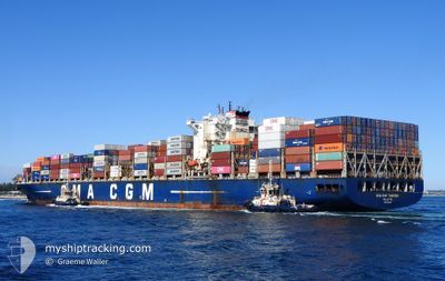
CMA CGM TANCREDI
Container Ship
Current Trip
| Time Travelled | 2 days |
|---|---|
| Remaining Time | --- |
| Distance Travelled | 142.76 nm |
| Remaining Distance | --- |
| AVG Speed | 13.2 Knots |
| MAX Speed | 15.2 Knots |
| AVG Wind | 6.9 knots |
| MAX Wind | 11 knots |
| MIN Temp | 27.1°C / 80.78°F |
| MAX Temp | 29.6°C / 85.28°F |
| Dybgang | 13.8 m |
| Position Modtaget | 1 d siden |
Current Position
| Longitude | 105.05798° |
|---|---|
| Latitude | 2.08623° |
| Status | Under way using engine |
| Fart | 0.4 Knots |
| Kurs | 191° |
| Område | South China Sea |
| Station | T-AIS |
| Position Modtaget | 1 d siden |
Info
Information
The current position of CMA CGM TANCREDI is in South China Sea with coordinates 2.08623° / 105.05798° as reported on 2024-04-18 05:24 by AIS to our vessel tracker app. The vessel's current speed is 0.4 Knots
The vessel CMA CGM TANCREDI (IMO: 9436355, MMSI: 256300000) is a Container Ship that was built in 2011 ( 13 år gamle ). It's sailing under the flag of [MT] Malta.
In this page you can find informations about the vessels current position, last detected port calls, and current voyage information. If the vessels is not in coverage by AIS you will find the latest position.
The current position of CMA CGM TANCREDI is detected by our AIS receivers and we are not responsible for the reliability of the data. The last position was recorded while the vessel was in Coverage by the Ais receivers of our vessel tracking app.
The current draught of CMA CGM TANCREDI as reported by AIS is 13.8 meters
Weather
| Temperature | 29.3°C / 84.74°F |
|---|---|
| Wind Speed | 5 knots |
| Direction | 94° E |
| Pressure | 1006.8 hPa |
| Humidity | 74.2 % |
| Cloud Coverage | 100 % |
Featured Company
Last Port Calls
| Port | Arrival | Departure | Time In Port |
|---|---|---|---|
| 2024-04-16 07:43 | 2024-04-17 16:22 | 1 d | |
| 2024-04-13 06:39 | 2024-04-14 08:46 | 1 d | |
| 2024-04-02 01:33 | 2024-04-03 11:26 | 1 d | |
| 2024-03-27 07:52 | 2024-03-29 05:26 | 1 d | |
| 2024-03-22 09:33 | 2024-03-24 16:29 | 2 d | |
| 2024-03-14 14:03 | 2024-03-18 02:49 | 3 d | |
| 2024-03-04 05:25 | 2024-03-05 04:18 | 22 h | |
| 2024-03-02 13:12 | 2024-03-04 02:12 | 1 d | |
| 2024-03-01 15:05 | 2024-03-02 09:55 | 18 h | |
| 2024-02-29 19:46 |
Most Visited Ports (Last year)
| Port | Arrivals | |
|---|---|---|
| 14 | ||
| 8 | ||
| 8 | ||
| 8 | ||
| 7 | ||
| 7 |
Last Trips
| Origin | Departure | Destination | Arrival | Distance | |
|---|---|---|---|---|---|
| 2024-04-14 16:46 | 2024-04-16 15:43 | 194.63 nm | |||
| 2024-04-03 19:26 | 2024-04-13 14:39 | 2523.76 nm | |||
| 2024-03-29 15:56 | 2024-04-02 09:33 | 1381.33 nm | |||
| 2024-03-25 03:29 | 2024-03-27 18:22 | 978.94 nm | |||
| 2024-03-18 13:49 | 2024-03-22 20:33 | 702.34 nm | |||
| 2024-03-05 12:18 | 2024-03-15 01:03 | 3786.42 nm | |||
| 2024-03-04 10:12 | 2024-03-04 13:25 | 5.45 nm | |||
| 2024-03-02 17:55 | 2024-03-02 21:12 | 26.25 nm | |||
| 2024-03-01 03:46 | 2024-03-01 23:05 | 194.64 nm | |||
| 2024-02-08 00:12 | 2024-02-19 16:16 | 1397.17 nm |
Events
| Tid | Hændelsen | Detaljer | Position / Dest | Info |
|---|---|---|---|---|
| 2024-04-18 07:59 | STOP Sejllads |
2.09402 / 105.08590
SGSIN
|
Fart: 0.2 kn Kurs: 114° |
|
| 2024-04-18 05:24 | Udenfor Dækning |
2.08623 / 105.05798
South China Sea
SGSIN
|
Fart: 0.4 kn Kurs: 353° |
|
| 2024-04-18 05:24 | Fundet i havområde | Malaysian part of the South China Sea |
2.08623 / 105.05798
South China Sea
SGSIN
|
Fart: 0.4 kn Kurs: 353° |
| 2024-04-18 05:24 | Indenfor Dækning |
2.08623 / 105.05798
South China Sea
SGSIN
|
Fart: 0.4 kn Kurs: 353° |
|
| 2024-04-18 04:12 | STOP Sejllads |
2.08342 / 105.05877
SGSIN
|
Fart: 0.3 kn Kurs: 193° |
|
| 2024-04-17 21:25 | Status er ændret | Default Under way using engine |
1.31282 / 104.36140
SGSIN
|
Fart: 13.4 kn Kurs: 44° |
| 2024-04-17 21:19 | Udenfor Dækning |
1.29638 / 104.34553
Singapore Strait
SGSIN
|
Fart: 13.4 kn Kurs: 44° |
|
| 2024-04-17 21:18 | Status er ændret | Under way using engine Default |
1.29458 / 104.34380
SGSIN
|
Fart: 12.8 kn Kurs: 58° |
| 2024-04-17 20:57 | Status er ændret | Default Under way using engine |
1.27160 / 104.26965
SGSIN
|
Fart: 13.6 kn Kurs: 83° |
| 2024-04-17 20:26 | Ændre havområde | Malaysian part of the Singapore Strait Indonesian part of the Singapore Strait |
1.25928 / 104.15435
Singapore Strait
SGSIN
|
Fart: 13.2 kn Kurs: 85° |