
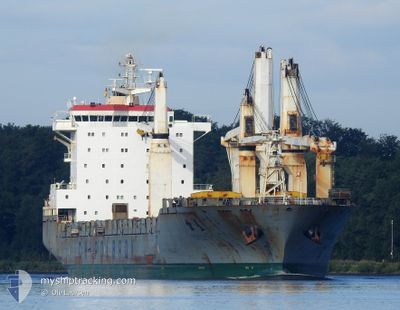
CHIPOLBROK STAR
General Cargo
Current Trip
| Time Travelled | 17 h, 25 mins |
|---|---|
| Remaining Time | --- |
| Distance Travelled | 158.14 nm |
| Remaining Distance | --- |
| AVG Speed | 10.7 Knots |
| MAX Speed | 16.2 Knots |
| AVG Wind | 8.8 knots |
| MAX Wind | 22.6 knots |
| MIN Temp | 10.1°C / 50.18°F |
| MAX Temp | 13.2°C / 55.76°F |
| Dybgang | 7.7 m |
| Position Modtaget | 9 h, 11 m siden |
Current Position
| Longitude | -74.97397° |
|---|---|
| Latitude | 38.71791° |
| Status | Under way using engine |
| Fart | 9.2 Knots |
| Kurs | 138.6° |
| Område | North Atlantic Ocean |
| Station | T-AIS |
| Position Modtaget | 9 h, 11 m siden |
Info
Information
The current position of CHIPOLBROK STAR is in North Atlantic Ocean with coordinates 38.71791° / -74.97397° as reported on 2024-04-18 16:04 by AIS to our vessel tracker app. The vessel's current speed is 9.2 Knots and is heading at the port of PUERTO SANTO TOMAS. The estimated time of arrival as calculated by MyShipTracking vessel tracking app is 2024-04-24 07:00 LT
The vessel CHIPOLBROK STAR (IMO: 9432127, MMSI: 477748600) is a General Cargo that was built in 2010 ( 14 år gamle ). It's sailing under the flag of [HK] Hong Kong.
In this page you can find informations about the vessels current position, last detected port calls, and current voyage information. If the vessels is not in coverage by AIS you will find the latest position.
The current position of CHIPOLBROK STAR is detected by our AIS receivers and we are not responsible for the reliability of the data. The last position was recorded while the vessel was in Coverage by the Ais receivers of our vessel tracking app.
The current draught of CHIPOLBROK STAR as reported by AIS is 7.7 meters
Weather
| Temperature | 11.3°C / 52.34°F |
|---|---|
| Wind Speed | 17 knots |
| Direction | 28° NNE |
| Pressure | 1017.4 hPa |
| Humidity | 91.4 % |
| Cloud Coverage | 47 % |
Featured Company
Last Port Calls
| Port | Arrival | Departure | Time In Port |
|---|---|---|---|
| 2024-04-16 06:55 | 2024-04-18 07:50 | 2 d | |
| 2024-04-16 05:44 | 2024-04-16 06:13 | 29 m | |
| 2024-04-12 21:50 | 2024-04-15 02:06 | 2 d | |
| 2024-04-04 22:12 | 2024-04-06 08:16 | 1 d | |
| 2024-03-29 10:10 | 2024-04-01 06:59 | 2 d | |
| 2024-03-25 12:42 | 2024-03-25 23:43 | 11 h | |
| 2024-03-23 06:58 | 2024-03-24 08:01 | 1 d | |
| 2024-02-02 11:53 | 2024-02-06 22:28 | 4 d |
Last Trips
| Origin | Departure | Destination | Arrival | Distance | |
|---|---|---|---|---|---|
| 2024-04-16 02:13 | 2024-04-16 02:55 | 2.48 nm | |||
| 2024-04-14 22:06 | 2024-04-16 01:44 | 255.40 nm | |||
| 2024-04-06 02:16 | 2024-04-12 17:50 | 1857.34 nm | |||
| 2024-04-01 01:59 | 2024-04-04 16:12 | 517.27 nm | |||
| 2024-03-25 17:43 | 2024-03-29 05:10 | 1087.81 nm | |||
| 2024-03-24 02:01 | 2024-03-25 06:42 | 64.18 nm | |||
| 2024-02-07 06:28 | 2024-03-23 00:58 | 14883.43 nm | |||
| 2024-02-01 02:09 | 2024-02-02 19:53 | 534.50 nm |
Events
| Tid | Hændelsen | Detaljer | Position / Dest | Info |
|---|---|---|---|---|
| 2024-04-18 16:29 | Status er ændret | Default Under way using engine |
38.66667 / -74.92667
SANTO TOMAS
|
Fart: 9.2 kn Kurs: 138.6° |
| 2024-04-18 16:04 | Udenfor Dækning |
38.71791 / -74.97397
North Atlantic Ocean
SANTO TOMAS
|
Fart: 9.2 kn Kurs: 138.6° |
|
| 2024-04-18 14:13 | Status er ændret | Under way using engine Default |
39.05708 / -75.17197
SANTO TOMAS
|
Fart: 15 kn Kurs: 157° |
| 2024-04-18 14:11 | Status er ændret | Default Under way using engine |
39.06667 / -75.17667
SANTO TOMAS
|
Fart: 15.1 kn Kurs: 143.2° |
| 2024-04-18 13:07 | Indenfor Dækning |
39.28627 / -75.36542
North Atlantic Ocean
SANTO TOMAS
|
Fart: 14.5 kn Kurs: 137.5° |
|
| 2024-04-18 13:06 | Status er ændret | Under way using engine Default |
39.29133 / -75.37136
SANTO TOMAS
|
Fart: 14 kn Kurs: 135° |
| 2024-04-18 10:00 | Status er ændret | Default Under way using engine |
39.80131 / -75.42407
SANTO TOMAS
|
Fart: 7.9 kn Kurs: 236.1° |
| 2024-04-18 09:46 | Udenfor Dækning |
39.81853 / -75.38907
North Atlantic Ocean
SANTO TOMAS
|
Fart: 7.9 kn Kurs: 236.1° |
|
| 2024-04-18 07:50 | Afsejlet fra sidste havn |
|
39.97523 / -75.09331
SANTO TOMAS
|
Fart: 8.1 kn Kurs: 255° |
| 2024-04-18 07:49 | START Sejllads |
39.97600 / -75.08994
[US] PORT RICHMOND
|
Fart: 5.5 kn Kurs: 253° |