
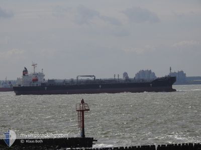
CHEMROAD SIRIUS
Tanker B
Current Trip
| Trip Time | 31 days |
|---|---|
| Trip Distance | 8580.50 nm |
| AVG Speed | 13.1 Knots |
| MAX Speed | 17.2 Knots |
| Dybgang | 11 m |
| AVG Wind | 9 knots |
| MAX Wind | 24.8 knots |
| MIN Temp | 8.3°C / 46.94°F |
| MAX Temp | 30.8°C / 87.44°F |
| Position Modtaget | 1 d siden |
Current Position
| Longitude | 49.19768° |
|---|---|
| Latitude | 27.55173° |
| Status | Moored |
| Fart | 0.1 Knots |
| Kurs | --- |
| Område | Persian Gulf |
| Station | T-AIS |
| Position Modtaget | 1 d siden |
Info
Information
The current position of CHEMROAD SIRIUS is in Persian Gulf with coordinates 27.55173° / 49.19768° as reported on 2024-04-18 02:15 by AIS to our vessel tracker app. The vessel's current speed is 0.1 Knots and is currently inside the port of RAS AL KHAIR.
The vessel CHEMROAD SIRIUS (IMO: 9757979, MMSI: 357571000) is a Tanker B It's sailing under the flag of [PA] Panama.
In this page you can find informations about the vessels current position, last detected port calls, and current voyage information. If the vessels is not in coverage by AIS you will find the latest position.
The current position of CHEMROAD SIRIUS is detected by our AIS receivers and we are not responsible for the reliability of the data. The last position was recorded while the vessel was in Coverage by the Ais receivers of our vessel tracking app.
The current draught of CHEMROAD SIRIUS as reported by AIS is 11 meters
Weather
| Temperature | 25.5°C / 77.9°F |
|---|---|
| Wind Speed | 7 knots |
| Direction | 178° S |
| Pressure | 1006.8 hPa |
| Humidity | 51.5 % |
| Cloud Coverage | --- |
Featured Company
Last Port Calls
| Port | Arrival | Departure | Time In Port |
|---|---|---|---|
| 2024-04-15 15:45 | |||
| 2024-03-13 22:38 | 2024-03-14 18:55 | 20 h | |
| 2024-03-08 00:18 | 2024-03-08 23:39 | 23 h | |
| 2024-02-24 17:26 | 2024-02-25 23:15 | 1 d | |
| 2024-02-17 08:24 | 2024-02-19 17:51 | 2 d | |
| 2024-02-08 11:30 | 2024-02-10 23:59 | 2 d | |
| 2024-02-05 07:26 |
Last Trips
| Origin | Departure | Destination | Arrival | Distance | |
|---|---|---|---|---|---|
| 2024-03-15 02:55 | 2024-04-15 18:45 | 8580.50 nm | |||
| 2024-03-09 07:39 | 2024-03-14 06:38 | 63.98 nm | |||
| 2024-02-26 03:15 | 2024-03-08 08:18 | 3329.13 nm | |||
| 2024-02-19 20:51 | 2024-02-24 21:26 | 530.85 nm | |||
| 2024-02-11 02:59 | 2024-02-17 11:24 | 675.55 nm | |||
| 2024-02-05 12:26 | 2024-02-08 14:30 | 1035.60 nm |
Events
| Tid | Hændelsen | Detaljer | Position / Dest | Info |
|---|---|---|---|---|
| 2024-04-18 02:22 | Status er ændret | Default Moored |
27.55178 / 49.19765
[SA] RAS AL KHAIR
|
Fart: 0.1 kn Kurs: 0° |
| 2024-04-18 02:15 | Status er ændret | Moored Default |
27.55173 / 49.19768
[SA] RAS AL KHAIR
|
Fart: Kurs: 225° |
| 2024-04-18 02:15 | Udenfor Dækning |
27.55173 / 49.19768
Persian Gulf
[SA] RAS AL KHAIR
|
Fart: 0.1 kn Kurs: 219° |
|
| 2024-04-18 02:00 | Indenfor Dækning |
27.55173 / 49.19768
Persian Gulf
[SA] RAS AL KHAIR
|
Fart: 0.1 kn Kurs: 219° |
|
| 2024-04-18 00:51 | Status er ændret | Default Moored |
27.55178 / 49.19765
[SA] RAS AL KHAIR
|
Fart: Kurs: 0° |
| 2024-04-18 00:39 | Status er ændret | Moored Default |
27.55177 / 49.19765
[SA] RAS AL KHAIR
|
Fart: Kurs: 131° |
| 2024-04-18 00:39 | Udenfor Dækning |
27.55177 / 49.19765
Persian Gulf
[SA] RAS AL KHAIR
|
Fart: Kurs: 131.2° |
|
| 2024-04-18 00:27 | Status er ændret | Default Moored |
27.55178 / 49.19767
[SA] RAS AL KHAIR
|
Fart: Kurs: 0° |
| 2024-04-18 00:09 | Fundet i havområde | Saudi Arabian part of the Persian Gulf |
27.55174 / 49.19764
Persian Gulf
|
Fart: Kurs: 18.8° |
| 2024-04-18 00:09 | Status er ændret | Moored Default |
27.55174 / 49.19764
[SA] RAS AL KHAIR
|
Fart: Kurs: 19° |