
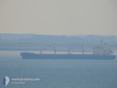
CAPETAN VASSILIS II
Bulk Carrier
Current Trip
| Time Travelled | 5 days |
|---|---|
| Remaining Time | 2 h, 12 mins |
| Distance Travelled | 1261.21 nm |
| Remaining Distance | 34.85 nm |
| AVG Speed | 11.3 Knots |
| MAX Speed | 15.3 Knots |
| AVG Wind | 9 knots |
| MAX Wind | 14 knots |
| MIN Temp | 17.2°C / 62.96°F |
| MAX Temp | 26.2°C / 79.16°F |
| Dybgang | 10.2 m |
| Position Modtaget | 2024-02-01 22:03 |
Current Position
| Longitude | -58.41960° |
|---|---|
| Latitude | -40.35853° |
| Status | Under way using engine |
| Fart | 11.3 Knots |
| Kurs | 209.8° |
| Område | South Atlantic Ocean |
| Station | T-AIS |
| Position Modtaget | 2024-02-01 22:03 |
Info
Information
The current position of CAPETAN VASSILIS II is in South Atlantic Ocean with coordinates -40.35853° / -58.41960° as reported on 2024-02-01 22:03 by AIS to our vessel tracker app. The vessel's current speed is 11.3 Knots and is heading at the port of GUAYAQUIL. The estimated time of arrival as calculated by MyShipTracking vessel tracking app is 2024-04-23 23:25 LT
The vessel CAPETAN VASSILIS II (IMO: 9580118, MMSI: 311000715) is a Bulk Carrier that was built in 2010 ( 14 år gamle ). It's sailing under the flag of [BS] Bahamas.
In this page you can find informations about the vessels current position, last detected port calls, and current voyage information. If the vessels is not in coverage by AIS you will find the latest position.
The current position of CAPETAN VASSILIS II is detected by our AIS receivers and we are not responsible for the reliability of the data. The last position was recorded while the vessel was in Coverage by the Ais receivers of our vessel tracking app.
The current draught of CAPETAN VASSILIS II as reported by AIS is 10.2 meters
Weather
| Temperature | 26.2°C / 79.16°F |
|---|---|
| Wind Speed | 12 knots |
| Direction | 267° W |
| Pressure | 1007.5 hPa |
| Humidity | 81.4 % |
| Cloud Coverage | 100 % |
Featured Company
Events
| Tid | Hændelsen | Detaljer | Position / Dest | Info |
|---|---|---|---|---|
| 2024-04-21 12:57 | START Sejllads | 3.55 nm, North West of CALLAO |
-12.02555 / -77.20737
ECGYE
|
Fart: 3.4 kn Kurs: 170° |
| 2024-04-21 02:09 | STOP Sejllads | 3.68 nm, North West of CALLAO |
-12.02120 / -77.20699
ECGYE
|
Fart: 0.3 kn Kurs: 169° |
| 2024-04-21 01:21 | START Sejllads | 2.78 nm, North West of CALLAO |
-12.02872 / -77.19383
ECGYE
|
Fart: 3.6 kn Kurs: 291° |
| 2024-04-20 11:03 | STOP Sejllads | 2.6 nm, North West of CALLAO |
-12.02887 / -77.19003
ECGYE
|
Fart: 0.1 kn Kurs: 71° |
| 2024-04-18 06:08 | START Sejllads | 1.17 nm, North West of ARICA |
-18.45833 / -70.34167
ECGYE
|
Fart: 8 kn Kurs: 282° |
| 2024-04-18 05:59 | Afsejlet fra sidste havn |
|
-18.46167 / -70.32667
ECGYE
|
Fart: 2 kn Kurs: -1° |
| 2024-04-15 17:47 | STOP Sejllads |
-18.47333 / -70.32500
[CL] ARICA
|
Fart: Kurs: -1° |
|
| 2024-04-15 17:47 | Skibe i havn |
|
-18.47333 / -70.32500
[CL] ARICA
|
Fart: 1.3 kn Kurs: 113° |
| 2024-04-15 17:08 | START Sejllads | 0.89 nm, North West of ARICA |
-18.46015 / -70.33674
ECGYE
|
Fart: 3.1 kn Kurs: 111° |