
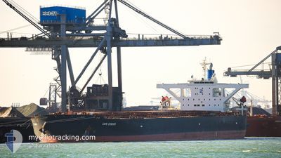
CAPE CONDOR
Bulk Carrier
Current Trip
INENR
| Time Travelled | --- |
|---|---|
| Remaining Time | --- |
| Distance Travelled | 10683.61 nm |
| Remaining Distance | --- |
| AVG Speed | 11.5 Knots |
| MAX Speed | 15.2 Knots |
| AVG Wind | 13.6 knots |
| MAX Wind | 28 knots |
| MIN Temp | 16.7°C / 62.06°F |
| MAX Temp | 29.1°C / 84.38°F |
| Dybgang | 18 m |
| Position Modtaget | 9 d siden |
Current Position
| Longitude | -62.02740° |
|---|---|
| Latitude | 11.64487° |
| Status | Under way using engine |
| Fart | 12 Knots |
| Kurs | 279.2° |
| Område | Caribbean Sea |
| Station | T-AIS |
| Position Modtaget | 9 d siden |
Info
Information
The current position of CAPE CONDOR is in Caribbean Sea with coordinates 11.64487° / -62.02740° as reported on 2024-04-16 00:02 by AIS to our vessel tracker app. The vessel's current speed is 12 Knots
The vessel CAPE CONDOR (IMO: 9560390, MMSI: 636019020) is a Bulk Carrier that was built in 2010 ( 14 år gamle ). It's sailing under the flag of [LR] Liberia.
In this page you can find informations about the vessels current position, last detected port calls, and current voyage information. If the vessels is not in coverage by AIS you will find the latest position.
The current position of CAPE CONDOR is detected by our AIS receivers and we are not responsible for the reliability of the data. The last position was recorded while the vessel was in Coverage by the Ais receivers of our vessel tracking app.
The current draught of CAPE CONDOR as reported by AIS is 18 meters
Weather
| Temperature | 28.4°C / 83.12°F |
|---|---|
| Wind Speed | 22 knots |
| Direction | 51° NE |
| Pressure | 1007.9 hPa |
| Humidity | 76.7 % |
| Cloud Coverage | 100 % |
Featured Company
Last Port Calls
Most Visited Ports (Last year)
| Port | Arrivals | |
|---|---|---|
| 2 | ||
| 1 | ||
| 1 | ||
| 1 | ||
| 1 | ||
| 1 |
Last Trips
| Origin | Departure | Destination | Arrival | Distance |
|---|
Events
| Tid | Hændelsen | Detaljer | Position / Dest | Info |
|---|---|---|---|---|
| 2024-04-18 00:46 | STOP Sejllads | 5.11 nm, North West of PUERTO BOLIVAR |
12.31333 / -72.02666
INENR
|
Fart: Kurs: -1° |
| 2024-04-16 00:07 | Status er ændret | Default Under way using engine |
11.64667 / -62.04500
INENR
|
Fart: 12 kn Kurs: 279.2° |
| 2024-04-16 00:02 | Udenfor Dækning |
11.64487 / -62.02740
Caribbean Sea
|
Fart: 12 kn Kurs: 279.2° |
|
| 2024-04-15 23:34 | Status er ændret | Under way using engine Default |
11.62991 / -61.93397
INENR
|
Fart: 12 kn Kurs: 279° |
| 2024-04-15 23:12 | Status er ændret | Default Under way using engine |
11.61860 / -61.86061
INENR
|
Fart: 12 kn Kurs: 280.7° |
| 2024-04-15 23:07 | Status er ændret | Under way using engine Default |
11.61561 / -61.84205
INENR
|
Fart: 12 kn Kurs: 281° |
| 2024-04-15 23:05 | Status er ændret | Default Under way using engine |
11.61426 / -61.83474
INENR
|
Fart: 12 kn Kurs: 279.5° |
| 2024-04-15 23:00 | Status er ændret | Under way using engine Default |
11.61138 / -61.81900
INENR
|
Fart: 11.9 kn Kurs: 276° |
| 2024-04-15 22:46 | Status er ændret | Default Under way using engine |
11.60500 / -61.77167
INENR
|
Fart: 11.9 kn Kurs: 274.5° |
| 2024-04-15 22:42 | Status er ændret | Under way using engine Default |
11.60477 / -61.75731
INENR
|
Fart: 11.7 kn Kurs: 275° |