
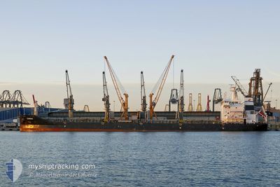
CABRERA
Bulk Carrier
Current Trip
| Trip Time | 38 days |
|---|---|
| Trip Distance | 5840.01 nm |
| AVG Speed | 10 Knots |
| MAX Speed | 14 Knots |
| Dybgang | 10.1 m |
| AVG Wind | 10.8 knots |
| MAX Wind | 25.3 knots |
| MIN Temp | 14.4°C / 57.92°F |
| MAX Temp | 34.9°C / 94.82°F |
| Position Modtaget | 8 d siden |
Current Position
| Longitude | -0.64992° |
|---|---|
| Latitude | 35.77039° |
| Status | At anchor |
| Fart | |
| Kurs | 1° |
| Område | Mediterranean Sea - Western Basin |
| Station | T-AIS |
| Position Modtaget | 8 d siden |
Info
Information
The current position of CABRERA is in Mediterranean Sea - Western Basin with coordinates 35.77039° / -0.64992° as reported on 2024-04-15 20:34 by AIS to our vessel tracker app. The vessel's current speed is 0 Knots and is currently inside the port of ORAN.
The vessel CABRERA (IMO: 9537977, MMSI: 248697000) is a Bulk Carrier that was built in 2011 ( 13 år gamle ). It's sailing under the flag of [MT] Malta.
In this page you can find informations about the vessels current position, last detected port calls, and current voyage information. If the vessels is not in coverage by AIS you will find the latest position.
The current position of CABRERA is detected by our AIS receivers and we are not responsible for the reliability of the data. The last position was recorded while the vessel was in Coverage by the Ais receivers of our vessel tracking app.
The current draught of CABRERA as reported by AIS is 10.1 meters
Weather
| Temperature | 15.2°C / 59.36°F |
|---|---|
| Wind Speed | 3 knots |
| Direction | 288° WNW |
| Pressure | 1016.3 hPa |
| Humidity | 64.1 % |
| Cloud Coverage | 2 % |
Featured Company
Most Visited Ports (Last year)
| Port | Arrivals | |
|---|---|---|
| 1 | ||
| 1 | ||
| 1 | ||
| 1 | ||
| 1 | ||
| 1 |
Events
| Tid | Hændelsen | Detaljer | Position / Dest | Info |
|---|---|---|---|---|
| 2024-04-18 03:28 | STOP Sejllads |
35.71167 / -.63833
[DZ] ORAN
|
Fart: Kurs: -1° |
|
| 2024-04-18 03:06 | Skibe i havn |
|
35.71970 / -.62459
[DZ] ORAN
|
Fart: 3.9 kn Kurs: 148° |
| 2024-04-18 02:58 | START Sejllads | 0.59 nm, North East of ORAN |
35.72333 / -.62833
ORAN
|
Fart: 4 kn Kurs: -1° |
| 2024-04-15 20:40 | Status er ændret | Default At anchor |
35.77042 / -.65001
ORAN
|
Fart: Kurs: 1° |
| 2024-04-15 20:34 | Status er ændret | At anchor Default |
35.77039 / -.64992
ORAN
|
Fart: Kurs: 130° |
| 2024-04-15 20:34 | Udenfor Dækning |
35.77039 / -.64992
Mediterranean Sea - Western Basin
|
Fart: Kurs: 129.9° |
|
| 2024-04-15 20:20 | Status er ændret | Default At anchor |
35.77034 / -.64976
ORAN
|
Fart: Kurs: 347° |
| 2024-04-15 20:07 | Status er ændret | At anchor Default |
35.77037 / -.64956
ORAN
|
Fart: Kurs: 344° |
| 2024-04-15 19:55 | Indenfor Dækning |
35.77037 / -.64956
Mediterranean Sea - Western Basin
|
Fart: Kurs: 129.9° |
|
| 2024-04-15 17:19 | Udenfor Dækning |
35.77065 / -.64862
Mediterranean Sea - Western Basin
|
Fart: Kurs: 129.9° |