
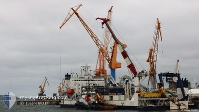
CABLE ENTERPRISE
Deck Cargo Pontoon
Current Trip
SAINT-NAZAIRE
| Time Travelled | 15 days |
|---|---|
| Remaining Time | --- |
| Distance Travelled | 2081.55 nm |
| Remaining Distance | --- |
| AVG Speed | 8.9 Knots |
| MAX Speed | 13.3 Knots |
| AVG Wind | 20.6 knots |
| MAX Wind | 36.8 knots |
| MIN Temp | -0.5°C / 31.1°F |
| MAX Temp | 12.5°C / 54.5°F |
| Dybgang | 4.8 m |
| Position Modtaget | 19 m siden |
Current Position
| Longitude | 17.20668° |
|---|---|
| Latitude | 56.34980° |
| Status | Default |
| Fart | 9.8 Knots |
| Kurs | 232.1° |
| Område | Baltic Sea |
| Station | T-AIS |
| Position Modtaget | 19 m siden |
Info
Information
The current position of CABLE ENTERPRISE is in Baltic Sea with coordinates 56.34980° / 17.20668° as reported on 2024-04-24 16:43 by AIS to our vessel tracker app. The vessel's current speed is 9.8 Knots
The vessel CABLE ENTERPRISE (IMO: 8645806, MMSI: 235093018) is a Deck Cargo Pontoon that was built in 2001 ( 23 år gamle ). It's sailing under the flag of [GB] United Kingdom.
In this page you can find informations about the vessels current position, last detected port calls, and current voyage information. If the vessels is not in coverage by AIS you will find the latest position.
The current position of CABLE ENTERPRISE is detected by our AIS receivers and we are not responsible for the reliability of the data. The last position was recorded while the vessel was in Coverage by the Ais receivers of our vessel tracking app.
The current draught of CABLE ENTERPRISE as reported by AIS is 4.8 meters
Weather
| Temperature | 3.7°C / 38.66°F |
|---|---|
| Wind Speed | 5 knots |
| Direction | 99° E |
| Pressure | 1008.5 hPa |
| Humidity | 66.2 % |
| Cloud Coverage | 25 % |
Featured Company
Events
| Tid | Hændelsen | Detaljer | Position / Dest | Info |
|---|---|---|---|---|
| 2024-04-24 16:07 | Fundet i havområde | Swedish part of the Baltic Sea |
56.41150 / 17.34837
Baltic Sea
SAINT-NAZAIRE
|
Fart: 9.7 kn Kurs: 232.2° |
| 2024-04-24 16:07 | Indenfor Dækning |
56.41150 / 17.34837
Baltic Sea
SAINT-NAZAIRE
|
Fart: 9.7 kn Kurs: 232.2° |
|
| 2024-04-23 15:00 | Udenfor Dækning |
59.39900 / 22.21528
Baltic Sea
SAINT-NAZAIRE
|
Fart: 9.2 kn Kurs: 231° |
|
| 2024-04-23 11:44 | Fundet i havområde | Finnish part of the Baltic Sea |
59.60490 / 23.07880
Baltic Sea
SAINT-NAZAIRE
|
Fart: 8.9 kn Kurs: 253.1° |
| 2024-04-23 07:33 | ETA er ændret | 2024/05/01 08:00 2024/04/29 09:00 |
59.87082 / 24.14337
SAINT-NAZAIRE
|
Fart: 6.6 kn Kurs: 198.8° |
| 2024-04-23 07:30 | Status er ændret | Default Restricted manoeuverability |
59.87477 / 24.14592
SAINT-NAZAIRE
|
Fart: 6.3 kn Kurs: 196.6° |
| 2024-04-23 07:25 | START Sejllads | 10.44 nm, South East of INKOO |
59.88192 / 24.15028
SAINT-NAZAIRE
|
Fart: 3.2 kn Kurs: 200° |
| 2024-04-22 18:10 | STOP Sejllads | 10.54 nm, South East of INKOO |
59.87992 / 24.15060
SAINT-NAZAIRE
|
Fart: 0.1 kn Kurs: 45° |
| 2024-04-22 18:06 | START Sejllads | 10.55 nm, South East of INKOO |
59.87824 / 24.14700
SAINT-NAZAIRE
|
Fart: 3.1 kn Kurs: 48° |
| 2024-04-22 13:19 | Status er ændret | Restricted manoeuverability Under way using engine |
59.87908 / 24.14902
SAINT-NAZAIRE
|
Fart: 0.3 kn Kurs: 38° |