
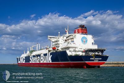
BW CLEAR SKY
Lng Tanker
Current Trip
| Time Travelled | 3 days |
|---|---|
| Remaining Time | --- |
| Distance Travelled | 1351.65 nm |
| Remaining Distance | --- |
| AVG Speed | 15.8 Knots |
| MAX Speed | 19.4 Knots |
| AVG Wind | 8.4 knots |
| MAX Wind | 18 knots |
| MIN Temp | 9.1°C / 48.38°F |
| MAX Temp | 21.5°C / 70.7°F |
| Dybgang | 10.7 m |
| Position Modtaget | 7 d siden |
Current Position
| Longitude | --- |
|---|---|
| Latitude | --- |
| Status | Under way using engine |
| Fart | 14.2 Knots |
| Kurs | 48.6° |
| Område | Philippine Sea |
| Station | T-AIS |
| Position Modtaget | 7 d siden |
Info
Information
The current position of BW CLEAR SKY is in Philippine Sea with coordinates 25.82329° / 128.34328° as reported on 2025-12-02 16:11 by AIS to our vessel tracker app. The vessel's current speed is 14.2 Knots and is heading at the port of TERNEUZEN. The estimated time of arrival as calculated by MyShipTracking vessel tracking app is 2025-12-04 22:00 LT
The vessel BW CLEAR SKY (IMO: 9413327, MMSI: 563223100) is a Lng Tanker that was built in 2011 ( 14 år gamle ). It's sailing under the flag of [SG] Singapore.
In this page you can find informations about the vessels current position, last detected port calls, and current voyage information. If the vessels is not in coverage by AIS you will find the latest position.
The current position of BW CLEAR SKY is detected by our AIS receivers and we are not responsible for the reliability of the data. The last position was recorded while the vessel was in Coverage by the Ais receivers of our vessel tracking app.
The current draught of BW CLEAR SKY as reported by AIS is 10.7 meters
Weather
| Temperature | 21.5°C / 70.7°F |
|---|---|
| Wind Speed | 10 knots |
| Direction | 183° S |
| Pressure | 1010.7 hPa |
| Humidity | 77.3 % |
| Cloud Coverage | 1 % |
Featured Company
Last Port Calls
| Port | Arrival | Departure | Time In Port |
|---|---|---|---|
| 2025-12-05 11:30 | 2025-12-06 11:05 | 23 h | |
| 2025-11-25 08:14 | 2025-11-26 10:29 | 1 d | |
| 2025-10-21 05:20 | 2025-10-22 11:05 | 1 d |
Most Visited Ports (Last year)
| Port | Arrivals | |
|---|---|---|
| 1 | ||
| 1 | ||
| 1 | ||
| 1 | ||
| 1 |
Last Trips
| Origin | Departure | Destination | Arrival | Distance | |
|---|---|---|---|---|---|
| 2025-11-26 10:29 | 2025-12-05 11:30 | 2724.17 nm | |||
| 2025-10-22 11:05 | 2025-11-25 08:14 | 13335.71 nm |
Events
| Tid | Hændelsen | Detaljer | Position / Dest | Info |
|---|---|---|---|---|
| 2025-12-06 02:05 | START Sejllads | 0.63 nm, South East of YANAI |
33.94511 / 132.13736
FOR ORDER
|
Fart: 4.7 kn Kurs: 147° |
| 2025-12-06 02:05 | Afsejlet fra sidste havn |
|
33.94511 / 132.13736
FOR ORDER
|
Fart: 0.8 kn Kurs: 40° |
| 2025-12-05 02:30 | Skibe i havn |
|
33.94788 / 132.13141
[JP] YANAI
|
Fart: 0.1 kn Kurs: 25° |
| 2025-12-05 02:26 | STOP Sejllads | 0.41 nm, South of YANAI |
33.94780 / 132.13158
FOR ORDER
|
Fart: 0.1 kn Kurs: 25° |
| 2025-12-02 16:15 | Status er ændret | Default Under way using engine |
25.83333 / 128.35500
FOR ORDER
|
Fart: 14.2 kn Kurs: 48.6° |
| 2025-12-02 16:11 | Ændre havområde | Japanese part of the Philippine Sea Malaysian part of the Singapore Strait |
25.82329 / 128.34328
Philippine Sea
FOR ORDER
|
Fart: 14.2 kn Kurs: 48.6° |
| 2025-12-02 16:11 | Status er ændret | Under way using engine Default |
25.82329 / 128.34328
FOR ORDER
|
Fart: 14 kn Kurs: 48° |
| 2025-12-02 16:11 | Indenfor Dækning |
25.82329 / 128.34328
Philippine Sea
FOR ORDER
|
Fart: 14.2 kn Kurs: 48.6° |
|
| 2025-12-02 16:11 | Udenfor Dækning |
25.82329 / 128.34328
Philippine Sea
FOR ORDER
|
Fart: 14.2 kn Kurs: 48.6° |