
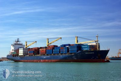
BUXFAVOURITE
Container Ship
Current Trip
| Time Travelled | 24 days |
|---|---|
| Remaining Time | --- |
| Distance Travelled | 4759.45 nm |
| Remaining Distance | 46.73 nm |
| AVG Speed | 11.8 Knots |
| MAX Speed | 16.7 Knots |
| AVG Wind | 22.1 knots |
| MAX Wind | 39.8 knots |
| MIN Temp | 4.8°C / 40.64°F |
| MAX Temp | 23.5°C / 74.3°F |
| Dybgang | 7.9 m |
| Position Modtaget | 4 m siden |
Current Position
| Longitude | 1.51575° |
|---|---|
| Latitude | 51.51784° |
| Status | At anchor |
| Fart | 0.2 Knots |
| Kurs | 338° |
| Område | North Sea |
| Station | T-AIS |
| Position Modtaget | 4 m siden |
Info
Information
The current position of BUXFAVOURITE is in North Sea with coordinates 51.51784° / 1.51575° as reported on 2024-04-19 13:13 by AIS to our vessel tracker app. The vessel's current speed is 0.2 Knots and is heading at the port of TILBURY. The estimated time of arrival as calculated by MyShipTracking vessel tracking app is 2024-04-15 16:00 LT
The vessel BUXFAVOURITE (IMO: 9150212, MMSI: 636091848) is a Container Ship that was built in 1997 ( 27 år gamle ). It's sailing under the flag of [LR] Liberia.
In this page you can find informations about the vessels current position, last detected port calls, and current voyage information. If the vessels is not in coverage by AIS you will find the latest position.
The current position of BUXFAVOURITE is detected by our AIS receivers and we are not responsible for the reliability of the data. The last position was recorded while the vessel was in Coverage by the Ais receivers of our vessel tracking app.
The current draught of BUXFAVOURITE as reported by AIS is 7.9 meters
Weather
| Temperature | 8.7°C / 47.66°F |
|---|---|
| Wind Speed | 23 knots |
| Direction | 351° N |
| Pressure | 1015.5 hPa |
| Humidity | 79.2 % |
| Cloud Coverage | 100 % |
Featured Company
Last Port Calls
| Port | Arrival | Departure | Time In Port |
|---|---|---|---|
| 2024-03-25 08:31 | 2024-03-25 19:24 | 10 h | |
| 2024-03-22 13:10 | 2024-03-22 14:03 | 53 m | |
| 2024-03-18 11:24 | 2024-03-18 12:38 | 1 h | |
| 2024-02-27 02:54 | 2024-02-27 18:05 | 15 h | |
| 2024-02-24 14:27 | 2024-02-26 06:02 | 1 d | |
| 2024-02-22 08:13 | 2024-02-23 07:49 | 23 h | |
| 2024-02-09 11:31 | 2024-02-10 02:23 | 14 h | |
| 2024-02-09 11:06 | 2024-02-09 11:23 | 17 m |
Most Visited Ports (Last year)
| Port | Arrivals | |
|---|---|---|
| 13 | ||
| 11 | ||
| 10 | ||
| 6 | ||
| 6 | ||
| 5 |
Last Trips
| Origin | Departure | Destination | Arrival | Distance | |
|---|---|---|---|---|---|
| 2024-03-22 10:03 | 2024-03-25 04:31 | 301.58 nm | |||
| 2024-03-18 08:38 | 2024-03-22 09:10 | 2.74 nm | |||
| 2024-02-27 19:05 | 2024-03-18 07:24 | 4451.53 nm | |||
| 2024-02-26 06:02 | 2024-02-27 03:54 | 167.18 nm | |||
| 2024-02-23 08:49 | 2024-02-24 14:27 | 176.93 nm | |||
| 2024-02-10 02:23 | 2024-02-22 09:13 | 242.46 nm | |||
| 2024-02-09 11:23 | 2024-02-09 11:31 | 0.38 nm | |||
| 2024-01-22 15:56 | 2024-02-09 11:06 | 4474.23 nm |
Events
| Tid | Hændelsen | Detaljer | Position / Dest | Info |
|---|---|---|---|---|
| 2024-04-16 12:02 | Status er ændret | At anchor Default |
51.51815 / 1.51717
GBTIL-GBTIL
|
Fart: 0.3 kn Kurs: 329° |
| 2024-04-16 11:53 | Status er ændret | Default At anchor |
51.51811 / 1.51695
GBTIL-GBTIL
|
Fart: 0.3 kn Kurs: 318° |
| 2024-04-16 10:11 | Dybgangen er ændret | 7.9 8 |
51.51892 / 1.51800
GBTIL-GBTIL
|
Fart: 0.4 kn Kurs: 298° |
| 2024-04-16 03:10 | Destination er ændret | GBTIL-GBTIL USILM-GBTIL |
51.51960 / 1.51822
GBTIL-GBTIL
|
Fart: 0.1 kn Kurs: 303° |
| 2024-04-16 03:10 | ETA er ændret | 2024/04/23 11:00 2024/04/15 16:00 |
51.51960 / 1.51822
GBTIL-GBTIL
|
Fart: 0.1 kn Kurs: 303° |
| 2024-04-16 03:04 | Status er ændret | At anchor Under way using engine |
51.51961 / 1.51825
USILM-GBTIL
|
Fart: 0.1 kn Kurs: 300° |
| 2024-04-15 15:03 | STOP Sejllads | 12.22 nm, North of RAMSGATE |
51.51986 / 1.51787
USILM-GBTIL
|
Fart: 0.1 kn Kurs: 303° |
| 2024-04-15 12:26 | Ændre havområde | United Kingdom part of the North Sea French part of the North Sea |
51.38634 / 2.05596
North Sea
USILM-GBTIL
|
Fart: 9.9 kn Kurs: 326.1° |
| 2024-04-15 09:50 | Ændre havområde | French part of the North Sea French part of the English Channel |
51.00346 / 1.61262
North Sea
USILM-GBTIL
|
Fart: 16.5 kn Kurs: 40.5° |
| 2024-04-15 07:41 | Ændre havområde | French part of the English Channel United Kingdom part of the English Channel |
50.61250 / 1.25534
English Channel
USILM-GBTIL
|
Fart: 12.3 kn Kurs: 42.3° |