
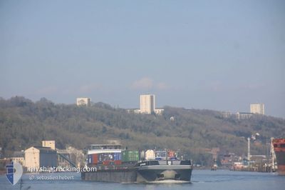
BOSPHORE
Cargo
Current Trip
| Trip Time | 2 days |
|---|---|
| Trip Distance | 276.98 nm |
| AVG Speed | 9.6 Knots |
| MAX Speed | 12.2 Knots |
| Dybgang | 2.2 m |
| AVG Wind | 9.1 knots |
| MAX Wind | 16.8 knots |
| MIN Temp | 4.5°C / 40.1°F |
| MAX Temp | 12.7°C / 54.86°F |
| Position Modtaget | 3 m siden |
Current Position
| Longitude | 0.18739° |
|---|---|
| Latitude | 49.49509° |
| Status | Moored |
| Fart | |
| Kurs | 68° |
| Område | English Channel |
| Station | T-AIS |
| Position Modtaget | 3 m siden |
Info
Information
The current position of BOSPHORE is in English Channel with coordinates 49.49509° / 0.18739° as reported on 2024-04-18 19:54 by AIS to our vessel tracker app. The vessel's current speed is 0 Knots and is currently inside the port of LE HAVRE.
The vessel BOSPHORE (MMSI: 226007020) is a Cargo It's sailing under the flag of [FR] France.
In this page you can find informations about the vessels current position, last detected port calls, and current voyage information. If the vessels is not in coverage by AIS you will find the latest position.
The current position of BOSPHORE is detected by our AIS receivers and we are not responsible for the reliability of the data. The last position was recorded while the vessel was in Coverage by the Ais receivers of our vessel tracking app.
The current draught of BOSPHORE as reported by AIS is 2.2 meters
Weather
| Temperature | 7.4°C / 45.32°F |
|---|---|
| Wind Speed | 5 knots |
| Direction | 276° W |
| Pressure | 1024.1 hPa |
| Humidity | 75.9 % |
| Cloud Coverage | 98 % |
Featured Company
Last Port Calls
| Port | Arrival | Departure | Time In Port |
|---|---|---|---|
| 2024-04-18 18:38 | |||
| 2024-04-16 09:14 | 2024-04-16 11:28 | 2 h | |
| 2024-04-14 14:11 | 2024-04-16 09:01 | 1 d | |
| 2024-04-14 12:40 | 2024-04-14 14:03 | 1 h | |
| 2024-04-11 18:06 | 2024-04-11 23:32 | 5 h | |
| 2024-04-11 16:20 | 2024-04-11 17:55 | 1 h | |
| 2024-04-11 10:51 | 2024-04-11 11:41 | 50 m | |
| 2024-04-07 16:14 | 2024-04-07 18:04 | 1 h | |
| 2024-04-06 13:59 | 2024-04-07 16:00 | 1 d | |
| 2024-04-06 12:25 | 2024-04-06 13:44 | 1 h |
Most Visited Ports (Last year)
| Port | Arrivals | |
|---|---|---|
| 263 | ||
| 54 | ||
| 12 | ||
| 10 | ||
| 4 | ||
| 4 |
Last Trips
| Origin | Departure | Destination | Arrival | Distance | |
|---|---|---|---|---|---|
| 2024-04-16 13:28 | 2024-04-18 20:38 | 276.98 nm | |||
| 2024-04-16 11:01 | 2024-04-16 11:14 | 1.76 nm | |||
| 2024-04-14 16:03 | 2024-04-14 16:11 | 0.95 nm | |||
| 2024-04-12 01:32 | 2024-04-14 14:40 | 285.76 nm | |||
| 2024-04-11 19:55 | 2024-04-11 20:06 | 1.64 nm | |||
| 2024-04-11 13:41 | 2024-04-11 18:20 | 3.85 nm | |||
| 2024-04-07 20:04 | 2024-04-11 12:51 | 275.86 nm | |||
| 2024-04-07 18:00 | 2024-04-07 18:14 | 1.85 nm | |||
| 2024-04-06 15:44 | 2024-04-06 15:59 | 2.24 nm | |||
| 2024-04-06 08:24 | 2024-04-06 14:25 | 4.64 nm |
Events
| Tid | Hændelsen | Detaljer | Position / Dest | Info |
|---|---|---|---|---|
| 2024-04-18 19:36 | Status er ændret | Moored Under way using engine |
49.49509 / .18740
[FR] LE HAVRE
|
Fart: 1.6 kn Kurs: 194° |
| 2024-04-18 19:36 | STOP Sejllads |
49.49509 / .18740
[FR] LE HAVRE
|
Fart: Kurs: 68° |
|
| 2024-04-18 19:28 | Status er ændret | Under way using engine Moored |
49.49504 / .18854
[FR] LE HAVRE
|
Fart: 1 kn Kurs: 79° |
| 2024-04-18 19:23 | Status er ændret | Moored Under way using engine |
49.49453 / .18729
[FR] LE HAVRE
|
Fart: 0.8 kn Kurs: 103° |
| 2024-04-18 19:13 | Status er ændret | Under way using engine Moored |
49.49796 / .20431
[FR] LE HAVRE
|
Fart: 0.4 kn Kurs: 265° |
| 2024-04-18 18:57 | Status er ændret | Moored Under way using engine |
49.49798 / .20940
[FR] LE HAVRE
|
Fart: 1 kn Kurs: 270° |
| 2024-04-18 18:38 | Skibe i havn |
|
49.49517 / .23038
[FR] LE HAVRE
|
Fart: 6.9 kn Kurs: 282.6° |
| 2024-04-18 17:16 | START Sejllads | 1.53 nm, South West of RADICATEL |
49.47315 / .45147
CONTAINER TERMINAL G
|
Fart: 4.1 kn Kurs: 277° |
| 2024-04-18 17:14 | Status er ændret | Under way using engine Moored |
49.47311 / .45368
CONTAINER TERMINAL G
|
Fart: Kurs: 273° |
| 2024-04-18 16:52 | STOP Sejllads | 1.44 nm, South West of RADICATEL |
49.47310 / .45439
CONTAINER TERMINAL G
|
Fart: 0.2 kn Kurs: 274° |