
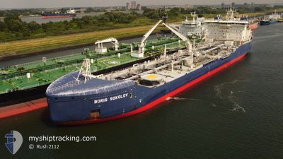
BORIS SOKOLOV
Tanker
Current Trip
FOR ORDERS
| Time Travelled | 2 days |
|---|---|
| Remaining Time | --- |
| Distance Travelled | 132.82 nm |
| Remaining Distance | --- |
| AVG Speed | 8.1 Knots |
| MAX Speed | 12.6 Knots |
| AVG Wind | 8.3 knots |
| MAX Wind | 12.6 knots |
| MIN Temp | -25.2°C / -13.36°F |
| MAX Temp | -15.8°C / 3.56°F |
| Dybgang | 10 m |
| Position Modtaget | 9 d siden |
Current Position
| Longitude | 28.11476° |
|---|---|
| Latitude | 71.98753° |
| Status | Under way using engine |
| Fart | 8.4 Knots |
| Kurs | 61.2° |
| Område | Barentsz Sea |
| Station | T-AIS |
| Position Modtaget | 9 d siden |
Info
Information
The current position of BORIS SOKOLOV is in Barentsz Sea with coordinates 71.98753° / 28.11476° as reported on 2024-04-10 06:23 by AIS to our vessel tracker app. The vessel's current speed is 8.4 Knots
The vessel BORIS SOKOLOV (IMO: 9817315, MMSI: 209387000) is a Tanker It's sailing under the flag of [CY] Cyprus.
In this page you can find informations about the vessels current position, last detected port calls, and current voyage information. If the vessels is not in coverage by AIS you will find the latest position.
The current position of BORIS SOKOLOV is detected by our AIS receivers and we are not responsible for the reliability of the data. The last position was recorded while the vessel was in Coverage by the Ais receivers of our vessel tracking app.
The current draught of BORIS SOKOLOV as reported by AIS is 10 meters
Weather
| Temperature | -18.5°C / -1.3°F |
|---|---|
| Wind Speed | 14 knots |
| Direction | 35° NE |
| Pressure | 1020.3 hPa |
| Humidity | 92 % |
| Cloud Coverage | 88 % |
Featured Company
Last Port Calls
| Port | Arrival | Departure | Time In Port |
|---|---|---|---|
| 2024-04-15 23:54 | 2024-04-17 01:46 | 1 d | |
| 2024-04-03 08:21 | 2024-04-04 22:56 | 1 d | |
| 2024-03-20 07:07 | |||
| 2024-03-05 02:55 | 2024-03-06 23:20 | 1 d | |
| 2024-02-23 07:34 | 2024-02-24 16:16 | 1 d | |
| 2024-02-07 05:02 | 2024-02-09 04:12 | 1 d |
Last Trips
| Origin | Departure | Destination | Arrival | Distance | |
|---|---|---|---|---|---|
| 2024-04-05 00:56 | 2024-04-16 04:54 | 2643.85 nm | |||
| 2024-03-07 00:20 | 2024-03-20 12:07 | 2652.89 nm | |||
| 2024-02-24 21:16 | 2024-03-05 03:55 | 2630.65 nm | |||
| 2024-02-09 05:12 | 2024-02-23 12:34 | 2640.05 nm | |||
| 2024-01-29 00:14 | 2024-02-07 06:02 | 2666.43 nm |
Events
| Tid | Hændelsen | Detaljer | Position / Dest | Info |
|---|---|---|---|---|
| 2024-04-18 01:15 | START Sejllads |
73.07003 / 72.76279
FOR ORDERS
|
Fart: 5.2 kn Kurs: 52° |
|
| 2024-04-17 23:55 | STOP Sejllads |
73.07709 / 72.75994
FOR ORDERS
|
Fart: Kurs: 337° |
|
| 2024-04-17 22:42 | START Sejllads |
72.97334 / 72.87666
FOR ORDERS
|
Fart: 6 kn Kurs: 345° |
|
| 2024-04-17 22:15 | STOP Sejllads |
72.96667 / 72.88333
FOR ORDERS
|
Fart: Kurs: -1° |
|
| 2024-04-17 19:51 | START Sejllads |
72.68500 / 73.54833
FOR ORDERS
|
Fart: 9 kn Kurs: 320° |
|
| 2024-04-17 15:57 | STOP Sejllads |
72.67287 / 73.57694
FOR ORDERS
|
Fart: 0.1 kn Kurs: 330° |
|
| 2024-04-17 11:29 | START Sejllads |
72.04359 / 73.00900
FOR ORDERS
|
Fart: 7.7 kn Kurs: 16° |
|
| 2024-04-17 09:36 | STOP Sejllads |
72.01833 / 72.98167
FOR ORDERS
|
Fart: Kurs: -1° |
|
| 2024-04-17 03:01 | START Sejllads | 6.64 nm, North East of SABETTA |
71.35295 / 72.33483
FOR ORDERS
|
Fart: 9.3 kn Kurs: 48° |
| 2024-04-17 02:24 | STOP Sejllads | 4.71 nm, North East of SABETTA |
71.33227 / 72.25803
FOR ORDERS
|
Fart: Kurs: 42° |