
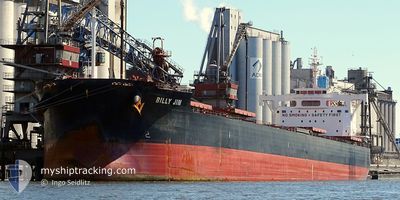
BILLY JIM
Cargo
Current Trip
| Time Travelled | 28 days |
|---|---|
| Remaining Time | 7 days |
| Distance Travelled | 8538.18 nm |
| Remaining Distance | 2406.97 nm |
| AVG Speed | 12.2 Knots |
| MAX Speed | 15.8 Knots |
| AVG Wind | 9.4 knots |
| MAX Wind | 28 knots |
| MIN Temp | 12.7°C / 54.86°F |
| MAX Temp | 32.2°C / 89.96°F |
| Dybgang | 8.6 m |
| Position Modtaget | 3 d siden |
Current Position
| Longitude | 17.35657° |
|---|---|
| Latitude | -34.81029° |
| Status | Under way using engine |
| Fart | 11.7 Knots |
| Kurs | 283.2° |
| Område | South Atlantic Ocean |
| Station | T-AIS |
| Position Modtaget | 3 d siden |
Info
Information
The current position of BILLY JIM is in South Atlantic Ocean with coordinates -34.81029° / 17.35657° as reported on 2024-04-20 14:23 by AIS to our vessel tracker app. The vessel's current speed is 11.7 Knots and is heading at the port of SANTOS. The estimated time of arrival as calculated by MyShipTracking vessel tracking app is 2024-05-02 01:03 LT
The vessel BILLY JIM (IMO: 9602411, MMSI: 538007088) is a Cargo It's sailing under the flag of [MH] Marshall Is.
In this page you can find informations about the vessels current position, last detected port calls, and current voyage information. If the vessels is not in coverage by AIS you will find the latest position.
The current position of BILLY JIM is detected by our AIS receivers and we are not responsible for the reliability of the data. The last position was recorded while the vessel was in Coverage by the Ais receivers of our vessel tracking app.
The current draught of BILLY JIM as reported by AIS is 8.6 meters
Weather
| Temperature | 20°C / 68°F |
|---|---|
| Wind Speed | 9 knots |
| Direction | 221° SW |
| Pressure | 1022.9 hPa |
| Humidity | 77 % |
| Cloud Coverage | 100 % |
Featured Company
Last Port Calls
| Port | Arrival | Departure | Time In Port |
|---|---|---|---|
| 2024-03-26 07:45 | |||
| 2024-03-13 01:49 | |||
| 2024-02-01 11:58 | 2024-02-06 11:47 | 4 d |
Events
| Tid | Hændelsen | Detaljer | Position / Dest | Info |
|---|---|---|---|---|
| 2024-04-20 14:31 | Status er ændret | Default Under way using engine |
-34.80506 / 17.32429
BRSSZ
|
Fart: 11.7 kn Kurs: 283.2° |
| 2024-04-20 14:23 | Udenfor Dækning |
-34.81029 / 17.35657
South Atlantic Ocean
BRSSZ
|
Fart: 11.7 kn Kurs: 283.2° |
|
| 2024-04-20 14:20 | Status er ændret | Under way using engine Default |
-34.81236 / 17.36964
BRSSZ
|
Fart: 11.6 kn Kurs: 280° |
| 2024-04-20 14:04 | Indenfor Dækning |
-34.81236 / 17.36964
South Atlantic Ocean
BRSSZ
|
Fart: 11.7 kn Kurs: 281.5° |
|
| 2024-04-20 13:19 | Status er ændret | Default Under way using engine |
-34.85498 / 17.60406
BRSSZ
|
Fart: 11.3 kn Kurs: 277.3° |
| 2024-04-20 13:14 | Udenfor Dækning |
-34.85781 / 17.62274
South Atlantic Ocean
BRSSZ
|
Fart: 11.3 kn Kurs: 277.3° |
|
| 2024-04-20 12:23 | Status er ændret | Under way using engine Default |
-34.88780 / 17.82142
BRSSZ
|
Fart: 11.6 kn Kurs: 278° |
| 2024-04-20 11:54 | Status er ændret | Default Under way using engine |
-34.90465 / 17.93413
BRSSZ
|
Fart: 12 kn Kurs: 277.4° |
| 2024-04-20 09:35 | Status er ændret | Under way using engine Default |
-34.93733 / 18.49255
BRSSZ
|
Fart: 12.8 kn Kurs: 285° |
| 2024-04-20 09:29 | Status er ændret | Default Under way using engine |
-34.93946 / 18.51785
BRSSZ
|
Fart: 12.8 kn Kurs: 284.5° |