
BBC LOUISE
Cargo
Current Trip
US M0B
| Time Travelled | 5 days |
|---|---|
| Remaining Time | --- |
| Distance Travelled | 1292.30 nm |
| Remaining Distance | --- |
| AVG Speed | 12.6 Knots |
| MAX Speed | 12.6 Knots |
| AVG Wind | 11.8 knots |
| MAX Wind | 31 knots |
| MIN Temp | 15°C / 59°F |
| MAX Temp | 21.7°C / 71.06°F |
| Dybgang | 7.9 m |
| Position Modtaget | 1 d siden |
Current Position
| Longitude | 13.92122° |
|---|---|
| Latitude | 36.31630° |
| Status | Under way using engine |
| Fart | 12.1 Knots |
| Kurs | 297.5° |
| Område | Mediterranean Sea - Eastern Basin |
| Station | T-AIS |
| Position Modtaget | 1 d siden |
Info
Information
The current position of BBC LOUISE is in Mediterranean Sea - Eastern Basin with coordinates 36.31630° / 13.92122° as reported on 2024-04-18 18:33 by AIS to our vessel tracker app. The vessel's current speed is 12.1 Knots
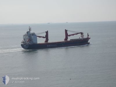
The vessel BBC LOUISE (IMO: 9685097, MMSI: 304617000) is a Cargo It's sailing under the flag of [AG] Antigua Barbuda.
In this page you can find informations about the vessels current position, last detected port calls, and current voyage information. If the vessels is not in coverage by AIS you will find the latest position.
The current position of BBC LOUISE is detected by our AIS receivers and we are not responsible for the reliability of the data. The last position was recorded while the vessel was in Coverage by the Ais receivers of our vessel tracking app.
The current draught of BBC LOUISE as reported by AIS is 7.9 meters
Weather
| Temperature | 14.9°C / 58.82°F |
|---|---|
| Wind Speed | 18 knots |
| Direction | 305° NW |
| Pressure | 1019.5 hPa |
| Humidity | 60.1 % |
| Cloud Coverage | --- |
Featured Company
Last Port Calls
| Port | Arrival | Departure | Time In Port |
|---|---|---|---|
| 2024-04-08 19:13 | 2024-04-14 15:54 | 5 d | |
| 2024-04-05 06:06 | 2024-04-05 14:54 | 8 h | |
| 2024-03-28 09:54 | 2024-04-03 09:23 | 5 d | |
| 2024-03-26 02:36 | 2024-03-26 11:46 | 9 h | |
| 2024-02-27 05:28 | |||
| 2024-02-24 08:41 | 2024-02-26 21:59 | 2 d | |
| 2024-02-21 00:34 | 2024-02-22 22:15 | 1 d | |
| 2024-02-17 17:19 | 2024-02-19 21:22 | 2 d | |
| 2024-02-13 18:46 | 2024-02-14 14:54 | 20 h |
Most Visited Ports (Last year)
| Port | Arrivals | |
|---|---|---|
| 3 | ||
| 2 | ||
| 2 | ||
| 2 | ||
| 2 | ||
| 2 |
Last Trips
| Origin | Departure | Destination | Arrival | Distance | |
|---|---|---|---|---|---|
| 2024-04-03 12:23 | 2024-04-08 22:13 | 1091.49 nm | |||
| 2024-04-03 12:23 | 2024-04-05 08:06 | 629.08 nm | |||
| 2024-02-26 15:59 | 2024-02-26 23:28 | 93.10 nm | |||
| 2024-02-22 16:15 | 2024-02-24 02:41 | 437.64 nm | |||
| 2024-02-19 15:22 | 2024-02-20 18:34 | 320.27 nm | |||
| 2024-02-14 08:54 | 2024-02-17 11:19 | 911.56 nm | |||
| 2024-01-31 06:51 | 2024-02-13 12:46 | 3539.34 nm |
Events
| Tid | Hændelsen | Detaljer | Position / Dest | Info |
|---|---|---|---|---|
| 2024-04-18 18:33 | Udenfor Dækning |
36.31630 / 13.92122
Mediterranean Sea - Eastern Basin
US M0B
|
Fart: 12.1 kn Kurs: 297.5° |
|
| 2024-04-18 16:17 | Dybgangen er ændret | 7.9 8 |
36.08387 / 14.43625
US M0B
|
Fart: 12.2 kn Kurs: 299.5° |
| 2024-04-18 16:17 | ETA er ændret | 2024/05/06 16:00 2024/05/04 17:00 |
36.08387 / 14.43625
US M0B
|
Fart: 12.2 kn Kurs: 299.5° |
| 2024-04-18 14:30 | Fundet i havområde | Maltese part of the Mediterranean Sea - Eastern Basin |
35.82818 / 14.59742
Mediterranean Sea - Eastern Basin
US M0B
|
Fart: 7.9 kn Kurs: 55° |
| 2024-04-18 14:30 | Indenfor Dækning |
35.82818 / 14.59742
Mediterranean Sea - Eastern Basin
US M0B
|
Fart: 7.9 kn Kurs: 55° |
|
| 2024-04-17 05:35 | START Sejllads |
35.88334 / 18.74500
US M0B
|
Fart: 12 kn Kurs: 269° |
|
| 2024-04-17 02:45 | STOP Sejllads |
35.91833 / 18.79500
US M0B
|
Fart: Kurs: -1° |
|
| 2024-04-16 19:31 | Status er ændret | Default Under way using engine |
35.98375 / 20.60995
US M0B
|
Fart: 13.8 kn Kurs: 267.8° |
| 2024-04-16 19:30 | Udenfor Dækning |
35.98389 / 20.61388
Mediterranean Sea - Eastern Basin
US M0B
|
Fart: 13.8 kn Kurs: 267.8° |
|
| 2024-04-16 19:26 | Status er ændret | Under way using engine Default |
35.98450 / 20.63211
US M0B
|
Fart: 13 kn Kurs: 267° |