
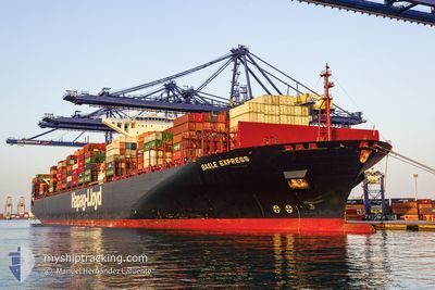
BASLE EXPRESS
Container Ship
Current Trip
| Time Travelled | 29 days |
|---|---|
| Remaining Time | 1 h, 42 mins |
| Distance Travelled | 8892.19 nm |
| Remaining Distance | 14.91 nm |
| AVG Speed | 14.9 Knots |
| MAX Speed | 20.4 Knots |
| AVG Wind | 12.3 knots |
| MAX Wind | 31.5 knots |
| MIN Temp | -1.6°C / 29.12°F |
| MAX Temp | 33.5°C / 92.3°F |
| Dybgang | 12.8 m |
| Position Modtaget | 1 m siden |
Current Position
| Longitude | -75.72897° |
|---|---|
| Latitude | 10.30537° |
| Status | Under way using engine |
| Fart | 9.9 Knots |
| Kurs | 86.8° |
| Område | Caribbean Sea |
| Station | T-AIS |
| Position Modtaget | 1 m siden |
Info
Information
The current position of BASLE EXPRESS is in Caribbean Sea with coordinates 10.30537° / -75.72897° as reported on 2024-04-18 07:13 by AIS to our vessel tracker app. The vessel's current speed is 9.9 Knots and is heading at the port of CARTAGENA. The estimated time of arrival as calculated by MyShipTracking vessel tracking app is 2024-04-18 08:56 LT
The vessel BASLE EXPRESS (IMO: 9501344, MMSI: 211549000) is a Container Ship that was built in 2012 ( 12 år gamle ). It's sailing under the flag of [DE] Germany.
In this page you can find informations about the vessels current position, last detected port calls, and current voyage information. If the vessels is not in coverage by AIS you will find the latest position.
The current position of BASLE EXPRESS is detected by our AIS receivers and we are not responsible for the reliability of the data. The last position was recorded while the vessel was in Coverage by the Ais receivers of our vessel tracking app.
The current draught of BASLE EXPRESS as reported by AIS is 12.8 meters
Weather
| Temperature | 27.6°C / 81.68°F |
|---|---|
| Wind Speed | 17 knots |
| Direction | 11° N |
| Pressure | 1008 hPa |
| Humidity | 87.1 % |
| Cloud Coverage | 100 % |
Featured Company
Last Trips
Events
| Tid | Hændelsen | Detaljer | Position / Dest | Info |
|---|---|---|---|---|
| 2024-04-18 05:41 | ETA er ændret | 2024/04/18 08:00 2024/04/18 06:30 |
10.32126 / -75.82121
CARTAGENA
|
Fart: 1.4 kn Kurs: 100° |
| 2024-04-18 05:07 | ETA er ændret | 2024/04/18 06:30 2024/04/18 06:00 |
10.32818 / -75.82679
CARTAGENA
|
Fart: 2.8 kn Kurs: 53° |
| 2024-04-18 04:34 | Destination er ændret | CARTAGENA CARTAE - GI GIB |
10.33136 / -75.91727
CARTAGENA
|
Fart: 13.3 kn Kurs: 93.9° |
| 2024-04-18 04:34 | ETA er ændret | 2024/04/18 06:00 2024/04/17 23:00 |
10.33136 / -75.91727
CARTAGENA
|
Fart: 13.3 kn Kurs: 93.9° |
| 2024-04-18 04:08 | Status er ændret | Under way using engine Default |
10.33897 / -76.01691
CARTAE - GI GIB
|
Fart: 13 kn Kurs: 94° |
| 2024-04-18 03:50 | Indenfor Dækning |
10.33897 / -76.01691
Caribbean Sea
|
Fart: 13.5 kn Kurs: 94.9° |
|
| 2024-04-18 03:38 | START Sejllads |
10.34500 / -76.11334
CARTAE - GI GIB
|
Fart: 4 kn Kurs: -1° |
|
| 2024-04-18 03:02 | Status er ændret | Default Under way using engine |
10.35500 / -76.11166
CARTAE - GI GIB
|
Fart: 1.6 kn Kurs: 12° |
| 2024-04-18 03:02 | STOP Sejllads |
10.35500 / -76.11166
CARTAE - GI GIB
|
Fart: Kurs: -1° |
|
| 2024-04-18 02:55 | Udenfor Dækning |
10.35368 / -76.11209
Caribbean Sea
CARTAE - GI GIB
|
Fart: 1.6 kn Kurs: 343.1° |