
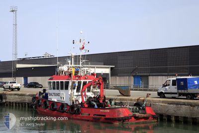
BALTSUND
Tug
Current Trip
| Trip Time | 17 h, 48 mins |
|---|---|
| Trip Distance | 43.06 nm |
| AVG Speed | 4.7 Knots |
| MAX Speed | 7.8 Knots |
| Dybgang | 2.7 m |
| AVG Wind | 16.3 knots |
| MAX Wind | 18.7 knots |
| MIN Temp | 5°C / 41°F |
| MAX Temp | 8.5°C / 47.3°F |
| Position Modtaget | 5 m siden |
Current Position
| Longitude | 8.58399° |
|---|---|
| Latitude | 53.50811° |
| Status | Moored |
| Fart | |
| Kurs | --- |
| Område | North Sea |
| Station | T-AIS |
| Position Modtaget | 5 m siden |
Info
Information
The current position of BALTSUND is in North Sea with coordinates 53.50811° / 8.58399° as reported on 2024-04-19 05:20 by AIS to our vessel tracker app. The vessel's current speed is 0 Knots and is currently inside the port of BREMERHAVEN.
The vessel BALTSUND (IMO: 9136307, MMSI: 220466000) is a Tug that was built in 1996 ( 28 år gamle ). It's sailing under the flag of [DK] Denmark.
In this page you can find informations about the vessels current position, last detected port calls, and current voyage information. If the vessels is not in coverage by AIS you will find the latest position.
The current position of BALTSUND is detected by our AIS receivers and we are not responsible for the reliability of the data. The last position was recorded while the vessel was in Coverage by the Ais receivers of our vessel tracking app.
The current draught of BALTSUND as reported by AIS is 2.7 meters
Weather
| Temperature | 6.8°C / 44.24°F |
|---|---|
| Wind Speed | 16 knots |
| Direction | 249° WSW |
| Pressure | 1003.3 hPa |
| Humidity | 95.3 % |
| Cloud Coverage | 100 % |
Featured Company
Last Port Calls
| Port | Arrival | Departure | Time In Port |
|---|---|---|---|
| 2024-04-19 01:01 | |||
| 2024-04-17 17:08 | 2024-04-18 07:13 | 14 h | |
| 2024-04-13 14:32 | 2024-04-17 09:52 | 3 d | |
| 2024-04-01 13:37 | 2024-04-12 13:08 | 10 d | |
| 2024-04-01 08:49 | 2024-04-01 11:54 | 3 h | |
| 2024-03-30 18:32 | 2024-04-01 07:04 | 1 d | |
| 2024-03-29 14:27 | 2024-03-30 07:05 | 16 h | |
| 2024-03-29 10:57 | 2024-03-29 11:49 | 51 m | |
| 2024-03-28 15:10 | 2024-03-28 15:58 | 48 m | |
| 2024-03-28 07:14 | 2024-03-28 08:39 | 1 h |
Most Visited Ports (Last year)
| Port | Arrivals | |
|---|---|---|
| 110 | ||
| 97 | ||
| 6 | ||
| 5 | ||
| 4 | ||
| 4 |
Last Trips
| Origin | Departure | Destination | Arrival | Distance | |
|---|---|---|---|---|---|
| 2024-04-18 09:13 | 2024-04-19 03:01 | 43.06 nm | |||
| 2024-04-17 11:52 | 2024-04-17 19:08 | 46.90 nm | |||
| 2024-04-12 15:08 | 2024-04-13 16:32 | 180.62 nm | |||
| 2024-04-01 13:54 | 2024-04-01 15:37 | 15.29 nm | |||
| 2024-04-01 09:04 | 2024-04-01 10:49 | 15.08 nm | |||
| 2024-03-30 08:05 | 2024-03-30 19:32 | 60.36 nm | |||
| 2024-03-29 12:49 | 2024-03-29 15:27 | 23.09 nm | |||
| 2024-03-28 16:58 | 2024-03-29 11:57 | 128.84 nm | |||
| 2024-03-28 09:39 | 2024-03-28 16:10 | 58.41 nm | |||
| 2024-03-26 13:37 | 2024-03-28 08:14 | 298.36 nm |
Events
| Tid | Hændelsen | Detaljer | Position / Dest | Info |
|---|---|---|---|---|
| 2024-04-19 02:47 | Status er ændret | Moored Under way using engine |
53.50816 / 8.58404
[DE] BREMERHAVEN
|
Fart: Kurs: 511° |
| 2024-04-19 02:41 | STOP Sejllads |
53.50816 / 8.58389
[DE] BREMERHAVEN
|
Fart: 0.3 kn Kurs: 511° |
|
| 2024-04-19 02:25 | START Sejllads |
53.53025 / 8.57692
[DE] BREMERHAVEN
|
Fart: 4.2 kn Kurs: 207.5° |
|
| 2024-04-19 02:14 | STOP Sejllads |
53.53212 / 8.57762
[DE] BREMERHAVEN
|
Fart: 0.2 kn Kurs: 511° |
|
| 2024-04-19 01:01 | Skibe i havn |
|
53.60325 / 8.49954
[DE] BREMERHAVEN
|
Fart: 4.1 kn Kurs: 137.7° |
| 2024-04-18 22:45 | Indenfor Dækning |
53.75377 / 8.19787
North Sea
DEBRV
|
Fart: 6.5 kn Kurs: 133.1° |
|
| 2024-04-18 19:14 | Udenfor Dækning |
53.80066 / 7.60051
North Sea
DEBRV
|
Fart: 3.7 kn Kurs: 10.4° |
|
| 2024-04-18 17:43 | Destination er ændret | DEBRV SPIEKEROOG |
53.74352 / 7.69553
DEBRV
|
Fart: 3.9 kn Kurs: 291.6° |
| 2024-04-18 17:43 | ETA er ændret | 2024/04/19 01:00 2024/04/17 16:00 |
53.74352 / 7.69553
DEBRV
|
Fart: 3.9 kn Kurs: 291.6° |
| 2024-04-18 17:30 | START Sejllads | 1.68 nm, North of NEUHARLINGERSIEL |
53.72951 / 7.70737
SPIEKEROOG
|
Fart: 3.5 kn Kurs: 346.4° |