
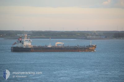
SEAWAYS GRACE
Oil/Chemical Tanker
Current Trip
FOR ORDERS
| Time Travelled | 11 days |
|---|---|
| Remaining Time | --- |
| Distance Travelled | 616.69 nm |
| Remaining Distance | --- |
| AVG Speed | 8.9 Knots |
| MAX Speed | 14.3 Knots |
| AVG Wind | 12.8 knots |
| MAX Wind | 19 knots |
| MIN Temp | 25°C / 77°F |
| MAX Temp | 30.6°C / 87.08°F |
| Dybgang | 8 m |
| Position Modtaget | 3 d siden |
Current Position
| Longitude | 38.14918° |
|---|---|
| Latitude | 22.32133° |
| Status | Under way using engine |
| Fart | 11.1 Knots |
| Kurs | 359.7° |
| Område | Red Sea |
| Station | T-AIS |
| Position Modtaget | 3 d siden |
Info
Information
The current position of SEAWAYS GRACE is in Red Sea with coordinates 22.32133° / 38.14918° as reported on 2024-04-16 06:03 by AIS to our vessel tracker app. The vessel's current speed is 11.1 Knots
The vessel SEAWAYS GRACE (IMO: 9337511, MMSI: 477047900) is a Oil/Chemical Tanker that was built in 2008 ( 16 år gamle ). It's sailing under the flag of [HK] Hong Kong.
In this page you can find informations about the vessels current position, last detected port calls, and current voyage information. If the vessels is not in coverage by AIS you will find the latest position.
The current position of SEAWAYS GRACE is detected by our AIS receivers and we are not responsible for the reliability of the data. The last position was recorded while the vessel was in Coverage by the Ais receivers of our vessel tracking app.
The current draught of SEAWAYS GRACE as reported by AIS is 8 meters
Weather
| Temperature | 26.2°C / 79.16°F |
|---|---|
| Wind Speed | 12 knots |
| Direction | 325° NW |
| Pressure | 1007 hPa |
| Humidity | 77.6 % |
| Cloud Coverage | --- |
Featured Company
Most Visited Ports (Last year)
| Port | Arrivals | |
|---|---|---|
| 2 | ||
| 2 | ||
| 2 | ||
| 1 | ||
| 1 | ||
| 1 |
Last Trips
| Origin | Departure | Destination | Arrival | Distance | |
|---|---|---|---|---|---|
| 2024-04-03 08:00 | 2024-04-06 21:03 | 198.30 nm | |||
| 2024-03-02 13:00 | 2024-04-01 00:46 | 4102.19 nm | |||
| 2024-03-02 13:00 | 2024-03-15 05:34 | 3409.15 nm | |||
| 2024-02-04 01:26 | 2024-02-25 18:08 | 4473.90 nm | |||
| 2024-01-15 17:30 | 2024-02-03 16:17 | 4793.17 nm |
Events
| Tid | Hændelsen | Detaljer | Position / Dest | Info |
|---|---|---|---|---|
| 2024-04-17 15:40 | START Sejllads | 19.64 nm, South West of RABIGH |
22.54856 / 38.70691
FOR ORDERS
|
Fart: 4.1 kn Kurs: 215° |
| 2024-04-17 11:30 | STOP Sejllads |
22.55484 / 38.63392
FOR ORDERS
|
Fart: 0.3 kn Kurs: 340° |
|
| 2024-04-17 09:59 | START Sejllads |
22.43468 / 38.66335
FOR ORDERS
|
Fart: 9.7 kn Kurs: 1° |
|
| 2024-04-16 22:22 | STOP Sejllads |
22.58393 / 38.56549
FOR ORDERS
|
Fart: 0.3 kn Kurs: 356° |
|
| 2024-04-16 12:37 | START Sejllads |
22.44573 / 38.06485
FOR ORDERS
|
Fart: 6.1 kn Kurs: 131° |
|
| 2024-04-16 08:41 | STOP Sejllads |
22.49501 / 38.09254
FOR ORDERS
|
Fart: 0.3 kn Kurs: 317° |
|
| 2024-04-16 06:05 | Status er ændret | Default Under way using engine |
22.32702 / 38.14919
FOR ORDERS
|
Fart: 11.1 kn Kurs: 359.7° |
| 2024-04-16 06:03 | Udenfor Dækning |
22.32133 / 38.14918
Red Sea
|
Fart: 11.1 kn Kurs: 359.7° |
|
| 2024-04-16 05:31 | Status er ændret | Under way using engine Default |
22.22183 / 38.15110
FOR ORDERS
|
Fart: 1.1 kn Kurs: 75° |
| 2024-04-16 05:18 | Status er ændret | Default Under way using engine |
22.21108 / 38.14718
FOR ORDERS
|
Fart: 1 kn Kurs: 75° |