
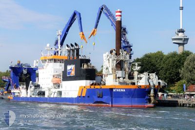
ATHENA
Cutter Suction Dredger
Current Trip
NMDC
| Time Travelled | 48 days |
|---|---|
| Remaining Time | --- |
| Distance Travelled | 280.09 nm |
| Remaining Distance | --- |
| AVG Speed | 8.4 Knots |
| MAX Speed | 8.4 Knots |
| AVG Wind | 8.6 knots |
| MAX Wind | 29.7 knots |
| MIN Temp | 20.6°C / 69.08°F |
| MAX Temp | 28.5°C / 83.3°F |
| Dybgang | 6.5 m |
| Position Modtaget | Nu |
Current Position
| Longitude | 54.50338° |
|---|---|
| Latitude | 24.71691° |
| Status | Restricted manoeuverability |
| Fart | 0.3 Knots |
| Kurs | 237° |
| Område | Persian Gulf |
| Station | T-AIS |
| Position Modtaget | Nu |
Info
Information
The current position of ATHENA is in Persian Gulf with coordinates 24.71691° / 54.50338° as reported on 2024-04-25 20:03 by AIS to our vessel tracker app. The vessel's current speed is 0.3 Knots
The vessel ATHENA (IMO: 9548603, MMSI: 245810000) is a Cutter Suction Dredger that was built in 2011 ( 13 år gamle ). It's sailing under the flag of [NL] Netherlands.
In this page you can find informations about the vessels current position, last detected port calls, and current voyage information. If the vessels is not in coverage by AIS you will find the latest position.
The current position of ATHENA is detected by our AIS receivers and we are not responsible for the reliability of the data. The last position was recorded while the vessel was in Coverage by the Ais receivers of our vessel tracking app.
The current draught of ATHENA as reported by AIS is 6.5 meters
Weather
| Temperature | 25.9°C / 78.62°F |
|---|---|
| Wind Speed | 6 knots |
| Direction | 20° NNE |
| Pressure | 1006.6 hPa |
| Humidity | 67.8 % |
| Cloud Coverage | --- |
Featured Company
Most Visited Ports (Last year)
| Port | Arrivals | |
|---|---|---|
| 2 | ||
| 1 | ||
| 1 | ||
| 1 |
Events
| Tid | Hændelsen | Detaljer | Position / Dest | Info |
|---|---|---|---|---|
| 2024-04-21 06:45 | STOP Sejllads | 10.61 nm, South West of KHALIFA |
24.71567 / 54.50177
NMDC
|
Fart: 0.1 kn Kurs: 224° |
| 2024-04-21 06:35 | START Sejllads | 10.6 nm, South West of KHALIFA |
24.71568 / 54.50188
NMDC
|
Fart: 6 kn Kurs: 33.2° |
| 2024-04-17 07:38 | Status er ændret | Restricted manoeuverability Default |
24.71238 / 54.49978
NMDC
|
Fart: 0.2 kn Kurs: 301° |
| 2024-04-17 07:30 | Status er ændret | Default Restricted manoeuverability |
24.71255 / 54.49990
NMDC
|
Fart: 0.3 kn Kurs: 317° |
| 2024-04-17 07:26 | Status er ændret | Restricted manoeuverability Default |
24.71235 / 54.49967
NMDC
|
Fart: 0.3 kn Kurs: 284° |
| 2024-04-17 07:17 | Status er ændret | Default Restricted manoeuverability |
24.71259 / 54.49996
NMDC
|
Fart: 0.4 kn Kurs: 309° |
| 2024-04-17 07:07 | Status er ændret | Restricted manoeuverability Default |
24.71248 / 54.49985
NMDC
|
Fart: 0.1 kn Kurs: 287° |
| 2024-04-17 07:02 | Status er ændret | Default Restricted manoeuverability |
24.71261 / 54.49995
NMDC
|
Fart: 0.1 kn Kurs: 308° |