
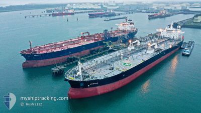
ARETEA
Tanker
Current Trip
| Time Travelled | 4 days |
|---|---|
| Remaining Time | 3 days |
| Distance Travelled | 1416.74 nm |
| Remaining Distance | 1413.47 nm |
| AVG Speed | 13 Knots |
| MAX Speed | 15.1 Knots |
| AVG Wind | 9.1 knots |
| MAX Wind | 25.4 knots |
| MIN Temp | 10.4°C / 50.72°F |
| MAX Temp | 29.5°C / 85.1°F |
| Dybgang | 9 m |
| Position Modtaget | 4 d siden |
Current Position
| Longitude | 125.98300° |
|---|---|
| Latitude | 36.80320° |
| Status | Under way using engine |
| Fart | 14.1 Knots |
| Kurs | 232.5° |
| Område | Yellow Sea |
| Station | T-AIS |
| Position Modtaget | 4 d siden |
Info
Information
The current position of ARETEA is in Yellow Sea with coordinates 36.80320° / 125.98300° as reported on 2024-04-20 00:44 by AIS to our vessel tracker app. The vessel's current speed is 14.1 Knots and is heading at the port of SINGAPORE. The estimated time of arrival as calculated by MyShipTracking vessel tracking app is 2024-04-28 06:42 LT
The vessel ARETEA (IMO: 9711456, MMSI: 241348000) is a Tanker It's sailing under the flag of [GR] Greece.
In this page you can find informations about the vessels current position, last detected port calls, and current voyage information. If the vessels is not in coverage by AIS you will find the latest position.
The current position of ARETEA is detected by our AIS receivers and we are not responsible for the reliability of the data. The last position was recorded while the vessel was in Coverage by the Ais receivers of our vessel tracking app.
The current draught of ARETEA as reported by AIS is 9 meters
Weather
| Temperature | 29.3°C / 84.74°F |
|---|---|
| Wind Speed | 2 knots |
| Direction | 146° SE |
| Pressure | 1010 hPa |
| Humidity | 77.7 % |
| Cloud Coverage | --- |
Featured Company
Events
| Tid | Hændelsen | Detaljer | Position / Dest | Info |
|---|---|---|---|---|
| 2024-04-20 00:46 | Status er ændret | Default Under way using engine |
36.79797 / 125.97579
KRTSN>SGSIN
|
Fart: 14.1 kn Kurs: 232.5° |
| 2024-04-20 00:44 | Udenfor Dækning |
36.80320 / 125.98300
Yellow Sea
KRTSN>SGSIN
|
Fart: 14.1 kn Kurs: 232.5° |
|
| 2024-04-19 23:31 | ETA er ændret | 2024/04/29 04:00 2024/04/29 08:00 |
36.95147 / 126.22765
KRTSN>SGSIN
|
Fart: 13.9 kn Kurs: 222.9° |
| 2024-04-19 22:58 | Afsejlet fra sidste havn |
|
37.00942 / 126.32926
KRTSN>SGSIN
|
Fart: 3.8 kn Kurs: 277° |
| 2024-04-19 22:54 | START Sejllads |
37.00662 / 126.33258
[KR] DAESAN
|
Fart: 3.4 kn Kurs: 343° |
|
| 2024-04-19 22:49 | ETA er ændret | 2024/04/29 08:00 2024/04/18 00:00 |
37.00460 / 126.33176
[KR] DAESAN
|
Fart: 0.1 kn Kurs: 64° |
| 2024-04-19 22:48 | Status er ændret | Under way using engine Moored |
37.00460 / 126.33178
[KR] DAESAN
|
Fart: Kurs: 64° |
| 2024-04-19 22:09 | Status er ændret | Moored Default |
37.00457 / 126.33179
[KR] DAESAN
|
Fart: Kurs: 64° |
| 2024-04-19 22:06 | Status er ændret | Default Moored |
37.00457 / 126.33178
[KR] DAESAN
|
Fart: Kurs: 64° |
| 2024-04-19 17:29 | Status er ændret | Moored Default |
37.00458 / 126.33182
[KR] DAESAN
|
Fart: Kurs: 64° |