
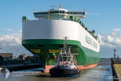
ARC INDEPENDENCE
Vehicles Carrier
Current Trip
| Time Travelled | 10 days |
|---|---|
| Remaining Time | 2 h, 53 mins |
| Distance Travelled | 3516.29 nm |
| Remaining Distance | 41.52 nm |
| AVG Speed | 9.8 Knots |
| MAX Speed | 18 Knots |
| AVG Wind | 25.2 knots |
| MAX Wind | 38 knots |
| MIN Temp | 8.4°C / 47.12°F |
| MAX Temp | 18.8°C / 65.84°F |
| Dybgang | 9.4 m |
| Position Modtaget | 8 h, 7 m siden |
Current Position
| Longitude | -69.34367° |
|---|---|
| Latitude | 40.58726° |
| Status | Under way using engine |
| Fart | 12.4 Knots |
| Kurs | 279.9° |
| Område | North Atlantic Ocean |
| Station | T-AIS |
| Position Modtaget | 8 h, 7 m siden |
Info
Information
The current position of ARC INDEPENDENCE is in North Atlantic Ocean with coordinates 40.58726° / -69.34367° as reported on 2024-04-15 23:26 by AIS to our vessel tracker app. The vessel's current speed is 12.4 Knots and is heading at the port of DAVISVILLE. The estimated time of arrival as calculated by MyShipTracking vessel tracking app is 2024-04-16 10:27 LT
The vessel ARC INDEPENDENCE (IMO: 9332925, MMSI: 338794000) is a Vehicles Carrier that was built in 2007 ( 17 år gamle ). It's sailing under the flag of [US] USA.
In this page you can find informations about the vessels current position, last detected port calls, and current voyage information. If the vessels is not in coverage by AIS you will find the latest position.
The current position of ARC INDEPENDENCE is detected by our AIS receivers and we are not responsible for the reliability of the data. The last position was recorded while the vessel was in Coverage by the Ais receivers of our vessel tracking app.
The current draught of ARC INDEPENDENCE as reported by AIS is 9.4 meters
Weather
| Temperature | 9.1°C / 48.38°F |
|---|---|
| Wind Speed | 9 knots |
| Direction | 333° NNW |
| Pressure | 1015 hPa |
| Humidity | 87.8 % |
| Cloud Coverage | 61 % |
Featured Company
Last Port Calls
| Port | Arrival | Departure | Time In Port |
|---|---|---|---|
| 2024-04-01 04:46 | 2024-04-05 07:55 | 4 d | |
| 2024-03-28 02:47 | 2024-03-30 13:32 | 2 d | |
| 2024-03-25 18:55 | 2024-03-26 19:01 | 1 d | |
| 2024-03-15 06:09 | 2024-03-17 07:51 | 2 d | |
| 2024-02-29 12:01 | 2024-02-29 23:24 | 11 h | |
| 2024-02-26 11:15 | 2024-02-26 23:30 | 12 h | |
| 2024-02-16 17:43 | 2024-02-21 13:08 | 4 d | |
| 2024-02-13 13:29 | 2024-02-14 18:47 | 1 d | |
| 2024-02-10 11:00 | 2024-02-11 00:52 | 13 h | |
| 2024-02-05 15:10 | 2024-02-06 05:20 | 14 h |
Most Visited Ports (Last year)
| Port | Arrivals | |
|---|---|---|
| 10 | ||
| 9 | ||
| 7 | ||
| 6 | ||
| 6 | ||
| 6 |
Last Trips
| Origin | Departure | Destination | Arrival | Distance | |
|---|---|---|---|---|---|
| 2024-03-30 14:32 | 2024-04-01 05:46 | 466.25 nm | |||
| 2024-03-26 20:01 | 2024-03-28 03:47 | 345.85 nm | |||
| 2024-03-17 09:51 | 2024-03-25 19:55 | 3120.07 nm | |||
| 2024-02-29 18:24 | 2024-03-15 08:09 | 5313.43 nm | |||
| 2024-02-26 18:30 | 2024-02-29 07:01 | 684.26 nm | |||
| 2024-02-21 07:08 | 2024-02-26 06:15 | 1413.11 nm | |||
| 2024-02-14 12:47 | 2024-02-16 11:43 | 625.53 nm | |||
| 2024-02-10 18:52 | 2024-02-13 07:29 | 588.98 nm | |||
| 2024-02-06 00:20 | 2024-02-10 05:00 | 1431.34 nm | |||
| 2024-02-04 14:20 | 2024-02-05 10:10 | 172.30 nm |
Events
| Tid | Hændelsen | Detaljer | Position / Dest | Info |
|---|---|---|---|---|
| 2024-04-15 23:33 | Status er ændret | Default Under way using engine |
40.59078 / -69.37334
USDVV
|
Fart: 12.4 kn Kurs: 279.9° |
| 2024-04-15 23:26 | Udenfor Dækning |
40.58726 / -69.34367
North Atlantic Ocean
USDVV
|
Fart: 12.4 kn Kurs: 279.9° |
|
| 2024-04-15 23:22 | Dybgangen er ændret | 9.4 9.6 |
40.58297 / -69.31063
USDVV
|
Fart: 12.3 kn Kurs: 280.7° |
| 2024-04-15 23:22 | ETA er ændret | 2024/04/16 10:00 2024/04/15 10:00 |
40.58297 / -69.31063
USDVV
|
Fart: 12.3 kn Kurs: 280.7° |
| 2024-04-15 22:17 | Ændre havområde | United States part of the North Atlantic Ocean United Kingdom part of the Celtic Sea |
40.53558 / -69.09117
North Atlantic Ocean
|
Fart: 8.3 kn Kurs: 294.1° |
| 2024-04-15 22:16 | Status er ændret | Under way using engine Default |
40.53528 / -69.09024
USDVV
|
Fart: 10.2 kn Kurs: 294° |
| 2024-04-15 22:05 | Indenfor Dækning |
40.53558 / -69.09117
North Atlantic Ocean
|
Fart: 8.3 kn Kurs: 294.1° |
|
| 2024-04-06 18:12 | Status er ændret | Default Under way using engine |
49.72699 / -6.54804
USDVV
|
Fart: 10.2 kn Kurs: 273.9° |
| 2024-04-06 18:08 | Status er ændret | Under way using engine Default |
49.72597 / -6.53267
USDVV
|
Fart: 10.1 kn Kurs: 273° |
| 2024-04-06 18:08 | Udenfor Dækning |
49.72597 / -6.53267
Celtic Sea
USDVV
|
Fart: 10.2 kn Kurs: 273.9° |